Summer Wanderweg: The Best of the Best
I put off making this list for a long time. And it’s because my real answer to this question - what are the best hikes in Switzerland - is: it depends!!
It depends on so many things: the season, the weather, the season & the weather, my fitness, my mood, my energy level, my hiking companions. And so on. Which means that after eight years of hiking hundreds of trails throughout Switzerland, my answer to this question will likely change depending on the day you ask. And I recognize that is a disappointing answer.
So I finally sat myself down and forced myself to pick fifteen - just fifteen! - of my favorite Swiss hikes. This was very difficult. Even as I type this introduction, I am already sad about the one I had to leave out. But I’ve done it - even reaching way back into the archives to bring back some of my very first hikes.
A few parameters to mention: Lest this become a list of repeats, these are my favorite summer hikes (as I already have a list of favorite spring and fall hikes ). They are also all day hikes, not hut overnights. In the spirit of diversity, I've tried to pick ones from different regions (because if I didn't, all my choices would probably be in Uri). I did not manage the same diversity when it comes to difficulty: these all land somewhere between moderate and challenging, and most of them involve a steep relentless climb at some point. Sorry! But hey, it’s my list, and I like what I like. Besides, these are the Alps - steepness is inevitable. And there’s often a gondola somewhere nearby.
(P.S. If you are looking for the Stoos Ridge, Oeschinensee, Bachalpsee or Zermatt 5 Lakes hikes - they did not make the list. Not because they aren’t pretty, but because there is so much more to Swiss hiking than the most popular spots!)
As it would be impossible to list the hikes in order of preference, I’ve ordered them by region. Think of it as a little tour of the country: starting in the east in Appenzell and heading (roughly) west, dipping south into Graubünden and Ticino, through Central Switzerland, into Valais, and ending at the Matterhorn. Where I've written a full post about the hike, I've linked it. And as always, before embarking on any hike: check conditions, download your maps, and know your limits.
Let’s go! Here are the very best hiking trails in Switzerland (according to me):
1. The Three Lakes Hike — Appenzell (Alpstein)
Distance: 17.6 km | Ascent/Descent: 1194 m/1142 m | Difficulty: Challenging (T2/T3)
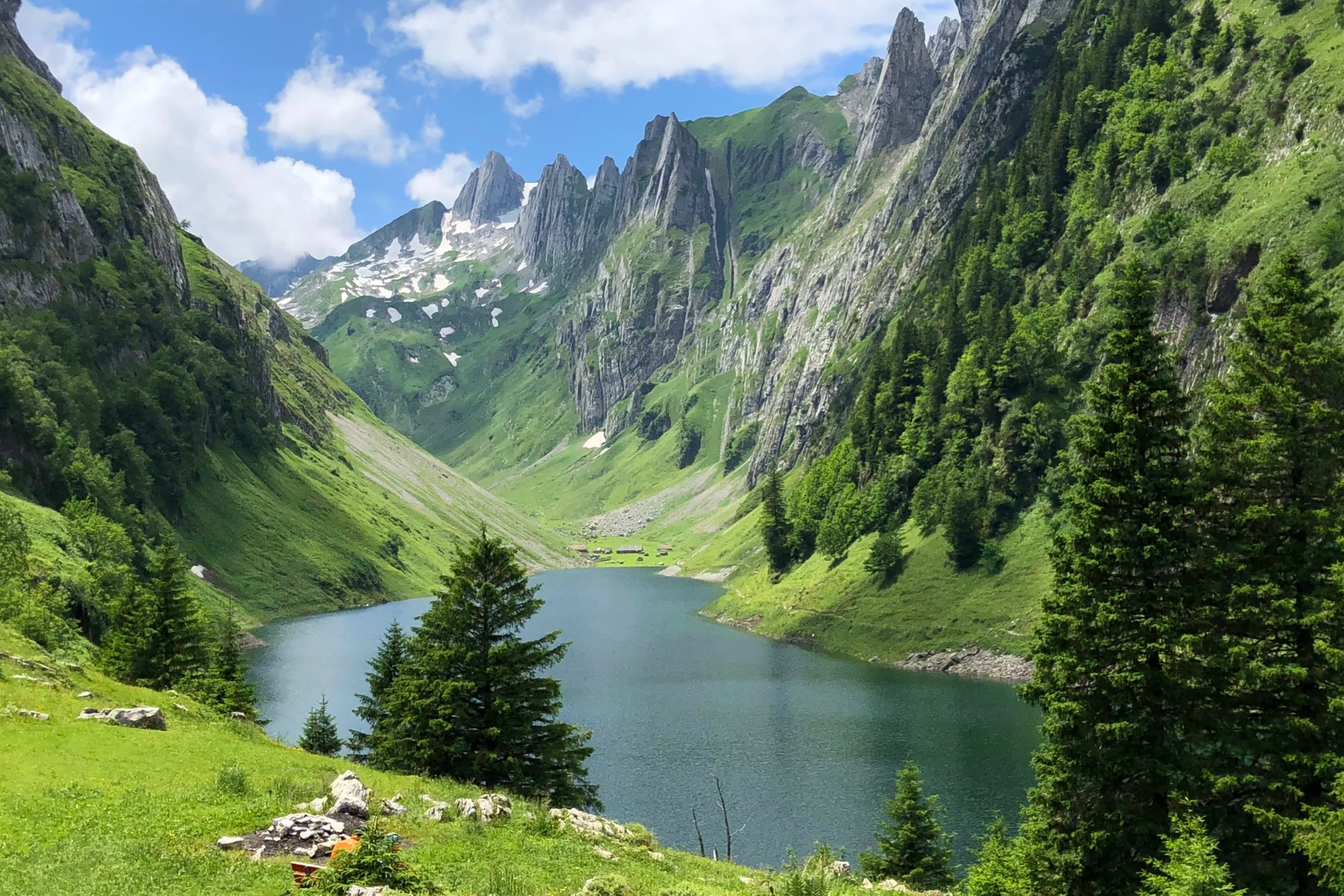
The Alpstein is a small but mighty part of Switzerland. Appenzell, one of the most rural and traditional Swiss cantons, is largely rolling green hills - with the exception of the Alpstein, which is the dramatic, craggy limestone range that rises right in the middle of it. This long hike takes you to the three lakes of the Alpstein region: Seealpsee, Fälensee, and Sämtisersee. They are each stunning in their own right, but it's the pastoral-meets-mountain landscape tying them together that makes it a favorite.
Tip: The Bollenwees Hut by Fälensee serves the very best rösti in the entire country. I’m not saying plan your entire hike around it but…plan your hike around it! Trust.
2. Chüebodensee — Glarus (Elm)
Distance: 8.5 km | Ascent/Descent: 712 m/708 m | Difficulty: Moderate (T2)
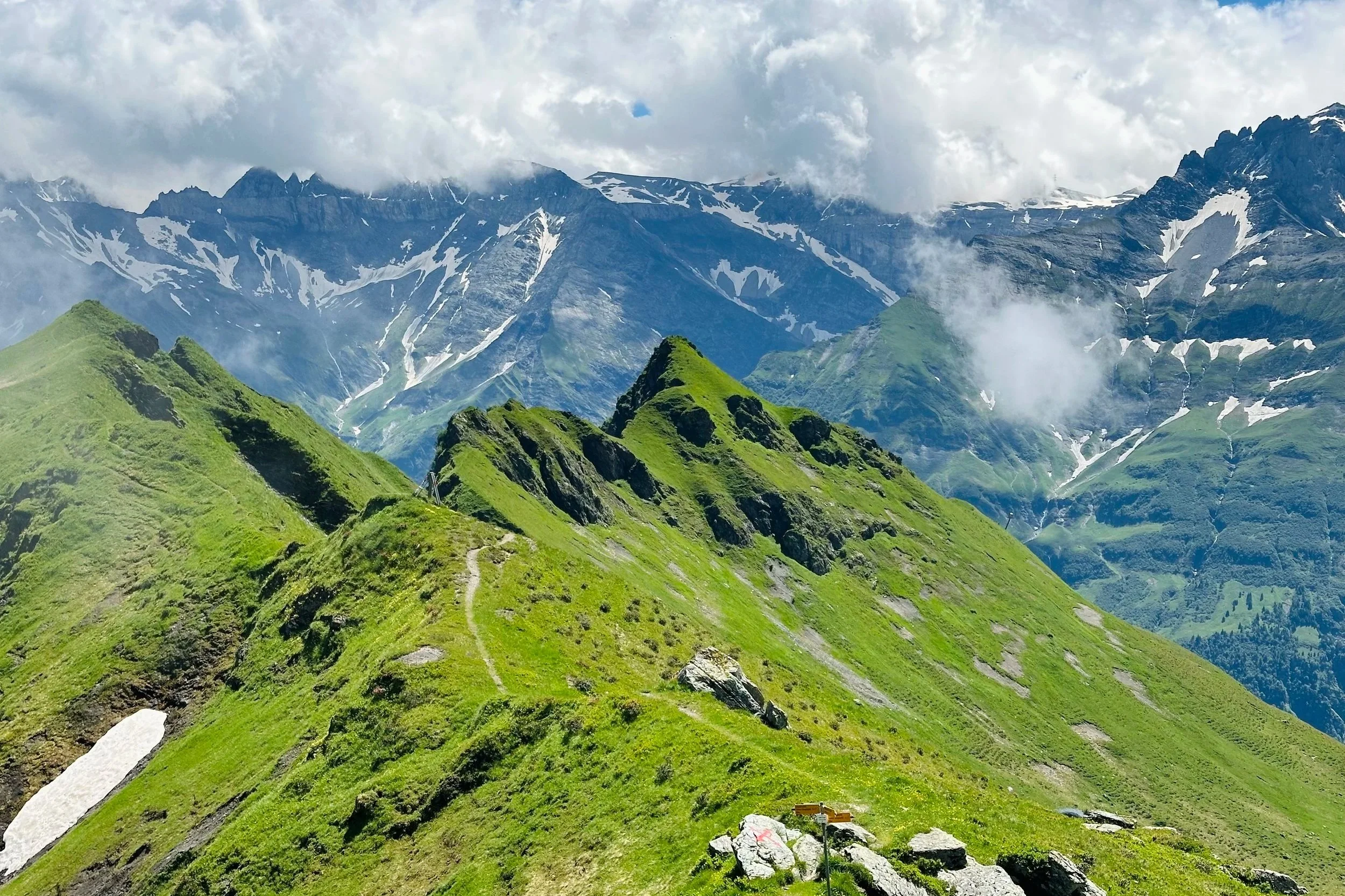
I sometimes think of Elm as a little Jungfrau region - but with literally no tourists. None. Elm is about as local’s only as it gets. And it has all of the things: the big beautiful mountains, the green hills, the wildflowers, the waterfalls, the cows, the villages in the valleys. There are many trails here, but I think this loop from the Ampachli to the Chüebodensee gets you all the highlights in one great hike. And while the lake is small, nestled in its little mountain basin, it still makes for a very picturesque swim on a hot day.
Tip: This is a protected area, so there is a high chance you’ll spot marmots, and maybe even chamois or ibex. Keep your eyes peeled!
3. Batöni Wasserfall Arena — St. Gallen
Distance: 8.5 km | Ascent/Descent: 623 m/623 m | Difficulty: Moderate (T2)
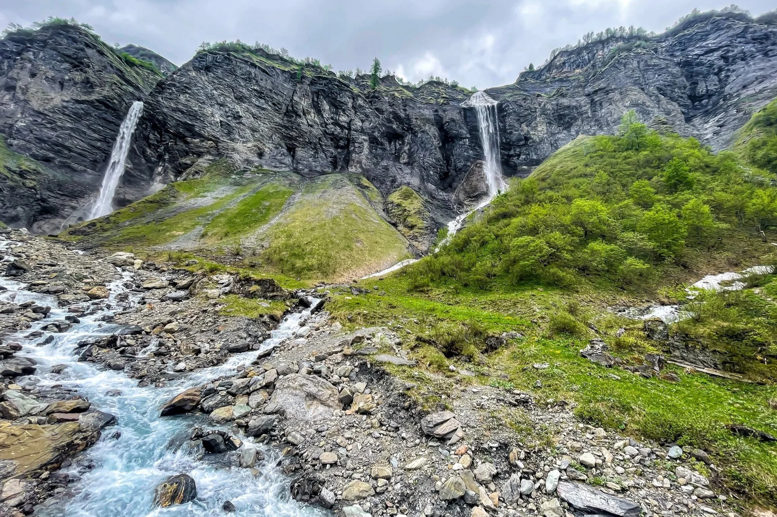
At the back of the quiet Weisstannental, the trail leads you into a natural amphitheater where three huge waterfalls come crashing down the cliffs all around you. I remember thinking that this felt like Iceland (having never been to that country, but it was about vibes, you know!). It’s quite stunning, and well worth the short but steep hike there. Keep in mind that the level of the falls will fluctuate with the season, with the falls being the strongest in early summer as the snow melts.
Tip: The out-and-back trail is great on its own, but if you have the stamina for a 1700m hike, you can continue all the way up to Pizol. Just be sure to check the last gondola times!
4. Val Frisal — Graubünden
Distance: 12 km | Ascent/Descent: 560 m/941 m | Difficulty: Moderate (T2)
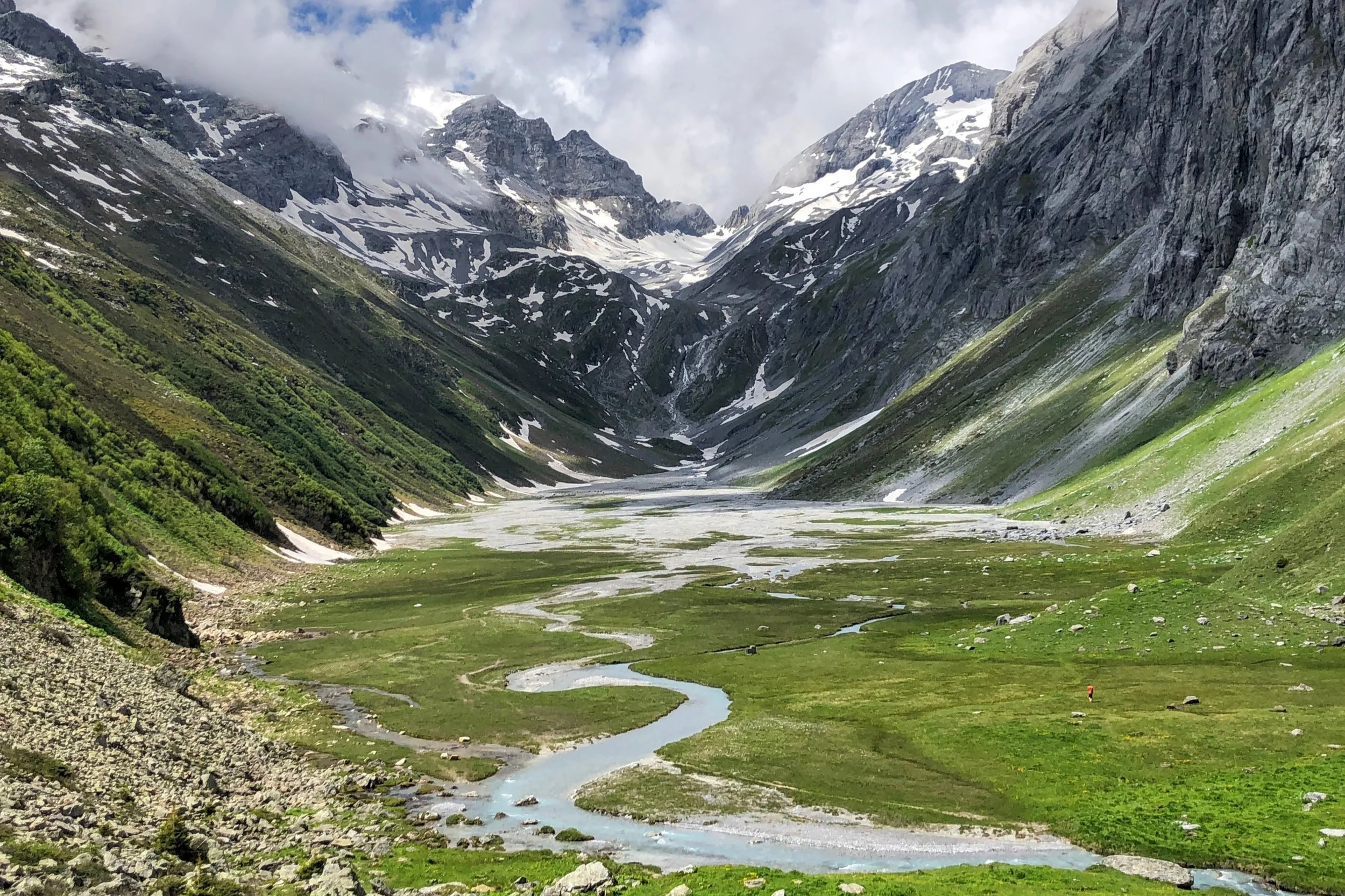
Deep in the Surselva lies the Val Frisal: a high-altitude floodplain, where glacial stream braids itself into dozens of silvery channels through the moorland, all beneath the walls of 3,000 meter peaks. The hike up slowly reveals the landscape, until the dramatic reveal of the plateau. It’s a remote and wild place, with an expansive beauty that can’t really be captured on camera.
Tip: The valley floor is a protected floodplain with unique flora and fauna - please stay only on the designated trails.
5. Höhenweg Maderanertal — Uri
Distance: 16 km | Ascent/Descent: 1350 m/830 m | Difficulty: Challenging (T2)
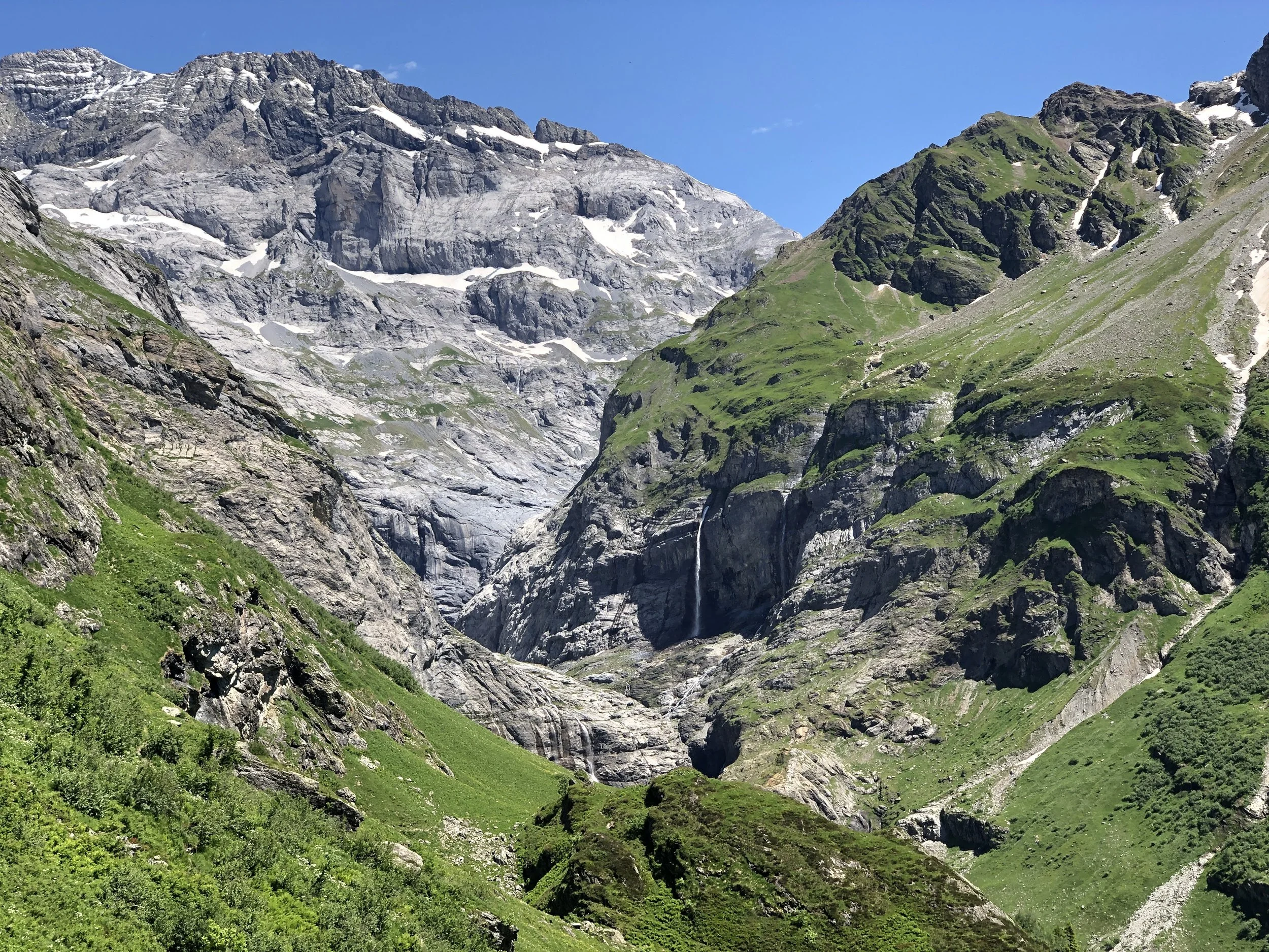
The climb through the Maderanertal to the Windgällenhütte is a near-constant 360-degree panorama of waterfalls and mountains, past quiet valleys filled with glacially-cold streams and wildflowers and butterflies. And it ends at the Golzernsee, where you can cool off, laze on the swimming platform, and stare up at the mountains without a care in the world. If that doesn't sound like hiking perfection, I don't know what does.
ROUTE (Note: I prefer this route in reverse)
Tip: Stop at Alp Stössi. It’s an alpine dairy with the most delicious yogurt I’ve ever tasted. We accidentally dripped some on the table, and licked it up with our fingers because we didn’t want to waste it.
6. Leutschachhütte Loop — Uri
Distance: 14 km | Ascent/Descent: 1200 m/1200 m | Difficulty: Challenging (T2/T3)
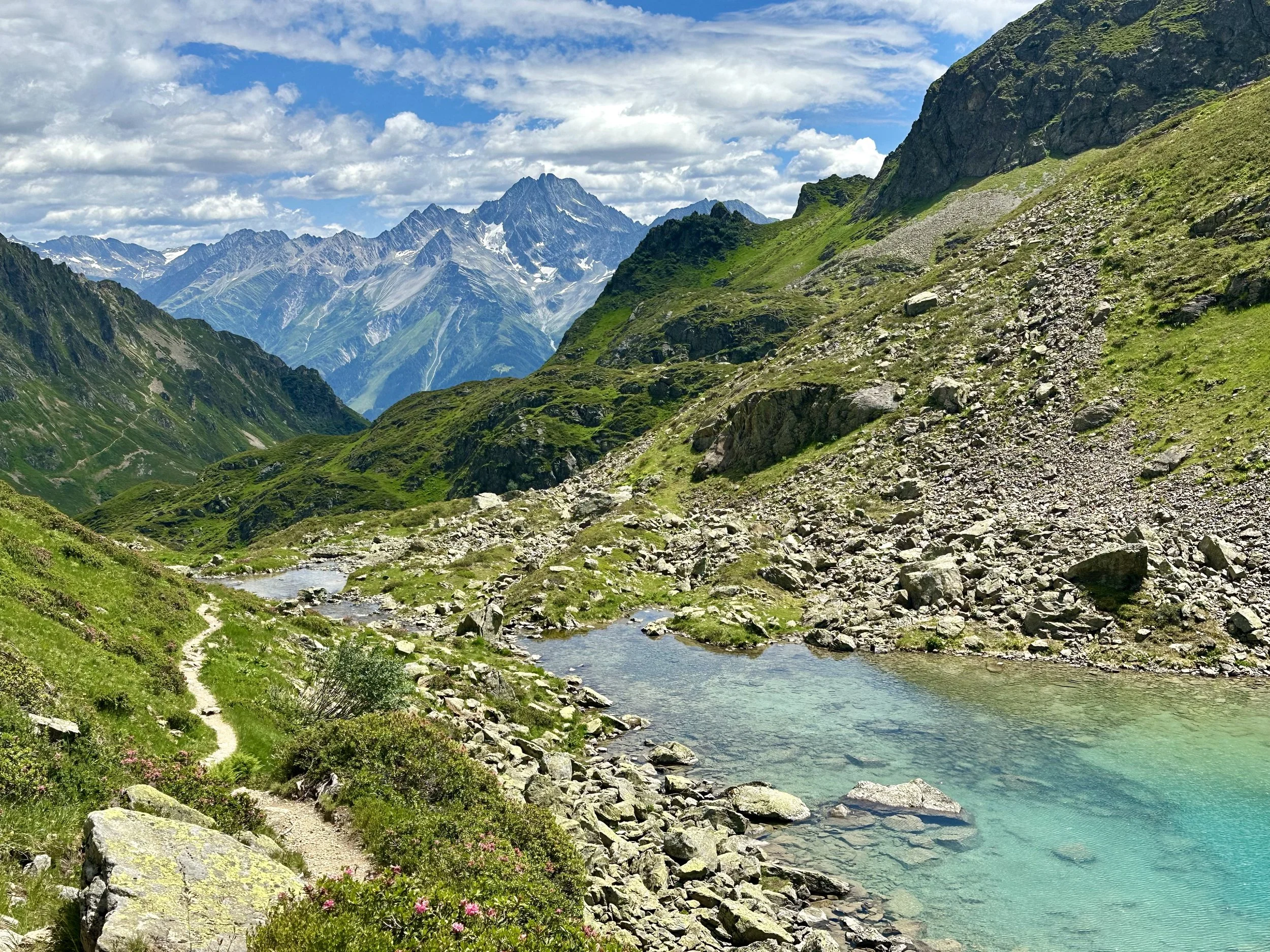
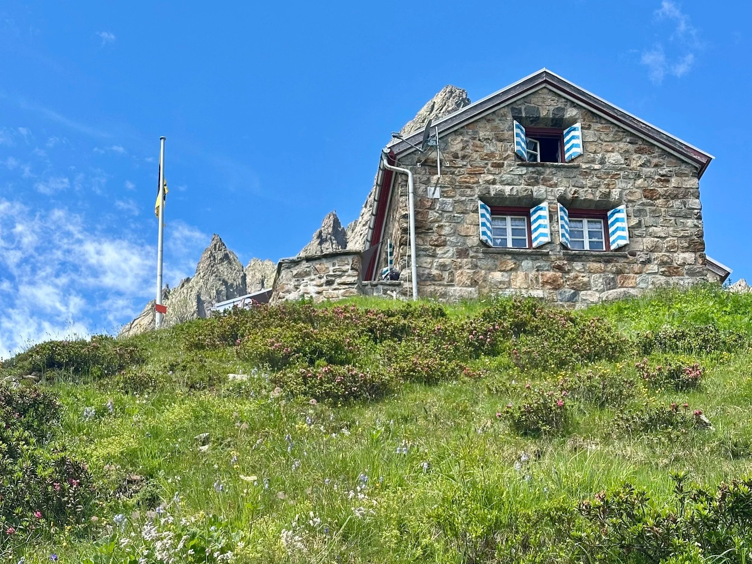
Two huts. Three lakes. And one very good day in the mountains. It starts, as all the great hikes in Uri do, with a tiny gondola ride. Then a steep climb past the first hut, a long traverse to the second hut, and past the deep green Obersee and the brilliantly tropical Nidersee. The descent is the final gift: a lush valley of streams and waterfalls where, if not for the cows, I would think I was in Hawaii.
Tip: There is a restaurant next to the Intschi gondola station that serves a really delicious Poulet im Chörbli. Once, I was so busy eating it I completely missed my bus. It was worth it!
7. Surenenpass — Uri/Obwalden
Distance: 17 km | Ascent/Descent: 1350 m/900 m | Difficulty: Challenging (T2/T3)
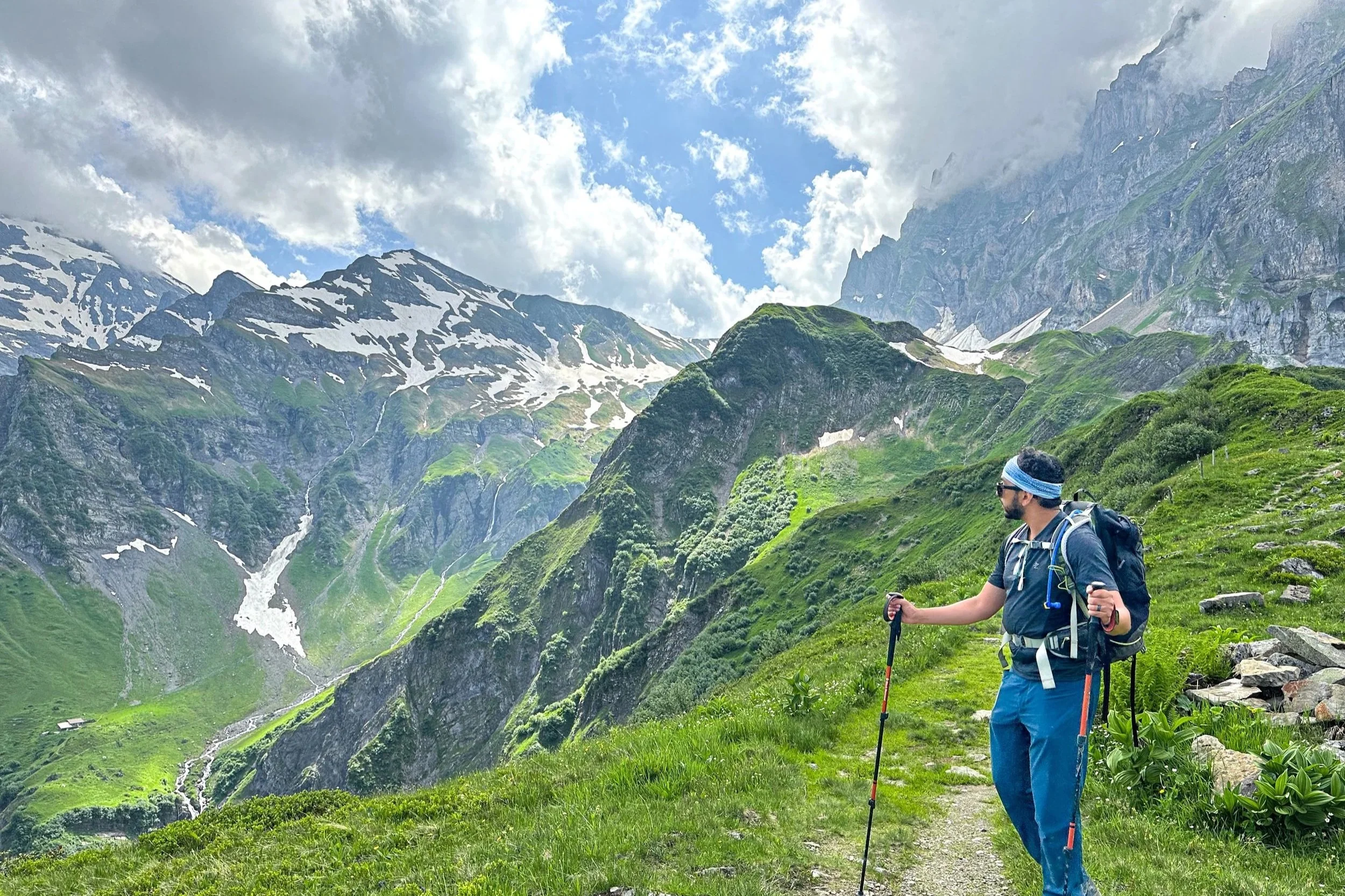
The Surenenpass is a high mountain pass across the Urner Alps that connects the villages of Engelberg and Attinghausen, considered a classic of Central Switzerland. The first half, from Fürenalp up to the pass, is easy walking on wide paths past grazing cows, wildflowers, and waterfalls, with a snow-capped Titlis in view the whole way. Then the second half flips the scenery entirely: dramatic craggy peaks, and the Urnersee glittering far below from the ridge path down to Brüsti. It’s a classic for a reason.
Tip: Cable cars at both ends (Engelberg-Fürenalp on one side, Brüsti-Attinghausen on the other) let you trim significant elevation off the day. I generally skip the Fürenalp cable car, but always take the Brüsti one.
8. Brisen Peak & Haldigrat — Nidwalden
Distance: 9.5 km | Ascent/Descent: 1320 m/520 m | Difficulty: Challenging (T3)
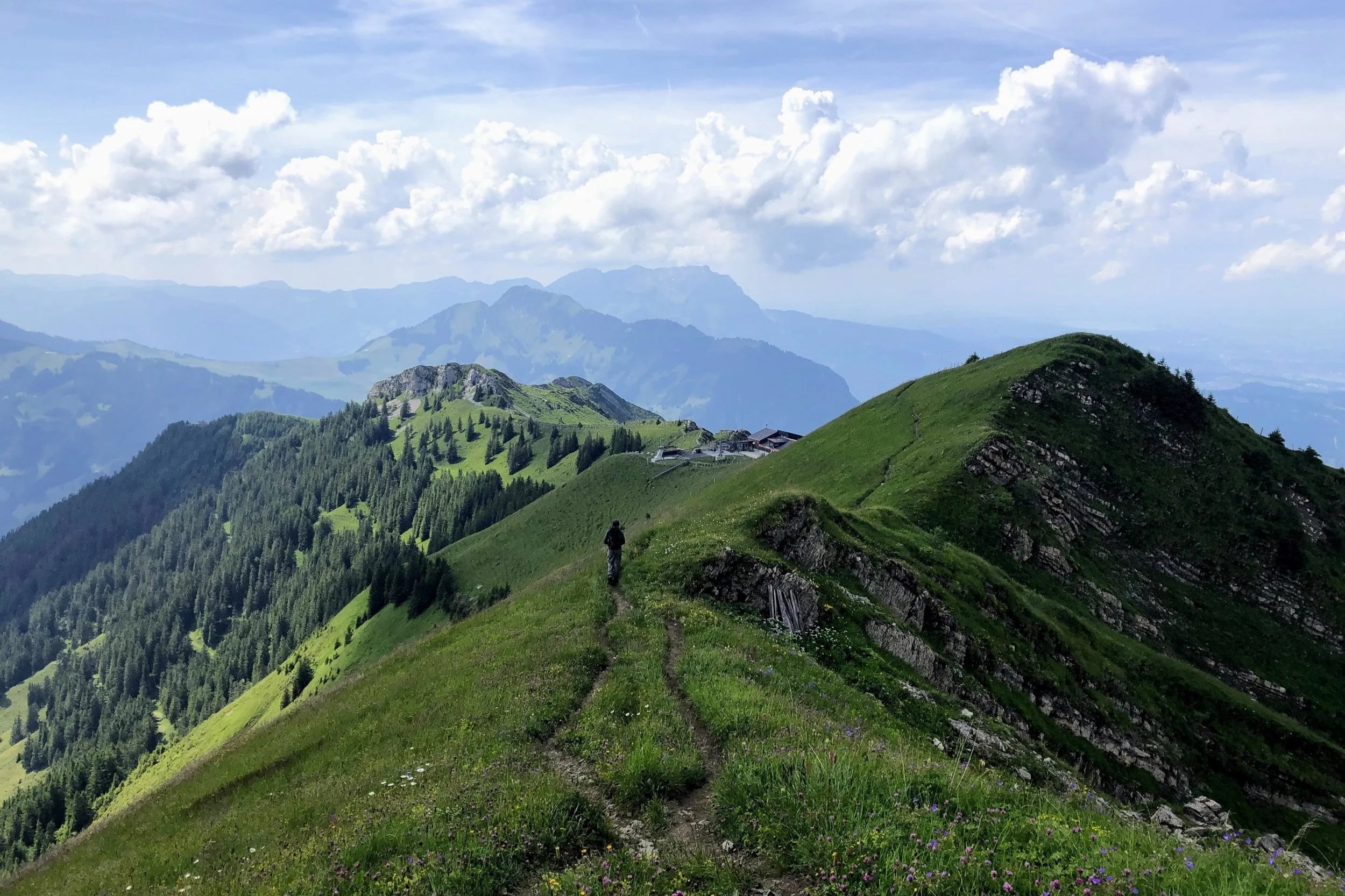
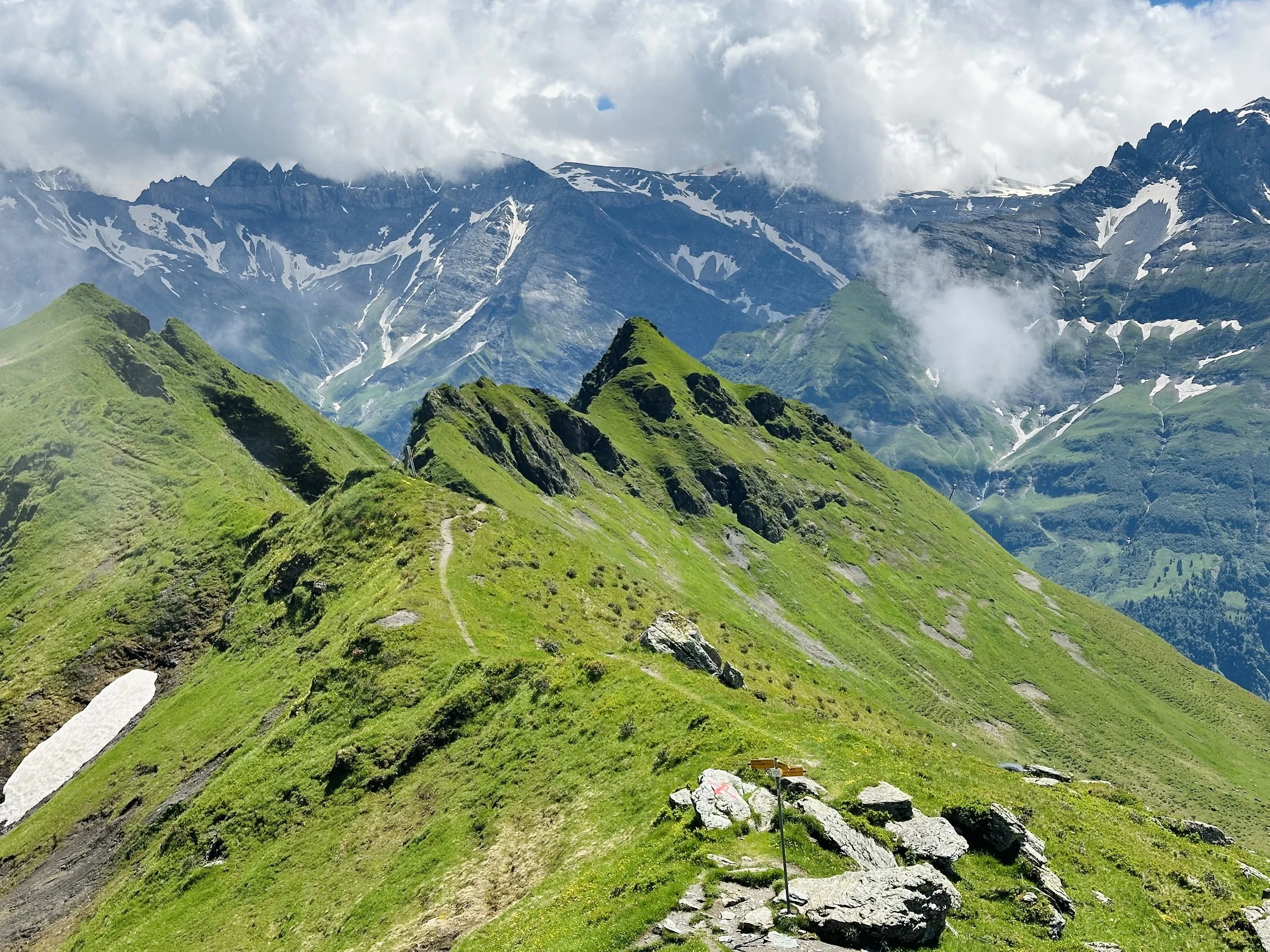
If you love a ridge hike, this one is for you. The trail starts in Niederrickenbach, a tiny hamlet with a Benedictine monastery that feels (sorry, I have to) very The Hills Are Alive. You’ll climb up through alpine pastures before climbing to the summit Brisen (2404 m). The Haldigrat comes after the summit - a narrow, airy ridge, with views stretching from the Säntis to the Bernese Alps and across practically the entire central Swiss Alps. If you’re scared of heights and exposure, I’d skip this one!
Tip: The hike ends at the Haldigrat chairlift station. Once you take the chairlift down, there is still a 2km (easy) walk to get back to Niederrickenbach.
9. Lago Tremorgio to Dalpe — Ticino
Distance: 15.7 km | Ascent/Descent: 980 m/1565 m | Difficulty: Challenging (T2/T3)
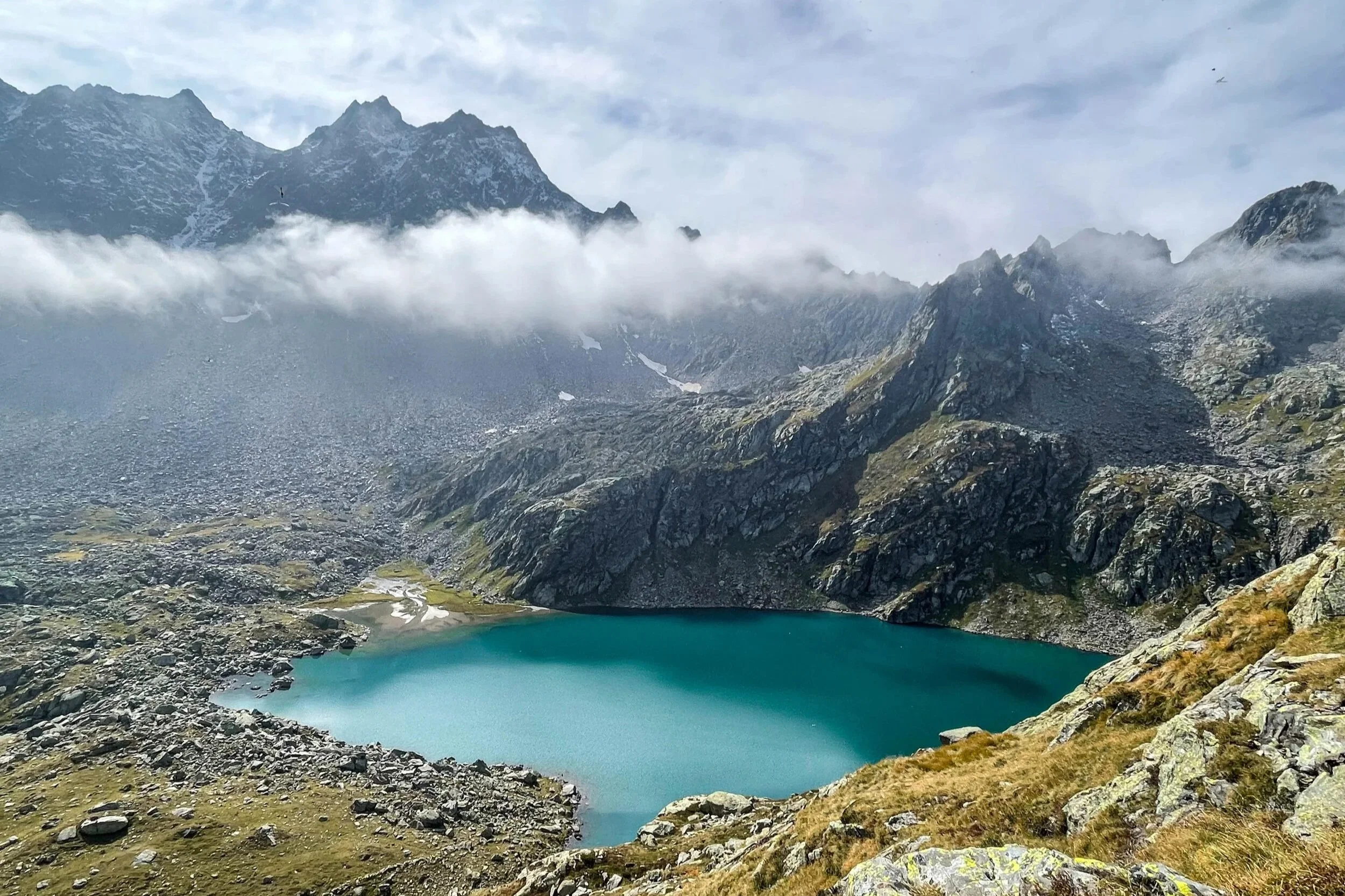
Most people picture palm trees and lakeside promenades when they think of Ticino (truthfully, so did I!), but there is a high-alpine world here in the Leventina mountains. I loved every second of every step of this trail. It truly has it all: vibrant alpine lakes, spiky mountains, high plateaus, colorful valleys, waterfalls, that perfectly idyllic remoteness. I loved climbing the boulders above Lago di Leit, and the high alpine meadows, and the deep cerulean water of Lago di Morghirolo. The descent is long and a bit brutal on the knees, but at least the landscape is a treat!
Tip: If Capanna Leit is selling their alpine cheese, buy some! You won't regret it.
10. Sentiero Verzasca — Ticino
Distance: depends | Ascent/Descent: depends | Difficulty: Moderate (T1/T2)
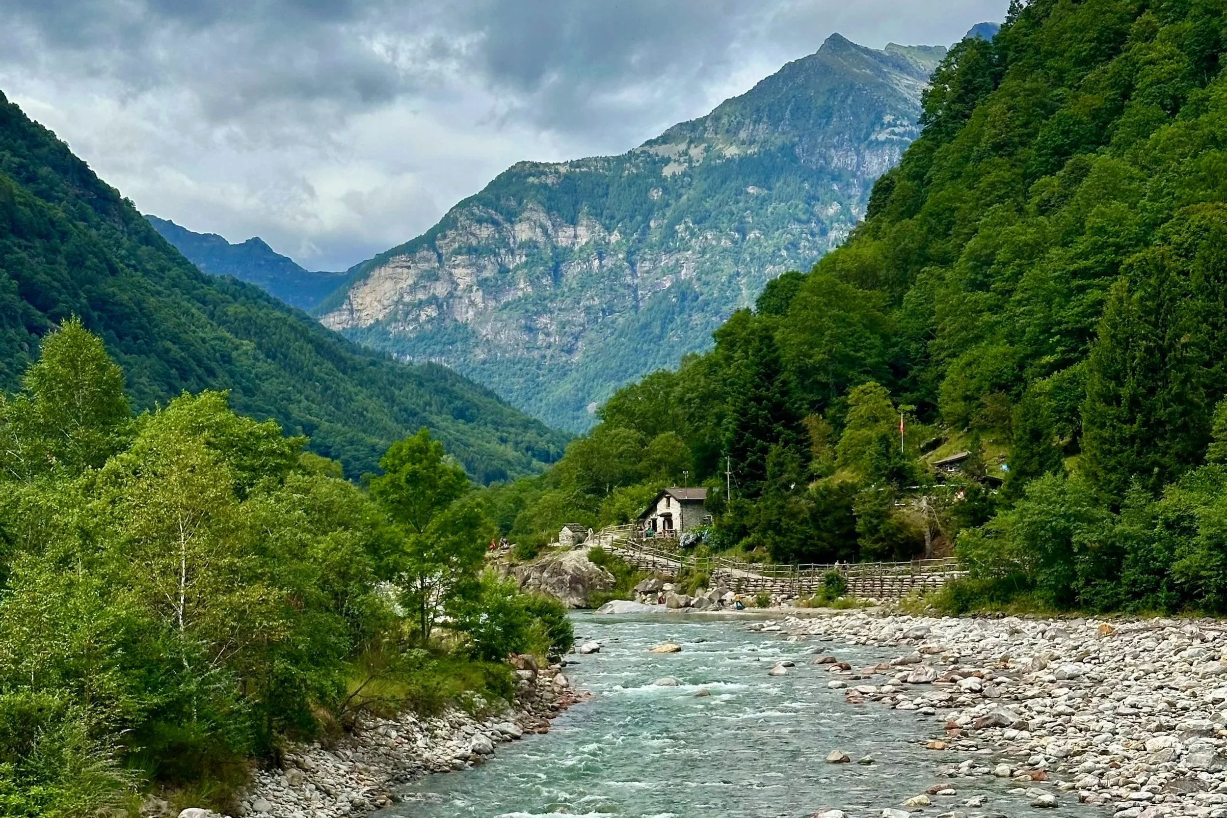
The most spectacular thing about Ticino, in my opinion, lies in its lush, remote valleys - and the Sentiero Verzasca runs the length of the most famous one. The full trail is 32 kilometers - probably too long for a day - so pick a stage! The first passes the tiny stone village of Corippo, a handful of slate-gray houses perched on a hill, and ends at Lavertezzo and its famous double-arched bridge. The second stage takes you deeper into the valley, and feels noticeably more remote. Either way, you're walking an old mule trail past old stone buildings, little bridges, waterfalls and vineyards - and never far from that unbelievable emerald water.
Tip: Most tourists cluster around Lavertezzo, which is now social media famous. The second you pass the village in either direction, the crowds disappear. And the Post Bus runs the length of the valley, stopping at most of the villages along the trail, so you can shorten either stage as much as you like.
11. Bäregg Hut — Bernese Oberland
Distance: 5.7km | Ascent/Descent: 520m/ 520m | Difficulty: Moderate (T2)
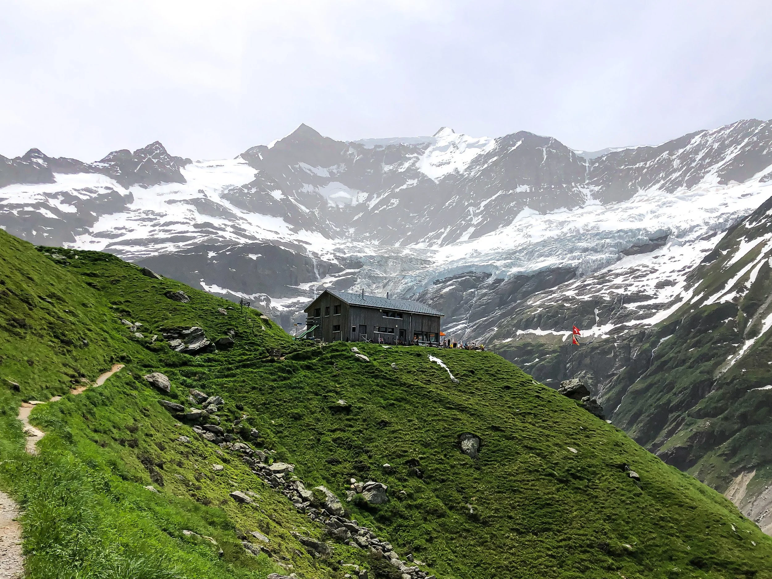
The hike up to Bäregg might have the best effort-to-drama ratio in the entire Berner Oberland. From Pfingstegg, the trail climbs steeply along the edge of the glacier gorge (it’s not exposed, but there is a steep drop-off, so you’ll need a head for heights). After just a few kilometers, you pop out at the Berghaus Bäregg - and suddenly you're standing face-to-face with the wild amphitheater of the Fiescherwand and the Ischmeer glacier, with the Eiger looming at your shoulder. It's a huge, raw, high-alpine scene, reached in a fraction of the time such views normally demand.
Tip: Instead of hiking down or taking the gondola from Pfingstegg back to Grindelwald, you could alternatively ride the alpine coaster. Just sayin’.
12. Höch Gumme - Bernese Oberland
Distance: 13 km | Ascent/Descent: 1350 m/ 830 m | Difficulty: Challenging (T2/T3)
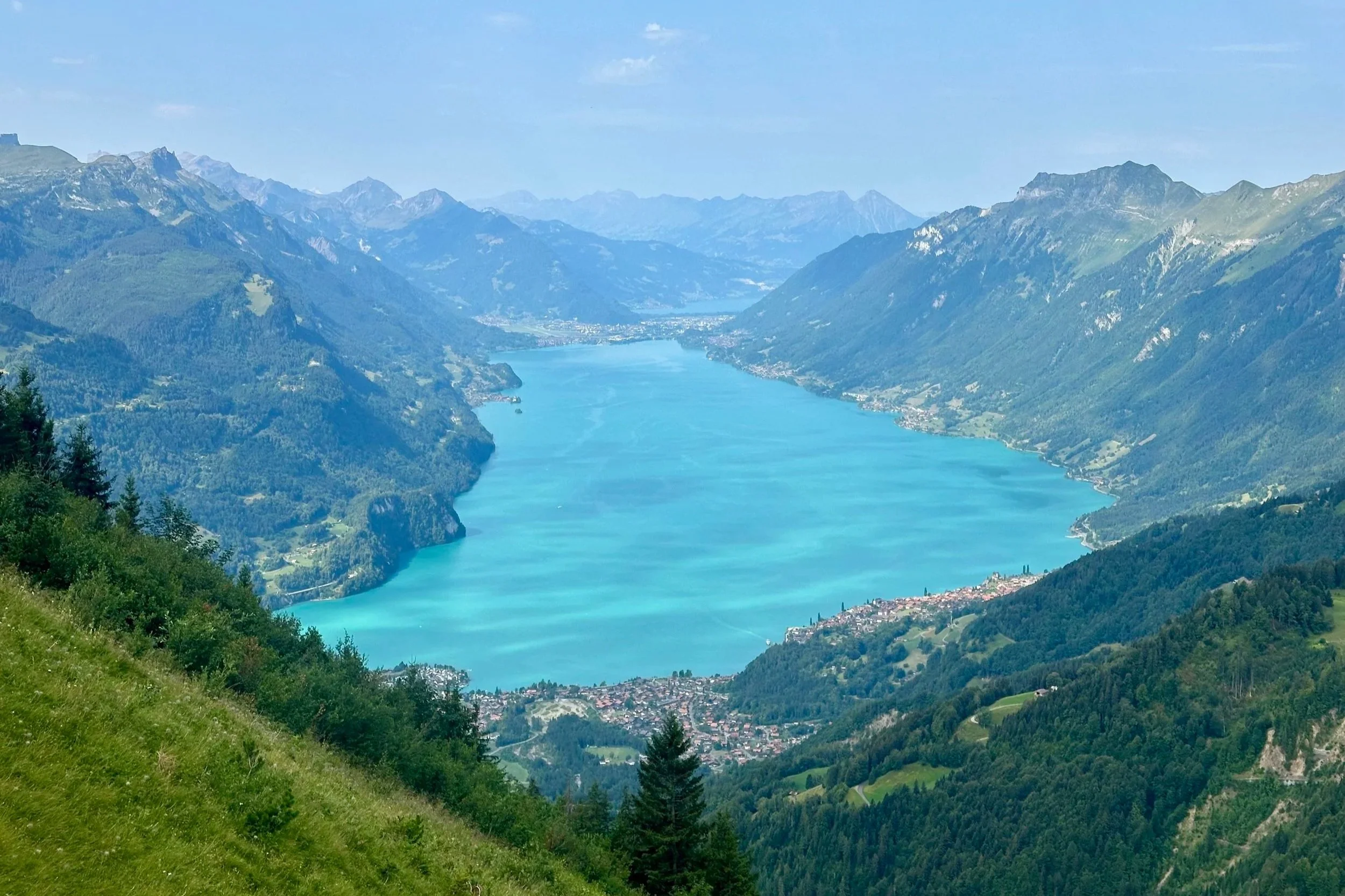
Everyone goes to the Brienzer Rothorn for views of the Brienzersee. This one has views just as good - arguably better - with none of the logistical coordination and far fewer crowds. It's a big, airy day of ridges and traverses high above the lake, and even after hours of extraordinary views, reaching that summit cross still feels like something. Then you drop down through alpine meadows absolutely thick with cows to Bärghuis Schönbüel, where you can get delicious Älplermagronen. Which is, frankly, the correct way to end a hike.
(P.S. Yes, yes, technically parts of this trail are in Obwalden — but it's really right on the cantonal border, so I'm making an executive decision to put it in the Berner Oberland category!)
Tip: There are many varieties of this trail. You could start from Brünig but skip the peak. You could start from the Turren station for an easy hike to the hut and back. The choice is yours!
13. Lausanne to Vevey - Vaud
Distance: 19 km | Ascent/Descent: 360 m/ 440 m | Difficulty: Moderate (T1)
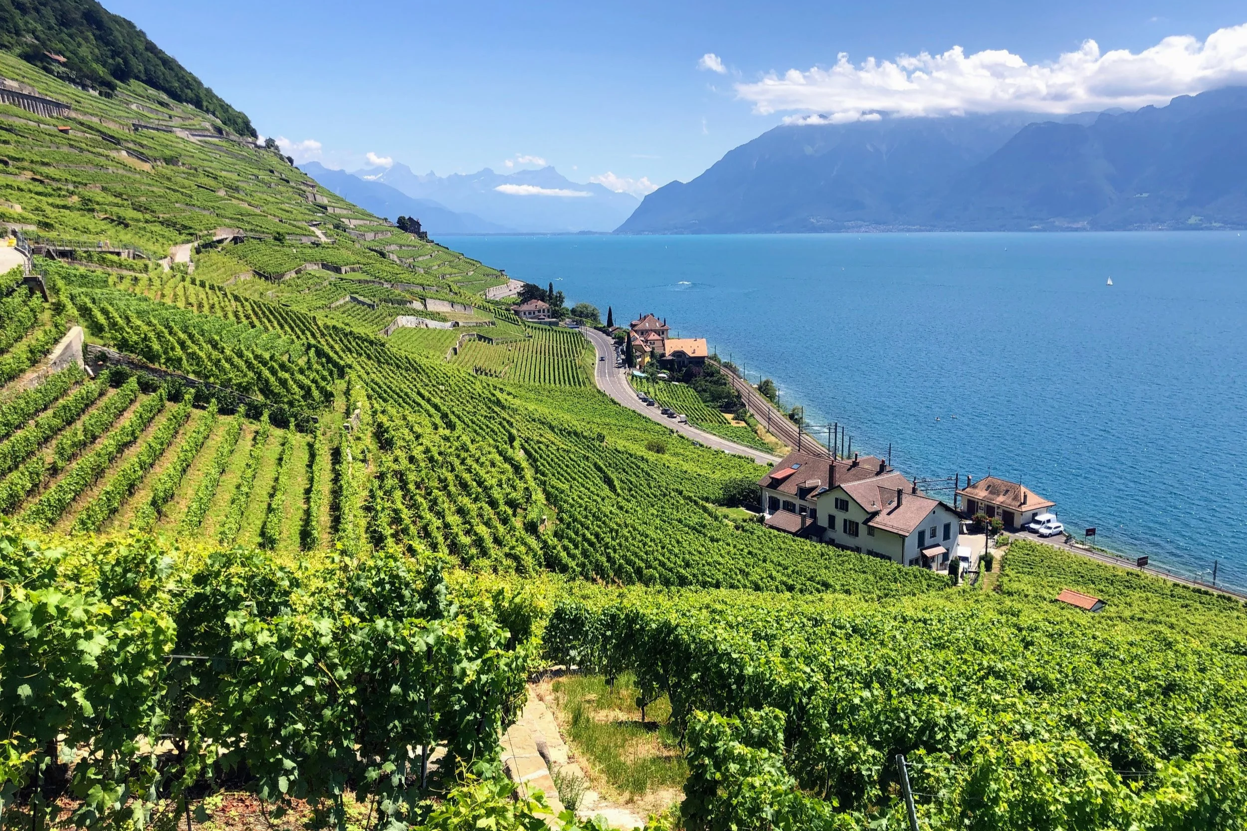
Not every hike has to be a mountain (I know, gasp!). This one is a long, sun-drenched stroll through the Swiss Riviera: terraced Lavaux vineyards climbing away on one side, the turquoise, almost ocean-like Lac Léman below, and France and the outlines of two countries' Alps across the water. You pass through the old wine villages of St-Saphorin, Rivaz and Epesses, and there's a certain je ne sais quoi in the air here (it is the French-speaking region, after all) — the whole vibe is leisurely and deliciously sun-drunk. It feels like being on vacation. Which is why, although you can do this one year-round, you should save it for summer.
Tip: Bring your bathing suit. There are perfect swim spots all along the way, especially around Lausanne, Lutry, Cully and Vevey. And most towns are connected by a regional train as well.
14. The Aletsch Glacier Trail — Valais
Distance: 12.2 km | Ascent/Descent: 510 m/ 630 m | Difficulty: Moderate (T2)
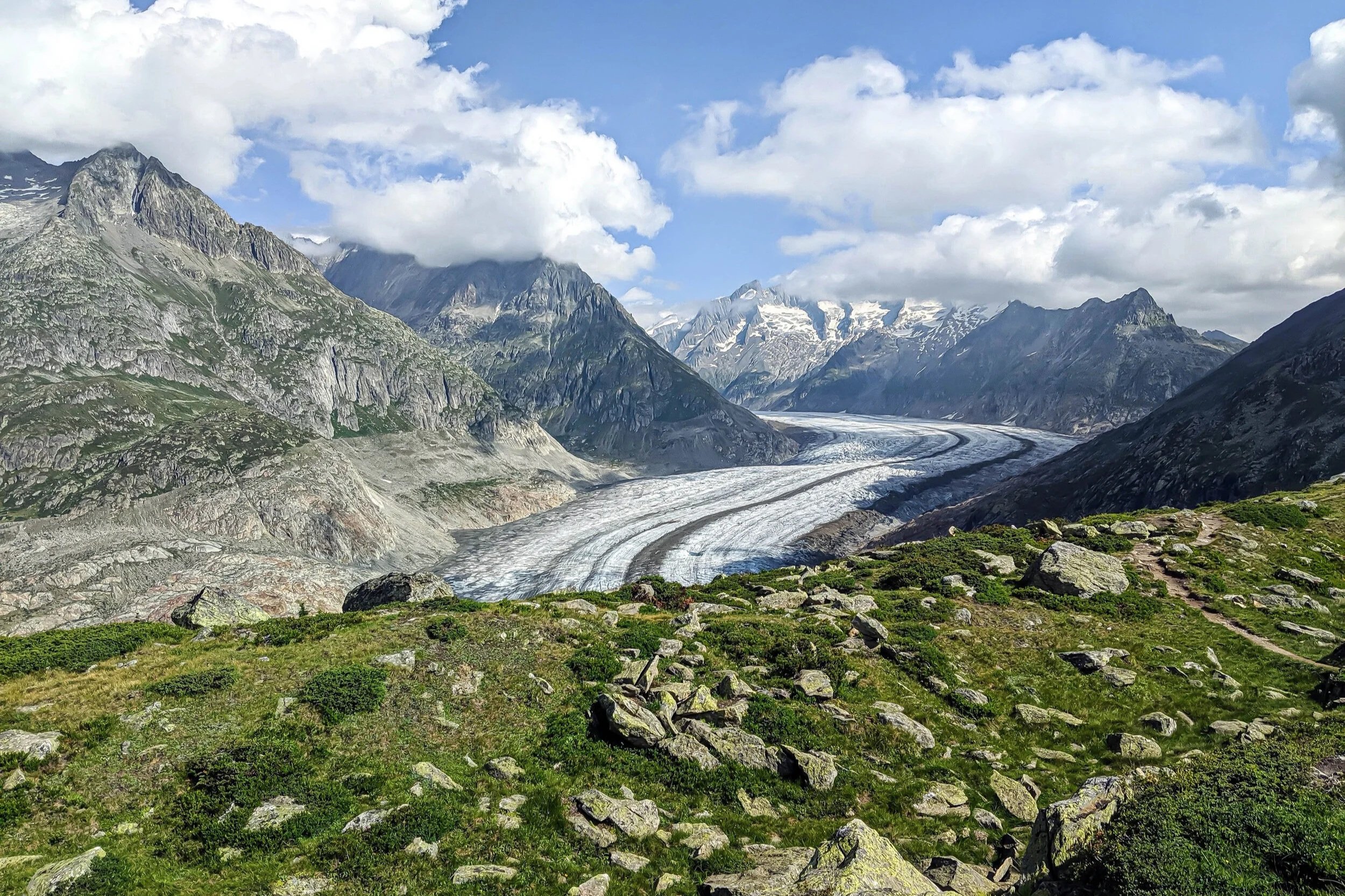
Finally, we head into Valais, for the grand-scale finale-before-the-finale: the Aletsch Glacier, the largest glacier in the Alps. A twenty-kilometer river of ice curving spectacularly through the mountains. There are many trails here, but I think the panoramic trail between Moosfluh and Fiescheralp is the best way to experience the absolute majesty of this glacier. You actually get quite close to the glacier's edge, which helps you take in its sheer size (and also understand how quickly it is receding). I actually can’t believe that people pay hundreds of francs to go to Jungfraujoch, and completely skip this.
Tip: After you pass the Gletscherstube by the Märjelensee, you'll have a choice: the loop around the Talligrat with its views of the Fiescher Glacier, or the tunnel shortcut that saves you an hour. Do the loop if you can!
15. The Edelweissweg — Valais
Distance: 19.7km | Ascent/Descent: 1330m /1330m | Difficulty: Challenging (T2)
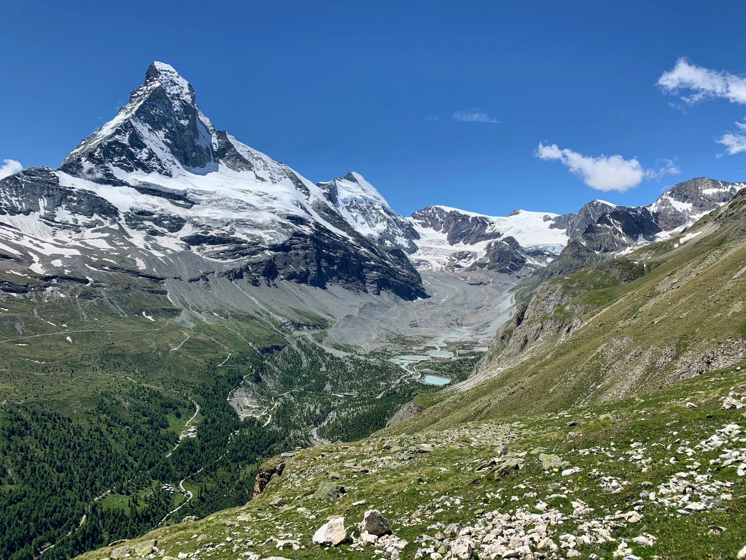
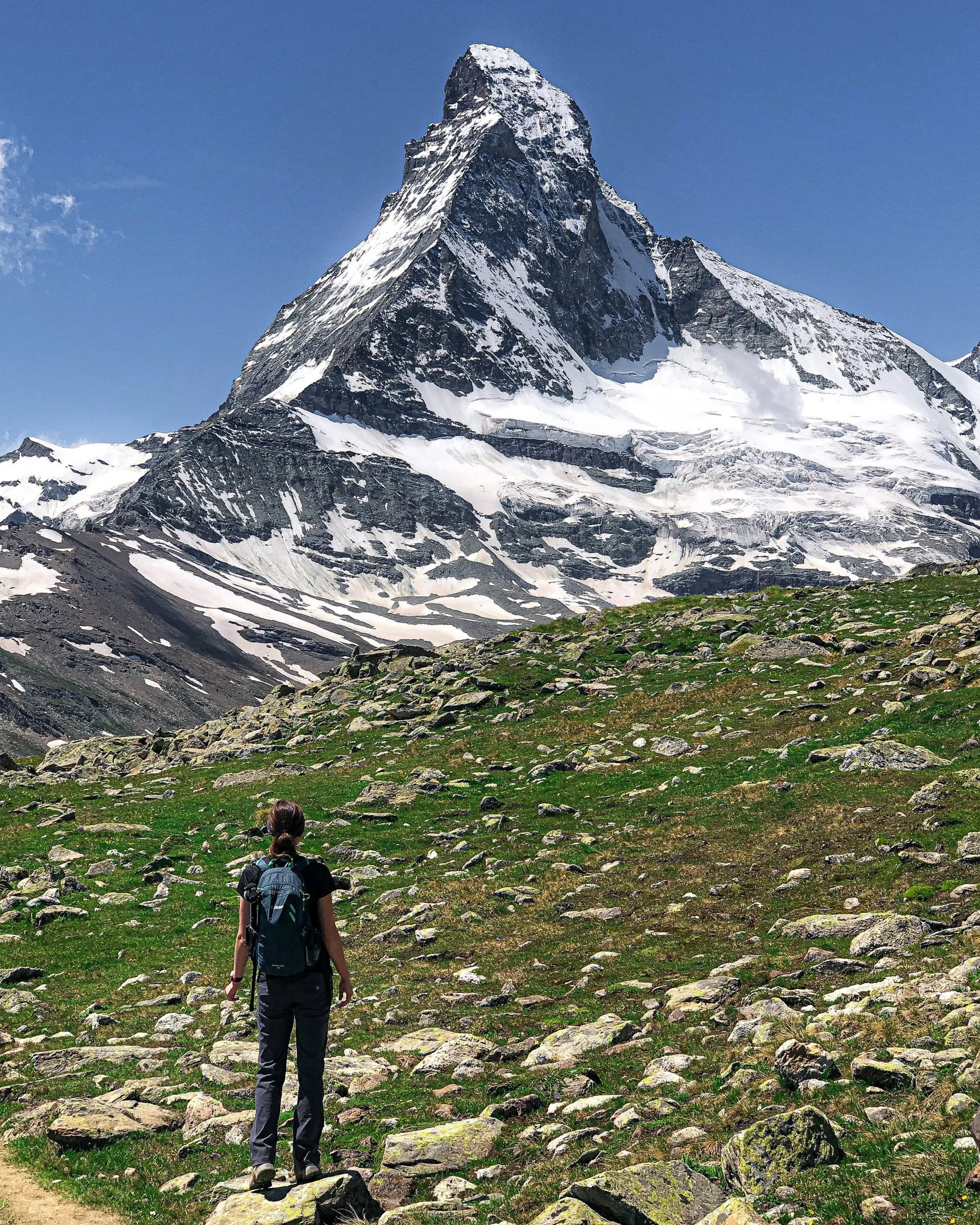
A hike with the Matterhorn has to be on this list, right? And while there are plenty of trails in Zermatt with Matterhorn views, the Edelweissweg feels wonderfully wild - which is actually quite tough to find here, given all the ski and transit infrastructure. This trail has none of it: no gondolas, no ski lifts, no mountain trains. Which means it's practically empty, and anyone up for a long day of hiking is rewarded with what might be the best views in the country. The moment the trail crests the Höhbalmen plateau and the tip of the Matterhorn comes into view is one I'll never forget. Core hiking memory.
Tip: You'll pass through the tiny wooden hamlet of Zmutt at the end, and there's a restaurant that makes a nice stop. And promise me you’ll save this hike for a clear-weather day: the whole thing hinges on the views.
So, that's the list…
…for now. Ask me again next season and it will probably have changed, because that's the thing about hiking in Switzerland: just when you think you've found your favorites, some unassuming valley you'd never heard of goes and blows your mind.
Have you done any of these? Which of your favorite did I miss? Let me know!
And if you're dreaming about doing one of these hikes but feeling intimidated - I'm happy to help! Check out my hike planning services here.
If these posts have inspired your next adventure, consider leaving me a tip! Your support keeps this space ad-free and fuels my work in the mountains.
Leave a Tip