25 Spring Hikes in Switzerland
**Updated April 2026**
Spring is a weird time in Switzerland. No, not weird - bipolar. I’ve never experienced weather as unpredictable as this. All four seasons in a single day. March sunshine, April snow. It’s odd. And very difficult to dress for.
But now, in late April, it feels like we have finally reached a turning point. I hope so, because if there is a freak May snow storm I might just lose my mind. I also put away all my winter clothes, because gosh darn it, tulips and wisteria and daffodils are blooming and I refuse to wear a parka anymore.
And so the summer longing begins. More specifically, the longing for summer hiking. But mountain transport doesn’t generally doesn’t start until Mid-May (at the very earliest), and even then most alpine trails don’t open until late June, and so to satiate our outdoor thirst, Raunaq and I have discovered a variety of other hikes.
These hikes are all lower altitude, with trailheads that generally start from a bus or train stop. Most of the elevation gains and descents aren’t that dramatic (except for the ones in the “challenging” section), which makes all of these perfect for your reintroduction into Swiss hiking shape. None of these trail are in high-altitude areas (remember that some resorts have ski seasons that run until the end of April), and most of them are easily reached as a day hike from Zurich. As always, please check current trail conditions before you head out. Happy trails!
Easy, early season strolls
These are all more like “walks” than proper hikes, but can be done fairly early in the spring season (starting in February and March). Don't expect everything to be green and lush until late April, though!
Gorges de l'Areuse, Jura, Northwestern Switzerland

The nickname for this whole area of Jura, Val-de-Travers, used to be “Pays de Fees” (Fairyland), and that perfectly captures the aura of the Areuse Gorge. In the spring, when everything is lush and green and covered in moss, it feels like Fern Gully. Most of the trail is flat, but it is rocky, and can get really slippery and muddy if its wet. The path closely follows the river nearly the whole way. Some sections, the river is wide and calm, and in other sections the water thunders dramatically down waterfalls and rapids. The best sections are the parts of the trail that cut narrowly along the high stone walls, deep in the gorge. But the whole area is incredibly stunning. It’s not a hidden gem - but a gem nonetheless.
I’m sure this hike is absolutely gorgeous in warm, sunny weather. But I think it’s equally delightful in the fog or rain. You’re in a gorge, after all, so it’s not like the clouds will be obscuring any soaring mountain views. And there is something about the dripping rain on the moss, and the shocking green leaves mixed with the wisps of fog that is pretty ethereal in its own right.
Start: Noiraigue Bahnhof
End: Boudry Bahnhof
Basic Route: Noiraigue - Champs du Moulin - Boudry
Length and Rating: Easy. 11 km, 3 hours.
Lauterbrunnen Valley Walk, Jungfrau Region
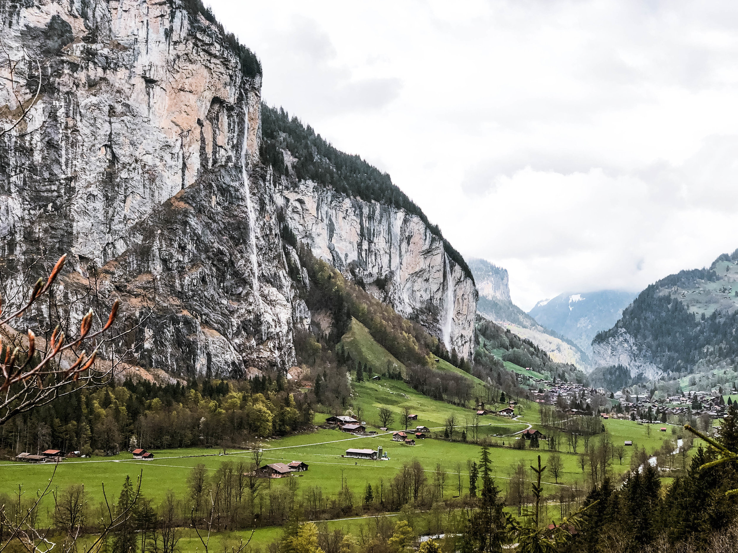
In the spring, when all the snow packs are melting, there’s no better time to wander through a Swiss valley - especially if that valley is the land of the 72 waterfalls. The day we went was cold and foggy, so while you couldn’t see the very tops of the Bernese Alps, the wispy clouds mixing with the forest greens created a moody, ethereal effect that was still very beautiful. The trail itself is a 6.7 km path from Lauterbrunnen village to Stechelberg, a wide, mostly paved path that meanders through the valley floor. There are plenty of places to stop and have a picnic, some of the sites even equipped with firewood and a barbecue. And as the trail is dotted with small farms and villages, you’d probably be able to pick up fresh cheese along the way. If it’s a clear day, it might be a nice idea to ride the gondola up to Schilthorn (you’ll pass the station en route).
Definitely make the short detour to the subterranean Trümmelbach falls, with it’s ten glacial waterfalls thundering inside the mountain. It’s worth it. I’ve never seen anything like it. Trümmelbach drains from the enormous glacial snow packs of the Eiger, Mönch, and Jungfrau, and the waters have carved these beautifully smooth slot canyons through the rock.
Start: Lauterbrunnen Bahnhof
End: Stechelberg
Basic Route: Lauterbrunnen - Trümmelbach - Stechelberg (there is a bus service from Stechelberg back to Lauterbrunnen if you don’t want to walk back)
Length and Rating: Easy. 6.7km one-way, 1.5-2 hours.
Seerenbachfälle Hike, Walensee, Eastern Switzerland
The Swiss call it their Riviera, but Raunaq and I have dubbed this area of the Walensee “Swiss Kauai.” It does feel a bit tropical, the way the mountains plunge into the lake, the jagged cliffs, the lush-looking vegetation and the crystal blue-green waters. Most of the trails here ring the lakeside, with lots of opportunities to pop over to one of the many small, rocky beaches for a lunch break and swim (only for the brave in the springtime).
I love the trail that starts at the Ziegelbrücke train station, goes through the town of Weesen and along the lakeside (sometimes sharing the road with cars as an FYI), then continues to Betlis and the Seerenbach waterfalls. Betlis is a small little storybook town, with a small chapel on the hill. Behind Betlis is the trail to the waterfalls, which will be at their biggest in May and June thanks to the melting snow from the Churfinsten mountain range. It’s also possible to continue past Betlis, and end at Quinten (then take the ferry back to Weesen).
Start and end: Ziegelbrücke Bahnhof (shorten by starting and ending at Weesen)
Basic Route: Ziegelbrücke - Weesen - Betlis - Seerenbachfälle - Betlis - Weesen - Ziegelbrücke
Length and Rating: Medium. The trail is almost completely flat, but it’s a lot of walking. 18.5km, 4 hours.
Pfannenstiel Trail, Zurich, Central Switzerland

What a fun, varied trail! This is another “more walk than hike” trail, but it makes for a great half-day excursion from Zurich. It’s split pretty nicely into two equal parts. The first section is through the forest and along the Pfannenstiel ridge, until it opens up to a truly amazing vista of Zurichsee and beyond, the Swiss Alps. Honestly, I think the views from the platform at the top of the Hochwach (30 meters high) are better than the views from the Uetliberg. Plus - it’s free to climb this tower (woot woot!). There’s also a huge picnic area with some BBQ pits and a restaurant. The second half descends down to lakeside village of Meilen, following a idyllic creek with moss-covered boulders and more than a few waterfalls. Very fairy forest-esque, especially when everything is lush and that vibrant spring-time green.
Start: Forch
End: Meilen
Basic Route: Forch - Pfannenstiel - Meilen
Length and Rating: Easy. 12km, 3 hours.
Caumasee and Crestasee, Flims, Graubunden
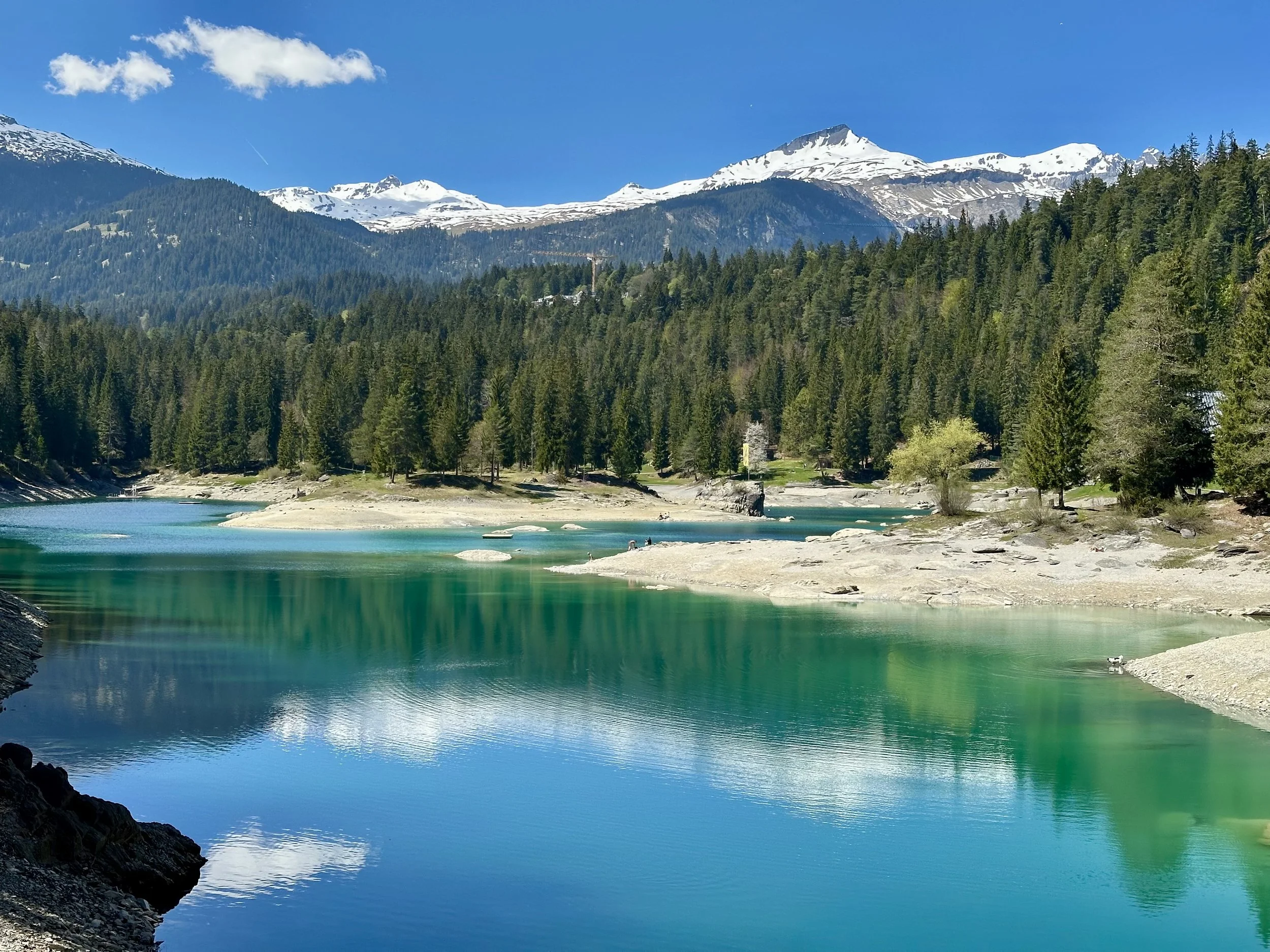
The second the weather starts warming up, I start looking for hikes near water. And wow, does this trail in Flims deliver. It passes by two alpine lakes, each with crystal-clear water so impossibly turquoise I *literally* stopped in my tracks. Which, in a country that is full of stunning lakes, really says something. The hike is officially called Senda Quatter Lags da Flem (don't worry, I can't pronounce it either). It's a moderate 15km loop through forest, gorge and alpine meadows. The Caumasee and Crestasee are the big highlights, but so is the Rhine Gorge overlook, and the peaceful forest path, and all of the surrounding mountains! The whole thing is beautiful.
This hike can technically be done fairly early in the season. but if it were me, I'd wait for that first really warm day of spring. Because with lakes that look like this, you are going to want to swim. There is an entrance fee for the Caumasee, but only during high summer (typically mid-June to mid-September).
P.S. This is a loop, but if you don’t want to walk all the way back to Flims, there is a bus stop about 10 minutes away from Crestasee.
Start/End: Flims, Dorf
Route: Flims – Lag la Cauma–Lag la Cresta – Flims
Length and Rating: Easy. 15km, 4-5 hours.
Uetliberg and Felsenegg, Zurich, Central Switzerland
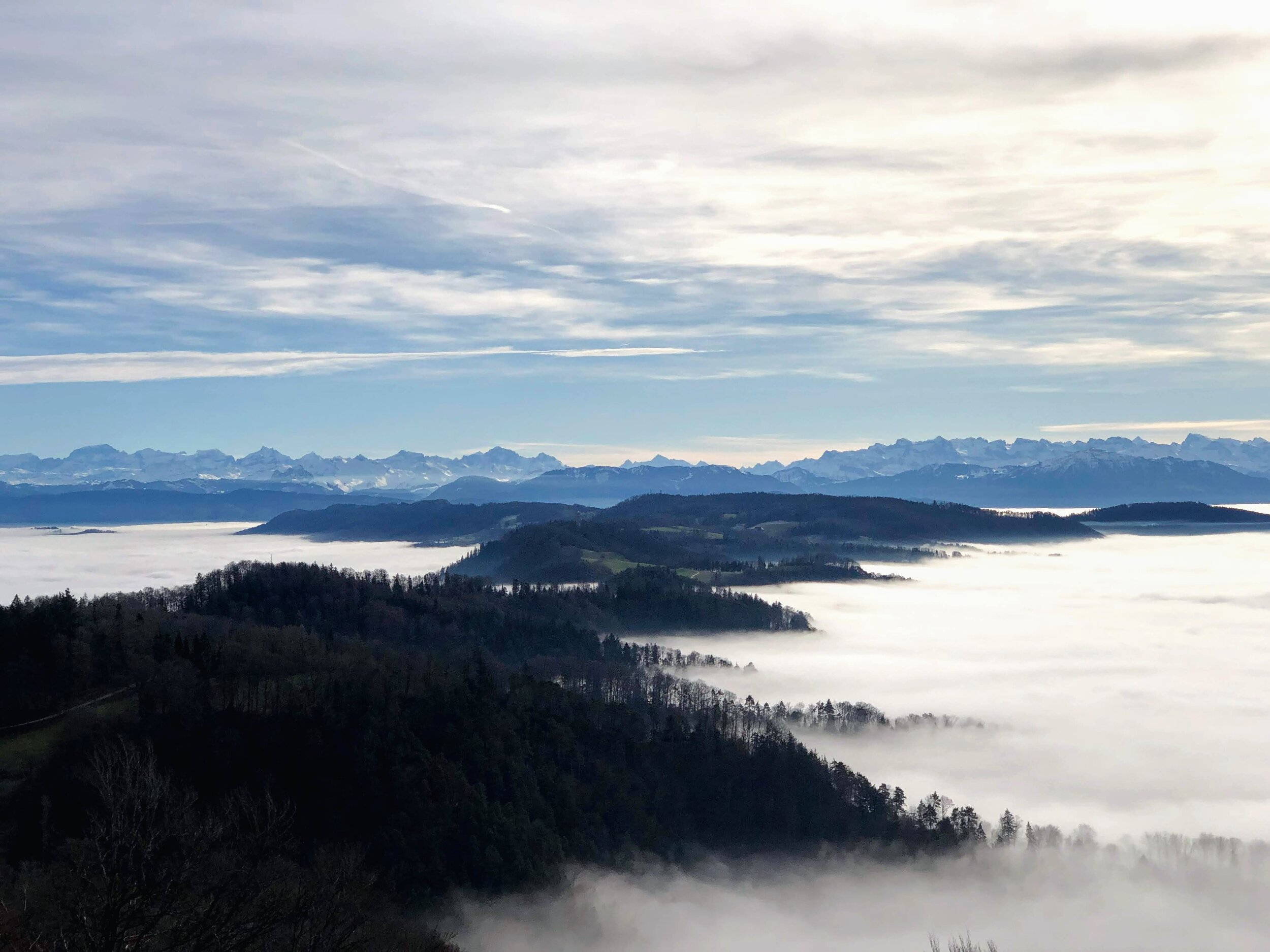
Uetliberg is Zurich’s “little mountain,” with beautiful views of the city and the lake. On super clear days, Uto Kulm offers panoramic views of the Alps which seem to go in every direction. There are lots of routes up to the top, but my favorite is the steep Föhreneggweg trail that starts at the Albisguetli tram stop. After enjoying the views at Uto Kulm, I like to double back and continue along the wide ridgeline trail to Felsenegg. Lake Zurich to one side, cows and countryside to the other, and Alps as far as the eye can see.
Once there, you can spend the rest of the afternoon eating at the Felsenegg restaurant or picnicking on the grassy knolls, before catching the cable car to the Adliswil train station (alternatively, there is a steep footpath path down). It’s a classic, local hike, especially great for those who near Zurich and just want to spend a couple hours outside. It’s right on the outskirts of the city but feels a world away once you get up into the forests of Uetliberg. Even if it is a foggy day, check the webcam! Most of the time, the peak and ridge are above the clouds.
Start: Albisguetli tram stop (Zurich)
End: Felsenegg (with cable car connection to Adliswil)
Basic Route: Albisguetli - Uto Kulm - Felsenegg
Length and Rating: Easy/Medium.
Türlersee, Zurich, Central Switzerland

The hike from Uetliberg to Türlersee (via Albis pass) is one of my new local favorites. I can’t believe I lived in Zurich for a couple years before discovering it! It’s calm, and understated and just a real gem.
Start: Albisguetli tram stop or Uetliberg train station (to shorten)
End: Türlersee
Basic Route: Uetliberg - Felsenegg - Buechenegg – Albispass – Türlen – Türlersee
Length and Rating: Medium. 16 km, 4 hours.
ViaRhenana (Stage 4), Schaffhausen, Northern Switzerland

This section is part of the longer ViaRhenana, a historic ten-stage hike.The section in particular packs in plenty of highlights for the leisurely, 14km walk: Schaffhausen, with it’s beautiful old town and medieval fortress, the Rhine Falls, which are always a spectacular sight in any season (but biggest in the spring), and the quaint town of Rheinau, with it’s striking baroque monastery built on a tiny island - not to mention the meandering Rhine River, which you follow the entire way. The best part, though, was that this trail felt really remote. The long stretch between the Rhine Falls and Rheinau was wonderfully serene: a nearly uninterrupted narrow path, right where the river bank met the forest. The setting is seriously beautiful.
Start: Schaffhausen
End: Rheinau
Basic Route: Schaffhausen - Rheinfall - Daschen – Rheinau
Length and Rating: Easy. 14 km, 3-4 hours.
Mid-season, moderate hikes
The Goldilocks of spring hiking: Not too easy, but not too tough, and perfect right in the middle of the season (April and May).
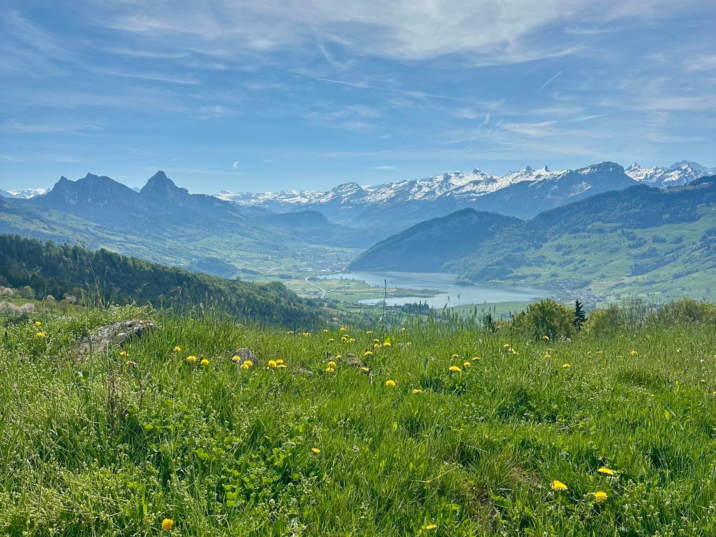
Weg der Schweiz, Stages 3 & 4, Central Switzerland

This one has all the classic Swiss views - but then again, would you expect anything else from the Weg der Schweiz?
Every time I do this trail, I remember how much I like it. I think because it is surprisingly varied for a low-elevation trail: There’s the first portion that winds up and down alongside Urnersee (which is this shockingly vivid, almost tropical turquoise color). Then there’s the second half, which includes a steep, heart-pumping climb up through the meadows. Maybe you don’t get all the way up into the mountains, but you certainly get some great views of them. And then, there are all the little things: the tiny chapels, the cows and the goats and the bells, the lakeside villages, the wildflowers, the seaside promenades, the small farmhouses. All the classics. It’s not called the Swiss Path for nothing, after all. It might not be off the grid, and you’re not going to feel like you’re out in the wild yonder - but it sure is pretty dang beautiful. And that’s basically all you need for a great Swiss spring hike, in my very humble opinion.
Start: Flüelen
End: Brunnen
Basic Route: Flüelen - Tellskapelle - Sisikon - Morschach - Brunnen
Length and Rating: Medium. 15 kilometers, 700 meter ascent, 4-5 hours.
Lägern Ridge (Jura Höhenweg), Baden

OK, straight off the bat: this is a moderate hike if you don’t have vertigo. But if partially exposed ridges are not your friend (hi! it me!), then this will be a challenge. A fun, adventurous challenge, though!
The highlight of this trail is the Lägern Gratweg. It is not particularly high, but as it leads along sloping, almost vertical rocky terrain, surefootedness is essential. There were definitely a few moments that felt…dicey…but honestly, it’s all completely manageable. I’d recommend starting the trail from Baden. That way, most of the tricky sections are when you are going uphill, which I find easier (and less scary) than going downhill. Other highlights of this sleeper hit of a trail include views of Zurichsee, Uetliberg, the Alps, the countryside (ok, you get the picture). Lots of nice views! But wait for good weather on this one. I wouldn’t want to be on that rocky ridge in the rain.
**Note: There is an alternate, safer path, if you want to skip the ridge section altogether**
Start: Baden Bahnhof
End: Dielsdorf Bahnhof
Basic Route: Baden - Lägern Burghorn (follow the Gratweg) - Lägern Hochwacht - Regensberg - Dielsdorf
Length and Rating: Medium. 13 kilometers, 4 hours.
Belchenflue Loop, Basel-Landschaft

A lovely hike up to the highest panoramic summit in the region. The path alternates up and down through open countryside, forests and rocky look-out points, which keeps things interesting throughout the 13 km trail. There are more direct paths to the Belchenflue - actually, there seem to be many different paths, as people kept arriving from all directions at the summit - but the path we took via Wuesthochi was a little more remote than the others, which was nice. There aren’t any restaurants or facilities on the trail, but many a beautiful spots to have a picnic. All in all, a nice hiking season warm-up!
Start/End: Langenbruck
Basic Route: Langenbruck - Wuesthochi - Belchenflue - Chilchzimmersattel - Spitzenflueli - Lauchflue- Humbelbergli - Schonthal - Langenbruck
Length and Rating: Medium. 12.5 kilometers, 620 meter ascent, 3-4 hours
Waldstätterweg Stage 1 (Brunnen to Vitznau), Central Switzerland
The trail officially starts by the lake in Brunnen, in Canton Schywz, following trail #98. As with most non-alpine trails, this one had sections that were through towns or on main roads, but I don’t think that took away from the overall beauty of the hike. Once you leave Brunnen and ascend up into the lakeside forests, all the city life and traffic noise melts away. There are views of snow-capped mountains, charming little lakeside villages (Gersau marks the halfway point, and seems like a weekend destination in its own right), cows and goats, even a little trailside cheese and honey stand. I dropped seven francs into the basket and took home a jar of Zitronenhonig. I was hot, sweaty and happy as a clam by the end of the day. It’s possible (and faster) to take a bus and train from Vitznau back to Zurich, but this is certainly the place to take the long way home. If you’ve never taken the ferry ride from Vitznau to Lucerne, you are in for a treat. It’s one of my favorites. Pro tip: if it’s a hot day, bring sandals and/or bathing suit to chill by the lake in Vitznau while you wait for the ferry.
Start: Brunnen Bahnhof
End: Vitznau (with bus and ferry connections)
Basic Route: Brunnen - Gersau - Vitznau
Length and Rating: Medium. 15 kilometers, 760 meter ascent, 4.5 hours.
**There is a section between Brunnen and Gersau (Brünischart - Fallenbach) that is closed due to rockfall and landslides. Use the alternative path via the pavement along the cantonal road.**
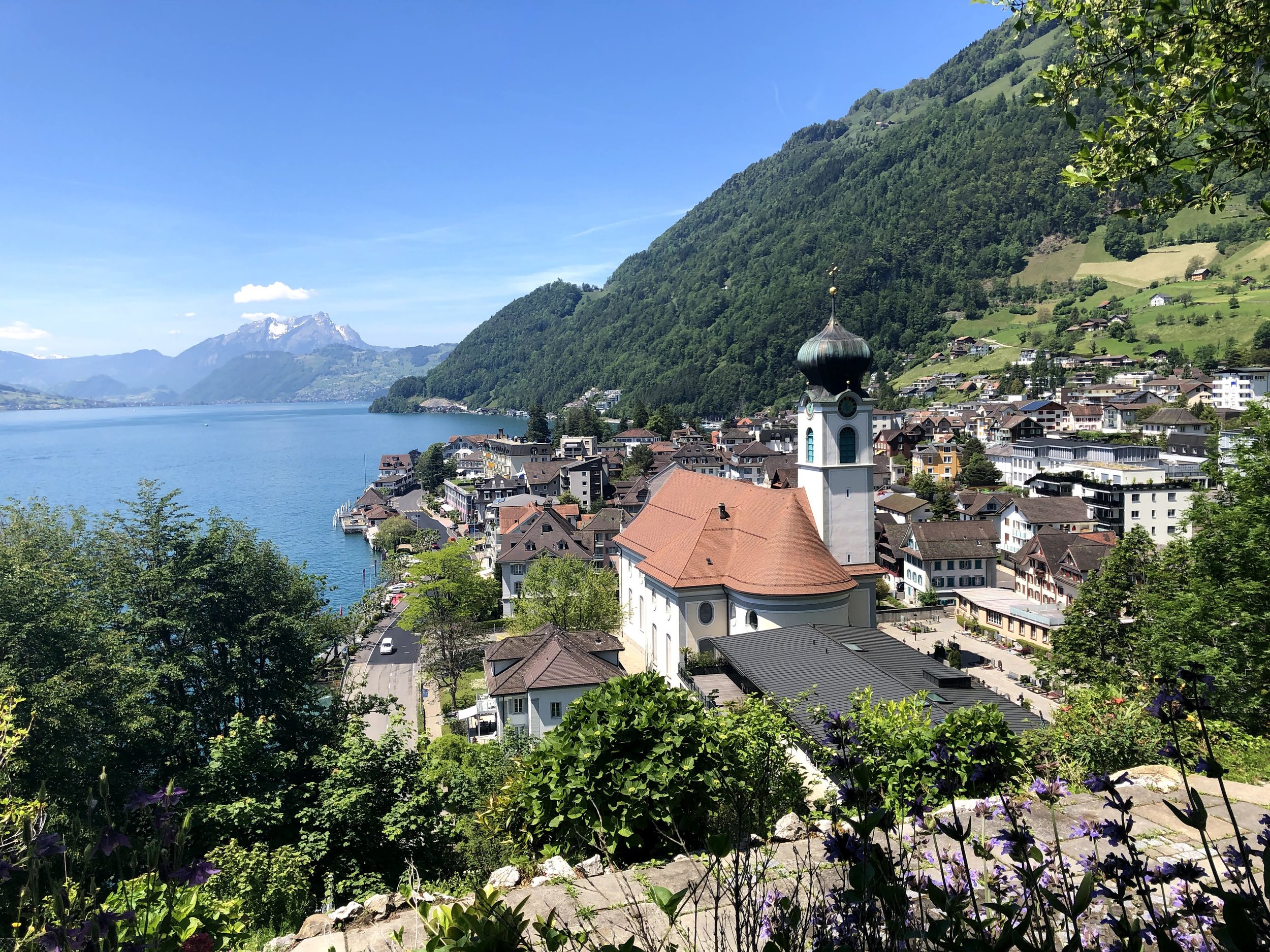
Ober Urmi (Gersau to Vitznau), Central Switzerland

This is a slightly higher variant than the above Waldstätterweg stage, and a great choice for a spring training hike. It can be done in either direction - we chose to end in Vitznau simply so that we could end the day with a ferry ride to Lucerne. The first half up from Gersau isn’t the most exciting (it’s on a local road), but the lake views more than make up for it, and the trail gets more exciting once you reach the forest and treeline. The view at the highest point, Ober Urmi, is gorgeous, with the lake, mountains, and villages. There are a couple options for the descent to Vitznau: one is steeper through the forest (this is the variant we took), and the other is a slightly gentler descent.
P.S. The wide plateau on Ober Urmi is an excellent for a picnic!
Start: Gersau
End: Vitznau Schiffstation
Route: Gersau - Oberreid - Ober Urmi - Wissifluh - Vitznau
Length and Rating: Moderate. 10km, 750m ascent/descent
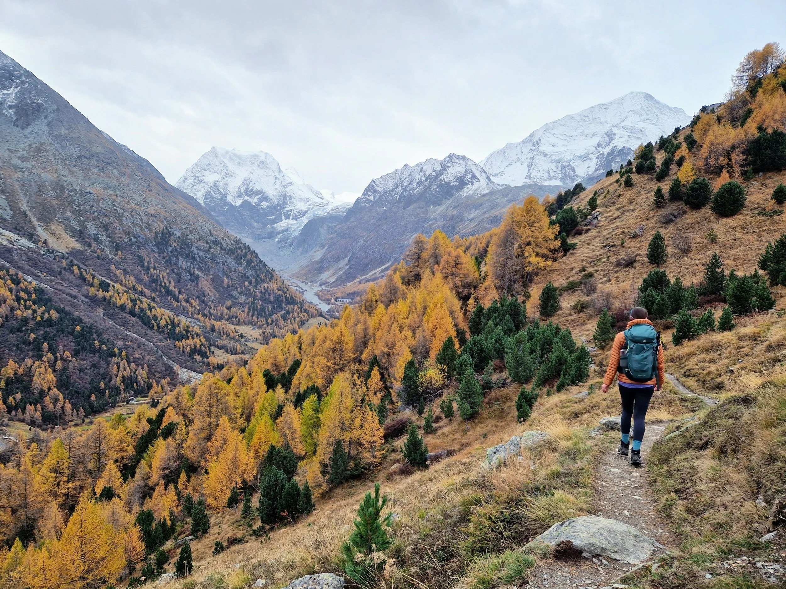
Fürenalp Panoramic Trail, Engelberg, Central Switzerland
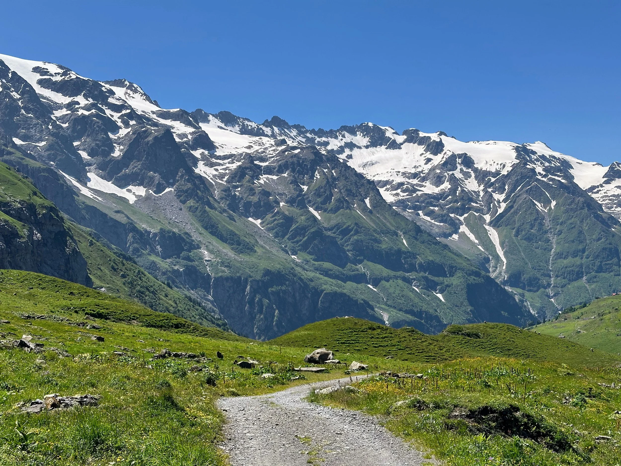
Take the cable car up to Fürenalp (one of the first cable cars to open for the season), and treat yourself to some of the best mountain views in Central Switzerland. From the top of the cable car, it’s a hike down through one of the most beautiful valleys I've seen. Waterfalls are absolutely everywhere, fed by snowmelt and running at full force in late spring. Everything is impossibly green, the mountains still have their snow caps, and the whole valley just feels alive. This hike, more than most, gets me so excited for summer hiking season. Feel free to reverse the direction for more uphill!
Start/End: Engelberg, Fürenalpbahn
Length and Rating: Moderate. 10km, 81m ascent/850m descent
Val Calnègia, Ticino, Southern Switzerland

Val Calnègia is known as ‘the suspended valley.” It’s an exceptionally wild and remote place that feels stuck in time, accessible only through a hiking path up beyond the Foroglio waterfall. It feels undiscovered, even though the small stone houses prove otherwise, that people have lived here long before. Three tiny hamlets mark the trail: Puntid, with its elegant arched stone bridge; Gerra, with its cave-like stone dwellings, and Calnegia (which we couldn’t reach in April, despite only being located at about 1000 meters, due to deep snow). We learned later that the valley gets no sunlight during the winter months, thanks to the high mountain peaks surrounding it. Even though we hiked in early spring, when the winds picked up, it felt like we were in the icy Arctic tundra with the snow swirling around us. Harshly beautiful. And a river runs through it all, the water morphing from glacially blue to a striking turquoise, depending on the way the sun hits. It’s pretty magical. Exactly the way a hidden valley within a valley within a valley should be.
Start/end: Foroglio
Basic Route: Forgolio - Puntid - Gerra - Calnegia (return same way).
Length and Rating: Easy/Moderate. 8km, 3-4 hours.
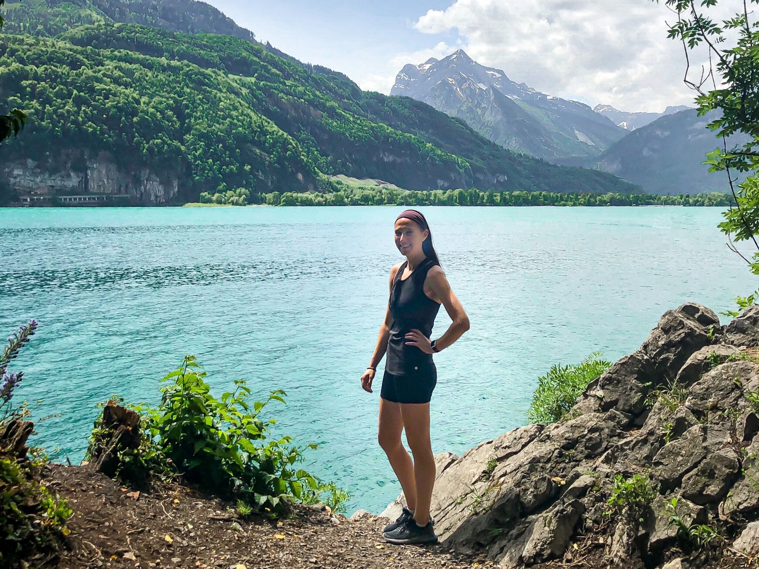
Weg der drei Wasserfälle, Brienz, Bernese Oberland
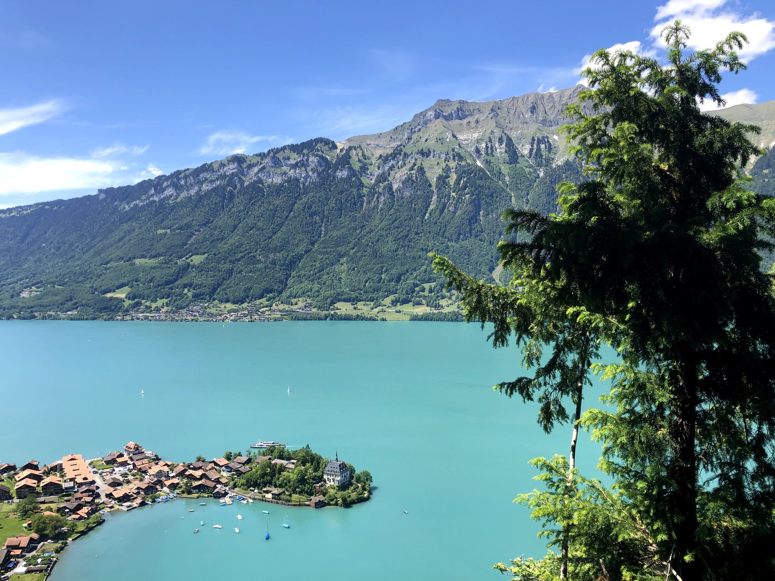
Spring is unquestionably the best time of the year for waterfall hiking. And a trail with three waterfalls, all along the stunningly blue Lake Brienz? Sign me UP. This route goes from Bönigen via Iseltwald to Brienz, and can be split into two sections (Isetlwald serving as the midpoint) or one long day hike. There are a couple long ascents and descents, but nothing too challenging. Luckily, the three waterfalls are pretty evenly spaced out, so there is always something to look forward to (if the color of the lake and the Alp views aren’t enough!).
The first section leads to the light-flooded Eschwanden waterfall, and then follows a forest path to the fishing village of Iseltwald ( a nice place for a lunch break). It’s a bit confusing to get back on the Weg der Wasserfalle after Iseltwald, but best course is to follow the signs for Isch. Otherwise, you’ll end up on a lakeside path to Brienz, which is also lovely, but then you will miss the next two waterfalls, and that’s the reason you are here! Mülibach falls is next, right after the underpass from the motorway. The best is saved for last. Giessbach Falls is huge and thunderous, and for me, completely unexpected! The cascades tumble pass the historic Grand Hotel Giessbach, which looks like a fairy-tale castle, and pour into Lake Brienz.
This entire trail is a lovely way to experience the Bernese Oberland region. The trail might be named for three waterfalls, but this whole area has waterfalls sprouting all over the place. It’s magical, and celebrates Swiss spring in all its glory.
Start: Bönigen See bus stop
End: Brienz Bahnhof
Basic Route: Bönigen - Eschwanden - Isetwald - Isch (follow signpost for Isch only until point 633, then cross the autostrasse) -Mülibachfall - Giessbach - Brienz
Length and Rating: Medium. 18 km, 5.5-6 hours
Creux-du-Van, Noiraigue, Northwestern Switzerland
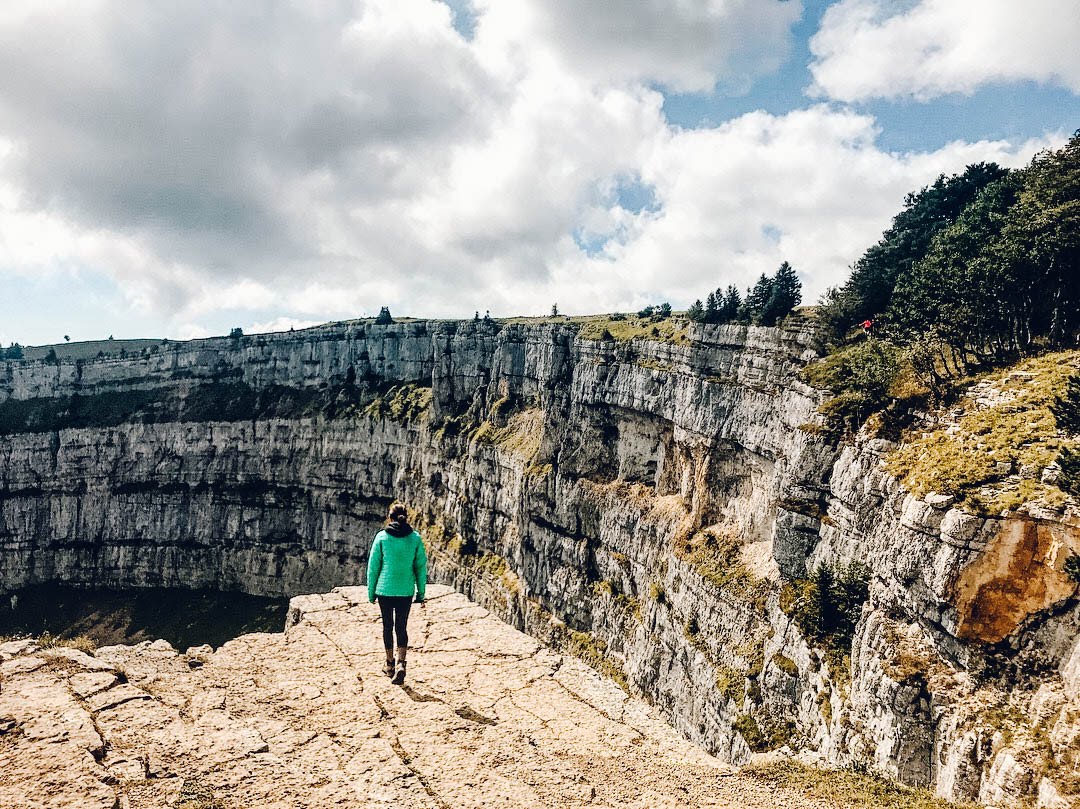
The Creux du Van is a giant, gaping hole in the ground, with sheer limestone cliffs shooting straight down 160 meters. It looks like one day, someone decided to reach down from the sky and scoop out the side of the earth. So different from what you come to expect from a typical Swiss hike, with their snow-capped mountain ranges and icy blue alpine lakes. We also had our first wild animal sighting, a small group of Ibex, which are a sort of Swiss mountain goat with impressive curled antlers and are much better suited to the sheer cliffs than us humans.
This area is in Western Switzerland, close to the border of France and a bit far from any major mountain range. The climate is different, slightly more predictable, and can make a nice escape from April showers or spring fog. I wrote a more in-depth account of the hike to the Creux-du-Van, and our absinthe adventures in the entire region, here.
Start and end: Noiraigue Bahnhof
Basic Route: Noiraigue - Ferme Robert - Les Oeuillons - Le Soliat - La Grand Vy - Pré au Favre - Ferme Robert - Noiraigue
Length and Rating: Medium. 14km, 4-5 hours
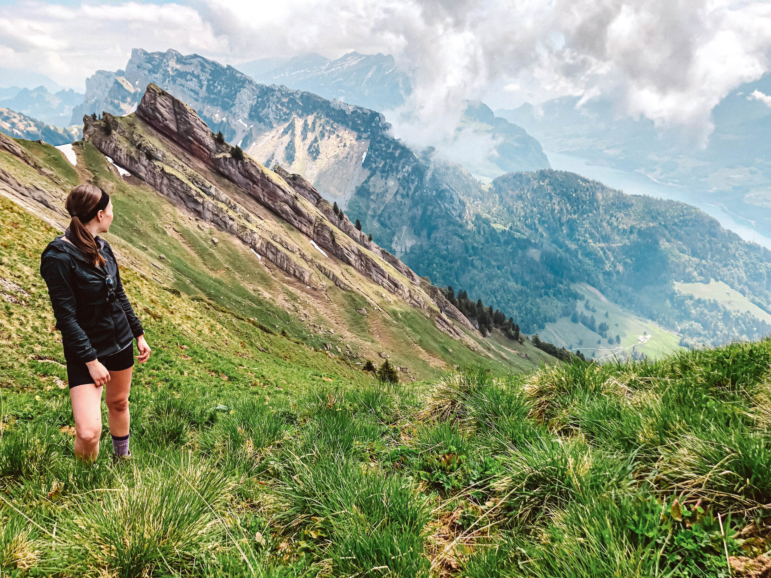
Schnebelhorn, Canton Zurich

In spring, I always find myself craving the big mountain hikes of summer. But this hike is a good reminder that the Swiss countryside offers a whole heck of a lot, too. Enter: the Schnebelhorn loop, a hike to the highest point in Canton Zurich. It’s surprisingly demanding, with (allegedly) clear views of the Säntis to the east, the Mythens to the south-west, and maybe the Bernese Alps if you are very lucky. It was a cloudy day for us, but even without the panoramic from the peak, I still really enjoyed the whole trail!
Start/End: Steg im Tösstal
Basic Route: Steg - Sennhütte - Tierhag - Schnebelhorn - Hirzegg - Chatzenböel - Vorderegg - Steg
Length and Rating: Medium. 15km, 715 meters up/down, 4-5 hours.
Brunni Alpthal, Canton Schywz, Central Switzerland
The Furggelenstock is one of my favorite local snowshoe trails, and so unsurprisingly, it also makes for an excellent spring hike.
Start and end: Seilbahn Brunni-Holzegg
Basic Route: Brunni/Holzeg - Stäglerenegg - Müsliegg - Zwäcken - Halbegg - Furggelenstock - Brunni
Length and Rating: Easy. 7-9km, 3-4 hours
Late-spring challenges
For when you are ready to get into Swiss summer hiking shape, these trail are for you. All should be attempted in later spring, from mid-May or early June. You'll need to be comfortable going through snowfields, as there will likely be a few.
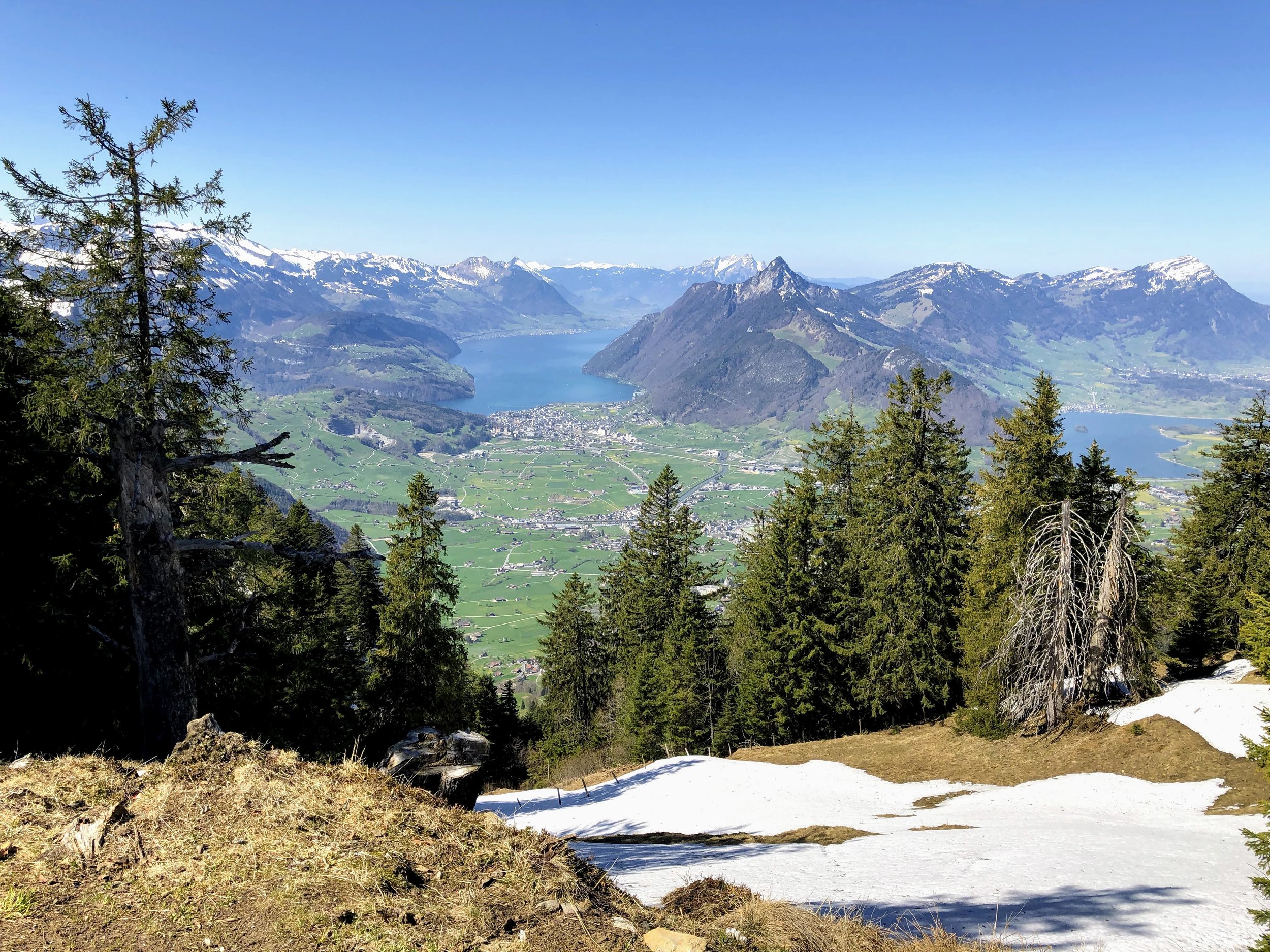
Gnipen & Wildspitz (Schwyzer Höhenweg Stage 3), Central Switzerland
If you are looking for a challenging, relatively uncrowded, gondola-free hike that is close to Zurich, look no further that the trail up to Wildspitz. The Wildspitz is the highest point in the Canton of Zug, and offers really incredible panoramas of Mt. Rigi, the Mythens, and the lakes of Central Switzerland. The views even stretched all the way to Jungfrau and the Eiger when the clouds cleared up.
We started the hike at Arth-Goldau, and ended at Sattel-Ageri, but you can go either way. I generally opt for the slightly longer ascent, but in this case, the ascents and descents are relatively comparable (1100 meters and 900 meters, respectively). The climb is tough, but there are no exposed portions or narrow ridges. This is a great hike to prepare for longer, higher-altitude summer hikes (and I imagine it would be gorgeous in the fall, too!).
Start: Arth-Goldau Bahnhof
End: Sattel-Ägeri
Basic Route: Arth-Goldnau - Spitzbühlalp - Gnipen - Wildspitz - Halsegg - Sattel-Ägeri
Length and Rating: Medium. 16 kilometers, 1100 meter ascent, 900 descent, 4-5 hours.
Grosser Mythen, Schwyz, Central Switzerland

The Mythen mountains are iconic in Central Switzerland, two rock mountains that loom above the valley. The trail up to Grosser Mythen (the bigger of the two) is short - just under 2km to the top, starting from Holzegg - but demanding: it’s steep, rocky and exposed, with plenty of steep drop-offs that got my vertigo-prone heart pumping. That being said, the trail itself is well-maintained and well-traveled. Lots of sections have chains on the side of the mountain, to grab onto for balance and safety. Unfortunately, I have no pictures of this because I was, well, gripping those chains myself as I made my way up the mountain.
And at the end of the 47 or so switchbacks, and after gaining 680 meters, you’ll reach the top of Grosser Mythen (1800 meters asl). The views are spectacular - especially if you are like me and didn’t take in the view on the way up. There’s a small little hut restaurant at the top. And, keep a look out for the local celebrity, the Mythen Man: Armin Schelbert is in his 70s, and has climbed the Mythen over 4600 times (sometimes several times a day). He zoomed past me on my way up!
Start and end: Seilbahn Brunni-Holzegg gondola
Basic Route: Brunni/Holzeg - Mythenweg
Length and Rating: Medium. Some exposed sections, but nothing dangerous. 7.2 km round-trip (if you skip the gondola and start at Brunni).
**This is a hike for later spring/early summer, starting Mid-May at the earliest. It can be very dangerous to hike up if there is still snow and ice on the path. The hut at the top is only open in good weather.**
Sentiero del Monte Bar, Ticino

Spring comes a bit earlier in Ticino, meaning that some higher mountain trails will be accessible sooner in the season than elsewhere. We did this trail in early April, and even though there was some snow at the very top (around 1750 meters), it was all passable. Expect unparalleled views at the top: Valle del Vedeggio, Monte Tamaro and Monte Lema, and further away, the Bernese and Valais Alps. This hike seems a little less known/popular than it’s more famous neighbors (like Monte Bre and Monte Tamaro), and we had wide stretches of the trail completely to ourselves. It was the first mountain hike of the 2021 season, and man, it felt good.
Start/End: Corticiasca
Basic Route: Corticiasca–Motto della Croce–Caval Drossa–Monte Bar – Capanna Monte Bar - Corticiasca
Length and Rating: Difficult. 12km, 1050m ascent/descent, 4-5 hours
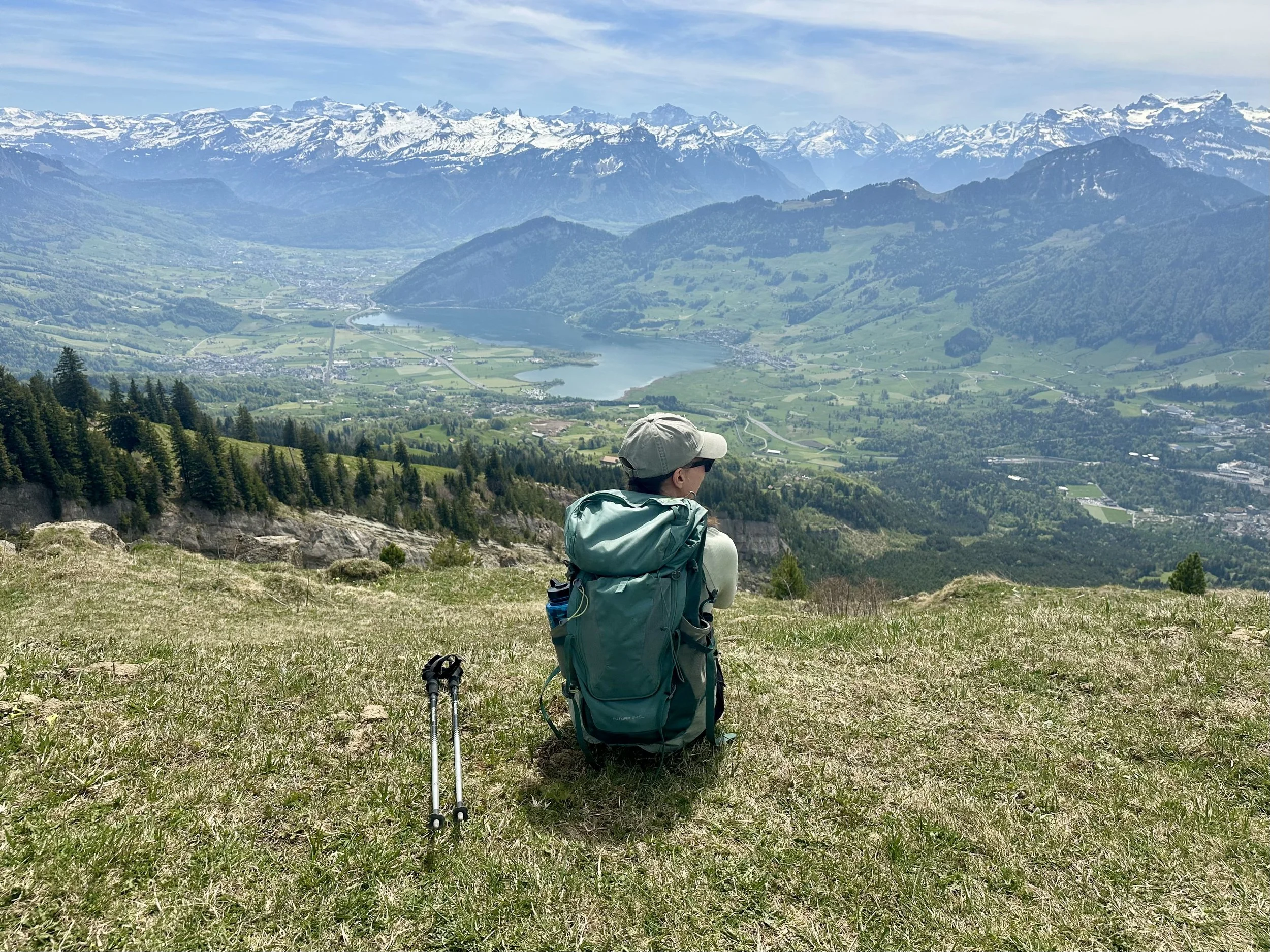
Federispitz, Eastern Switzerland
What a beautiful BEAST of a hike this is. The climb to the top of Federispitz is not for the faint of heart (1400 meters of elevation gain in 8 kilometers means you are climbing the entire first half of the hike). But with great effort comes great reward: incredible views of the Glarus Alps, Appenzell Alps, Walensee, Zürichsee. There seem to be plenty of different routes for this hike - we opted to start from Ziegelbrucke, and then once at the summit, took an alternate path that lead to Weesen. I highly recommend this route. The descent is a knee-buster, but the trail weaves through field after field of wildflowers, the embodiment of every Swiss pastoral dream you’ve ever had.
It’s a tough one. Wear sturdy hiking boots, bring your poles, prepare to sweat, and make sure you have a head for heights: the “Federigrat,” the ridge right before the summit, is quite narrow. Because of its location at the north end of the Alps, the summit is accessible much earlier in the year than at many other location, but you know what I’m going to say - always always always check the trail status beforehand. We went in mid-May and the conditions were perfect.
Start: Ziegelbrücke Bahnhof
End: Weesen
Basic Route: Ziegelbrücke - Grüt - Obernänen - Federigrat - Federispitz - Weesen
Length and Rating: Difficult. This hike is for those who like long, strenuous climbs. 14km, 1400m ascent/1400m descent, 4-5 hours
Amden to Speer, Eastern Switzerland

The mountain of Speer, standing at 1951m, doesn’t seem that intimidating - until you see it. I started at Amden, and somewhat foolishly skipped the chairlift, which added 350 meters (and unnecessary sweat) to my day. The first section winds around the Mattstock, and doesn’t start climbing for a while - but once it does, it is steep and feels relentless. Eventually, Speer comes into view, and it looks farther and higher than possible for a day hike. Once at Oberchäseren, I was exhausted, and really debated whether I wanted to go further. But I pushed on, and let me tell you, it felt good climbing those last steps. The descent is a knee-busting, but beautiful, 2.5 hours, weaving through the forests until the trail suddenly opens with views to the always stunning Walensee.
Start/End: Amden (to shorten, take the chairlift from Amden to Niederschlagwald)
Basic Route: Amden - Niederschlagwald - Hinter Höhi - Oberchäseren - Speer - Oberchäseren - Unterchäseren - Durschlegi - Amden
Length and Rating: Challenging. 19km, 1100 meters ascent/descent, 5-7 hours.
Mattstock, Eastern Switzerland

If you want something slightly easier than Speer, this is a good choice. Skip the chairlift for a bigger workout - it’s always there to help with the descent! Climb through forest, meadows, and little villages before you get to the top. The views of Walensee, Speer and Santis make the countless switchbacks all worth it in the end.
Start/End: Amden (to shorten, take the chairlift from Amden to Niederschlagwald)
Basic Route: Amden - Niederschlagwald - Mattsock - Niederschlagwald - Amden
Length and Rating: Challenging. 10km, 1000meters ascent/descent, 4-5 hours.
Monte Brè to Monte Boglia, Ticino

Start/End: Monte Brè
Basic Route: Monte Brè - Brè Paese - Monte Boglia - Curregia - Monte Brè
Length and Rating: Moderate. 13km, 1000 meters ascent/descent, 4-5 hours.
Bonus: Spring huts
Mountain hut season doesn’t technically start until late June (or even early July). However - if you simply cannot wait until then, there are a few options! Even though these huts are located at lower elevations, take extra care with planning your hikes and certainly be prepared to deal with snow.

Rifugio Al Legn (pictured): This rifugio is open year round, but unguarded in the winter and spring.
Capanna Alzasca: A cozy hut build in the typical Ticinese stone above the Maggiatal.
Capanna Monte Bar: A modern hut set on a wide plateau overlooking Lake Lugano, this one is pretty reliable to be snow-free by early May.
Lobhornhutte: Depending on snow, this hut in the Jungfrau region sometimes opens in early May.
Treschhutte: One of the few SAC huts located in the forest instead of on top of a mountain.
Capanna Nimi: Hike up for the views, stay for the friendly goats and “Nimi Beach” cold plunge bath
P.S. Need help planning your hut hike? You can check out my planning services here.