
![Raunaq's Hikes - Part 3: Via Alpina [Guest Post]](https://images.squarespace-cdn.com/content/v1/5c33451b710699b10e8e4576/1664464182062-ADLP11H0FH4K22OWY78M/78E30AFB-271C-40D9-9F82-2798E8A602D9.jpg)
Raunaq's Hikes - Part 3: Via Alpina [Guest Post]
Your appetite for #summerofraunaq hikes is insatiable!

Welcome to Part 3 of the #summerofraunaq hikes.
#summerofwhat?! If you stumbled upon this without reading the disclaimers and caveats (this is a guest post) you can find them all listed in Part 1 here.
Parts of the Via Alpina
I also hiked parts of the Via Alpina. Sometimes I hiked them as (long) day hikes from Zurich, sometimes as part of a multi-day tour. Sometimes I did them as advertised, other times I shortened or extended them, and sometimes I split them up into different stages because of accommodation and/or weather considerations.
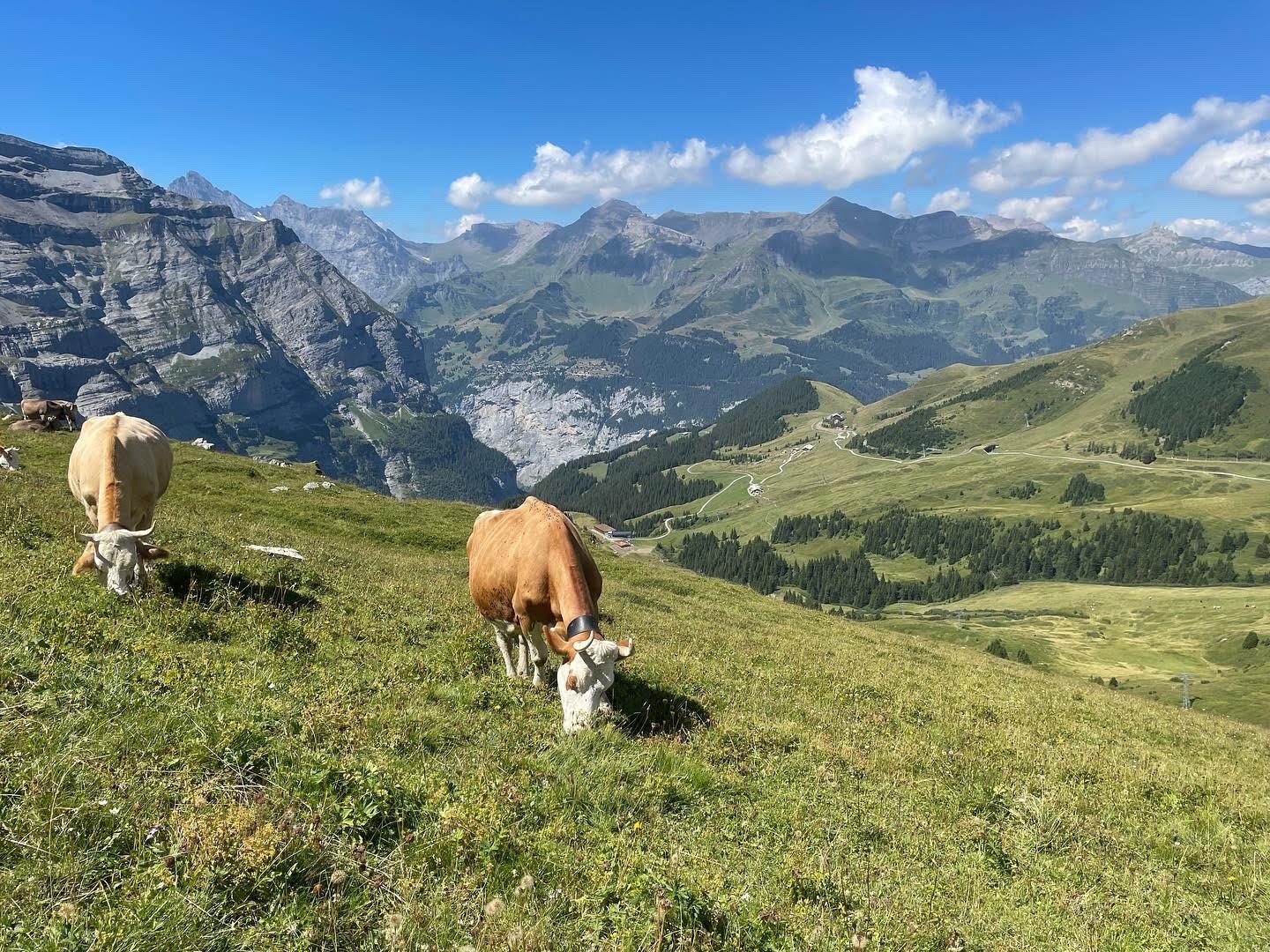
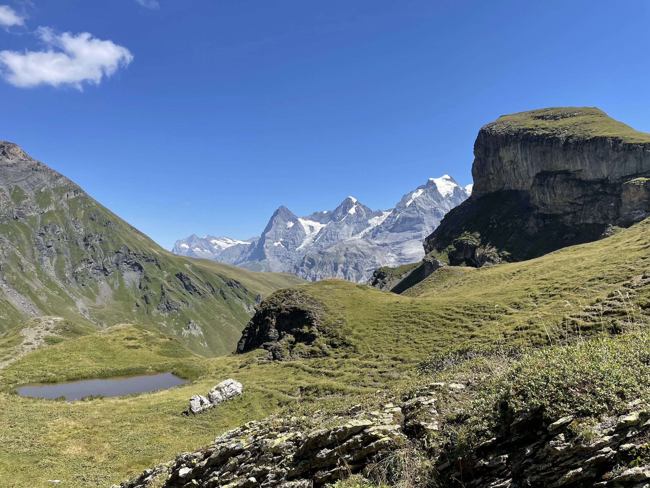
Grindelwald to Wengen via Eigergletscher
I did this as a (long) day hike from Zurich. The hike up to Kleine Sheidegg is pretty boring. I would not recommend it. It’s mostly along either a gondola line and/or the train and a straight slog uphill. It was particularly hot (hello summer 2022) when I did it so my recollection is perhaps colored by that.
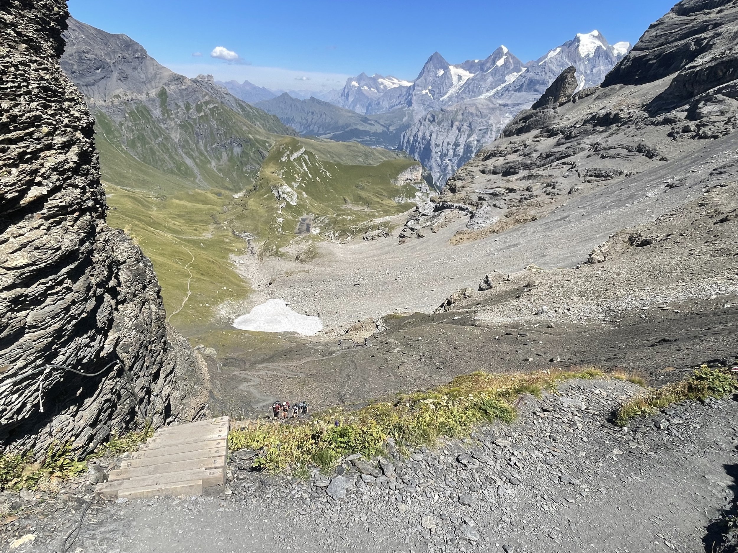
Once up to Kleine Sheidegg things begin to look up (but not if you follow the actual signs for the Via Alpina which take you along the train line again). Instead, there’s a really nice path up to the Eiger glacier - to around where the new Eiger cable car drops people off. From there there's a much more interesting path down to Wengen skirting some glacier and pasture, and away from the various forms of public transportation.
Eventually I did meander back to the official Via Alpina route which was (surprise surprise) along the train line for the most part until Wengen.
I shortened the end of the hike by taking the train down from Wengen to Lauterbrunnen which I think was a good move. The train ride is pretty and short and the hike down just seemed to be along the train line of villages for the most part.
All up - this is probably my least favorite stage of the Via Alpina so far. But hey - it's Switzerland so it is still pretty damn nice. First world problems.
Difficulty: Easy | Length: 21km / 1500 up / 1300 down | Route
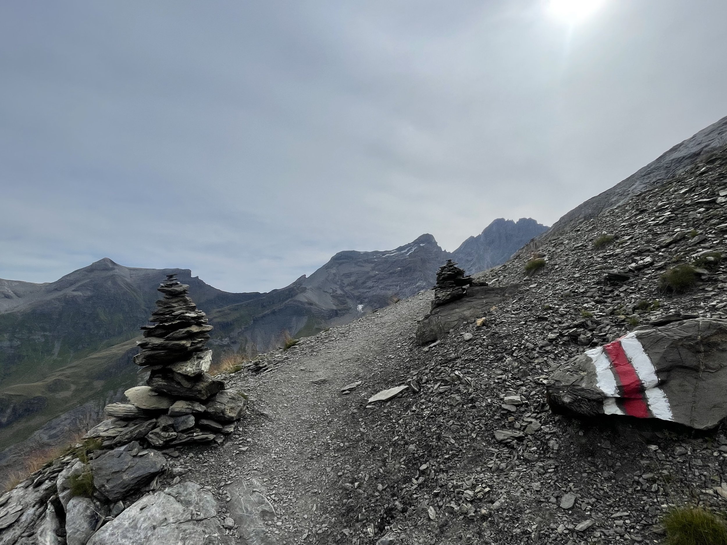
Mürren to Griesalp
The official Via Alpina route goes from Lauterbrunnen to Griesalp but I learned a valuable lesson in my previous Via Alpina experience and took the train directly to Mürren instead of slogging it up an extra 500 meters.
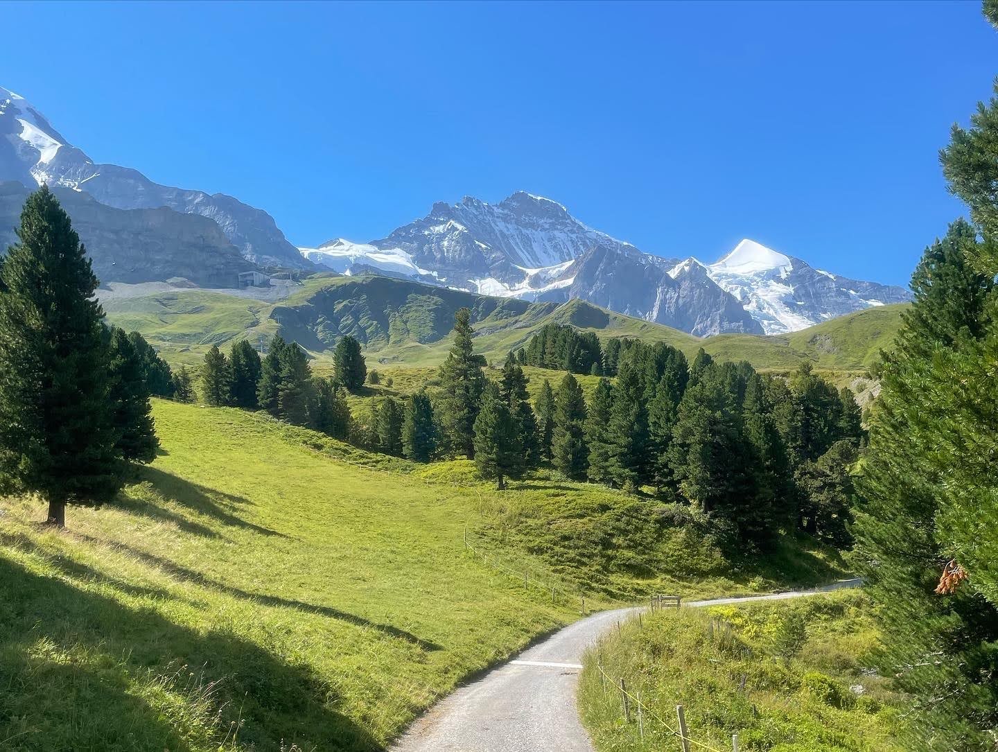
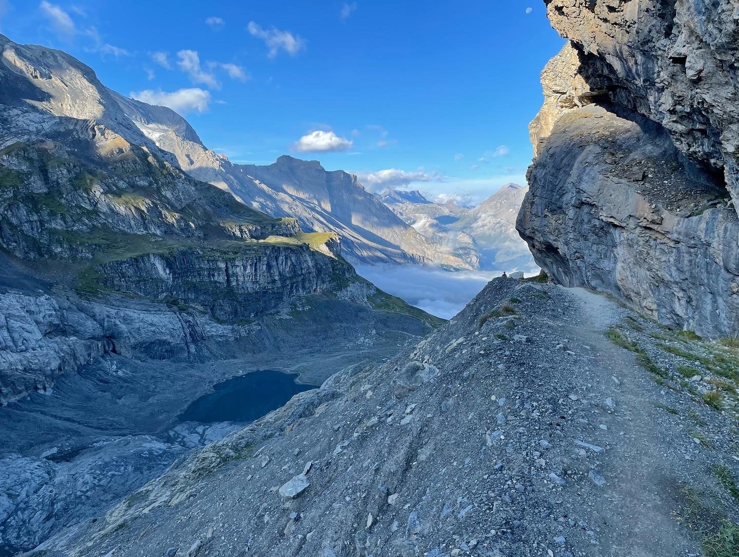
The trail ascends from Mürren up with views for days through a saddle (with some ladders to help getting up) just past Rotstockhütte. There’s a small descent (also with stairs / ladders) and a bit of a steep scree section before the descent gets more gentle all the way down to Griesalp. All up this was a very nice section of the Via Alpina.
I spent the night at the Naturfreundehaus Gorneren in Griesalp which was a delight. Daniel the innkeeper was a lovely host and the meal was delicious. Unlike hüttes the Naturfreundehaus is a bit different. I was put up in a single room so the only person I could disturb with my snoring was me.
Difficulty: Moderate | Length: 16km / 1200 up / 1300 down | Route
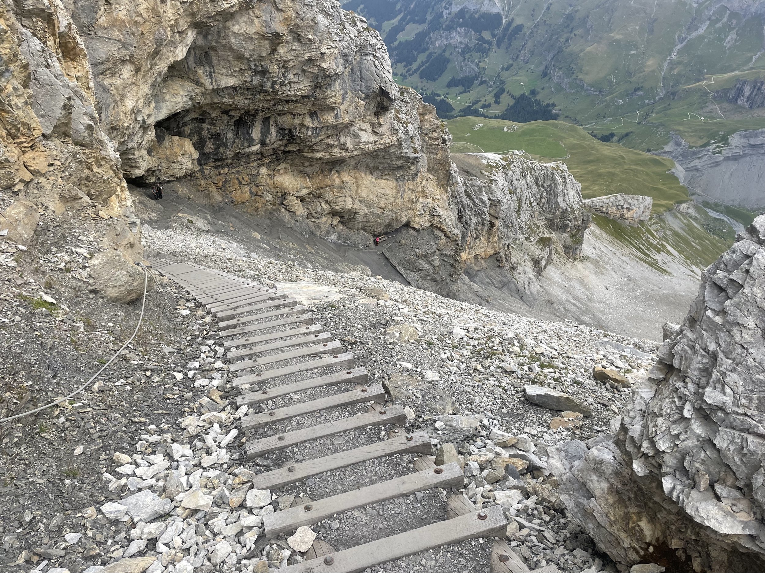
Griesalp to Blüemlisalphütte
This is actually half the official Via Alpina section. In hindsight I should have probably done the whole section at once but wanted to get a hütte stay in so halved the section - I had longer sections lined up the next few days but the weather gods were not kind so I had to cancel the extensions.
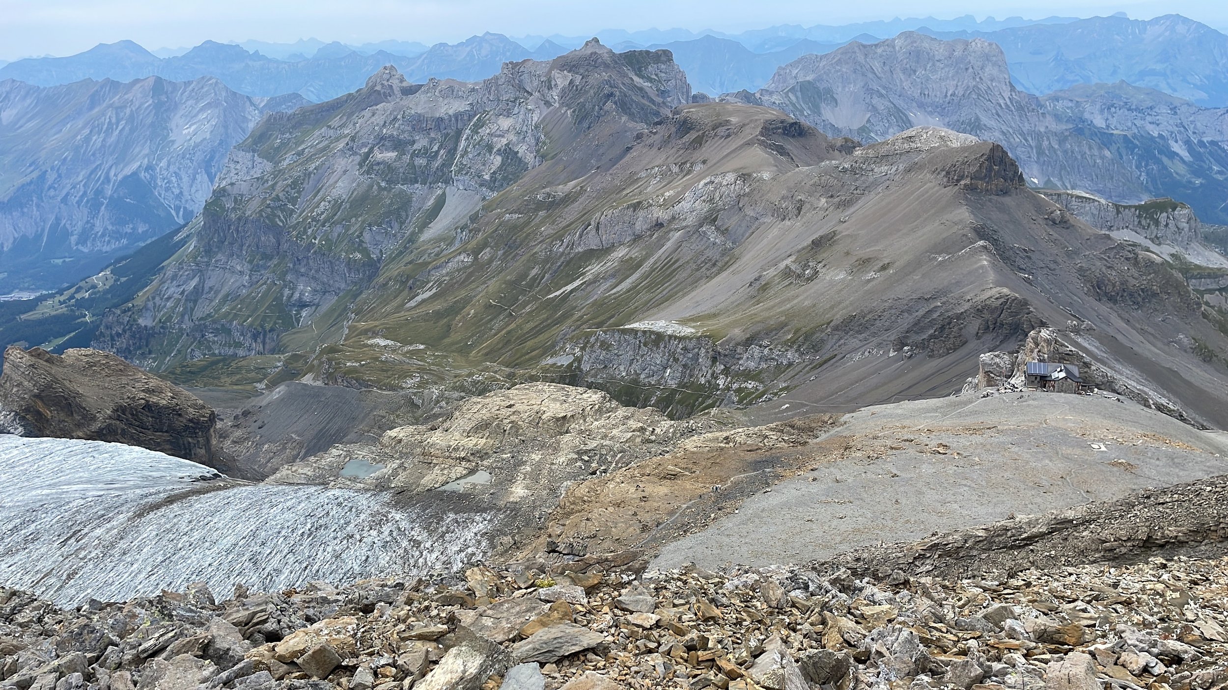
The way from Griesalp to Blüemlisalphütte is a straight slog up the mountain. No section is particularly sketchy or too steep because there are a lot of switchbacks. There’s a few stairs, and possibly a ladder or so at Hohtürli but nothing too precarious when ascending. That said - this would be a hell of a descent so I’d recommend going up, not down, if you can.
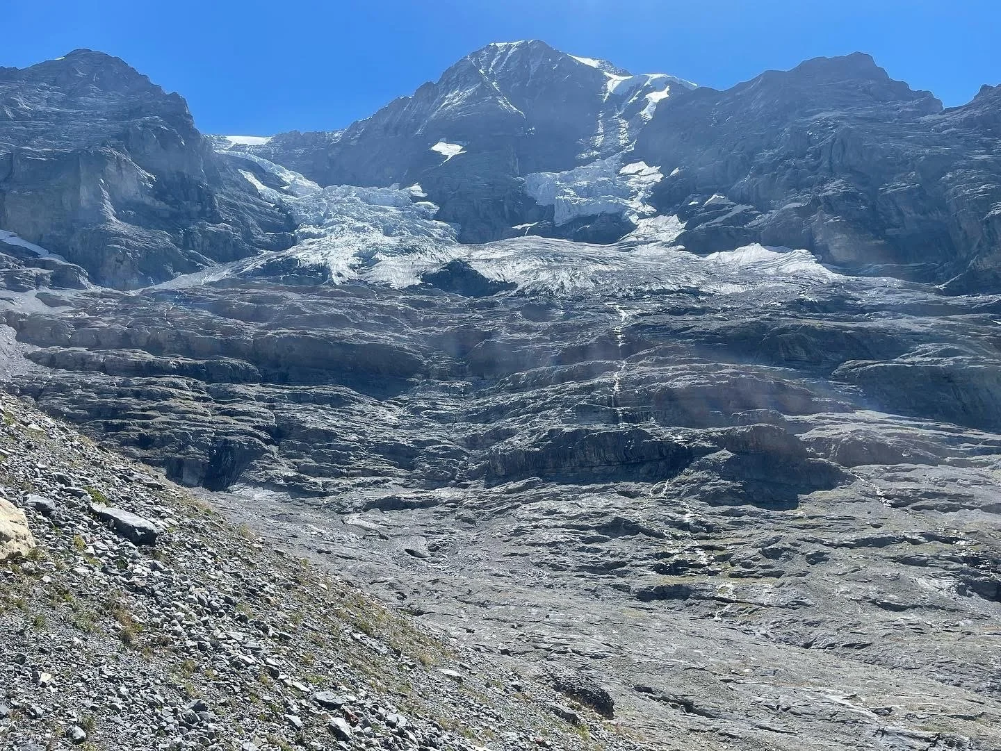
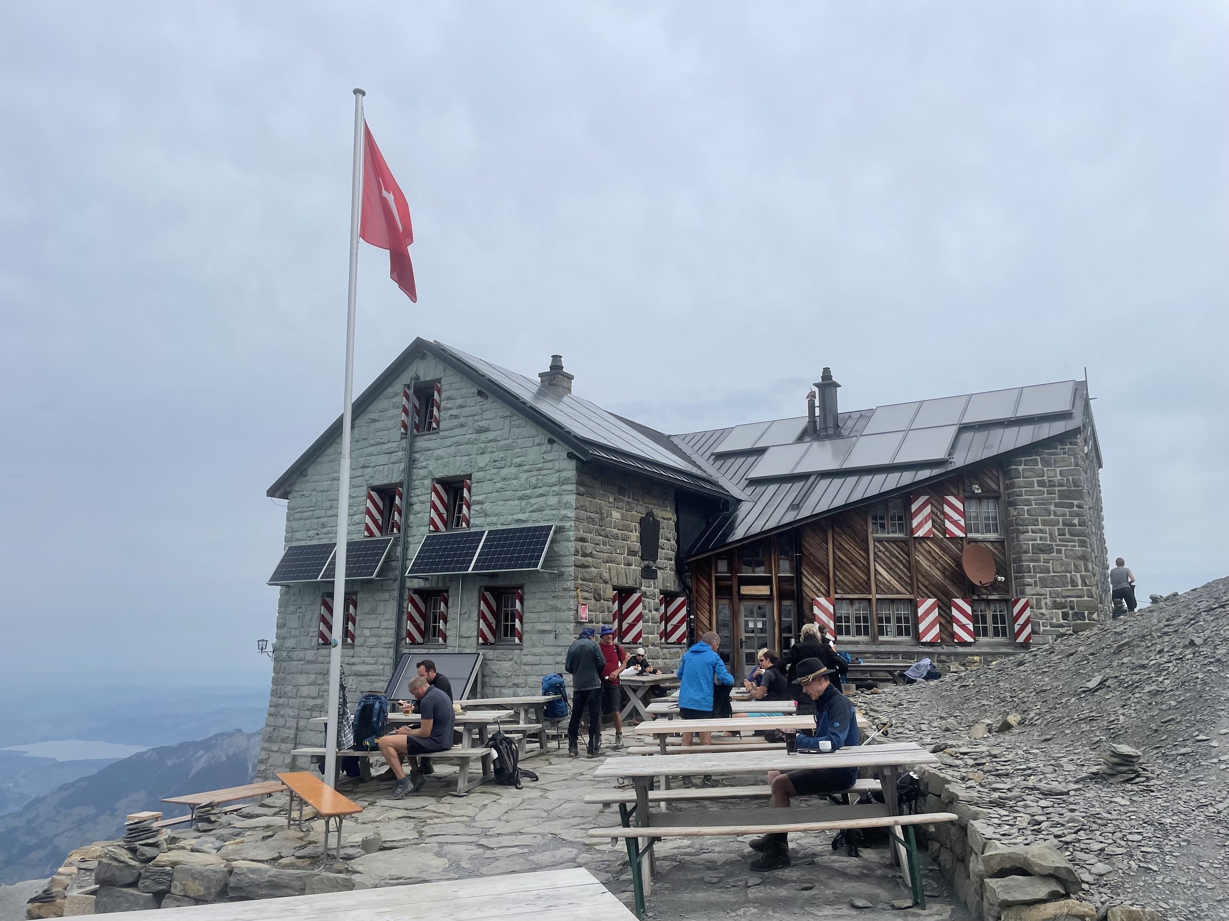
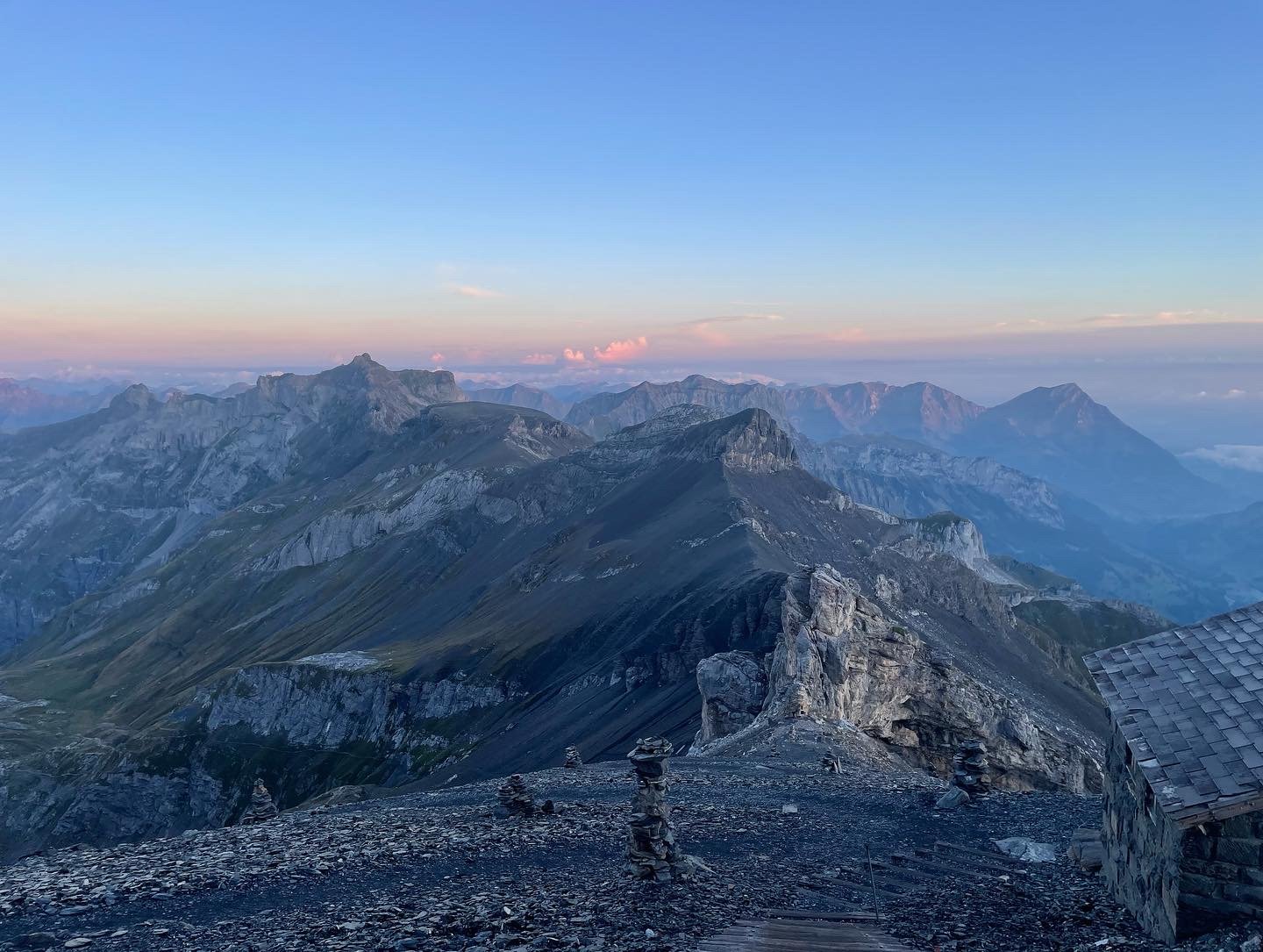
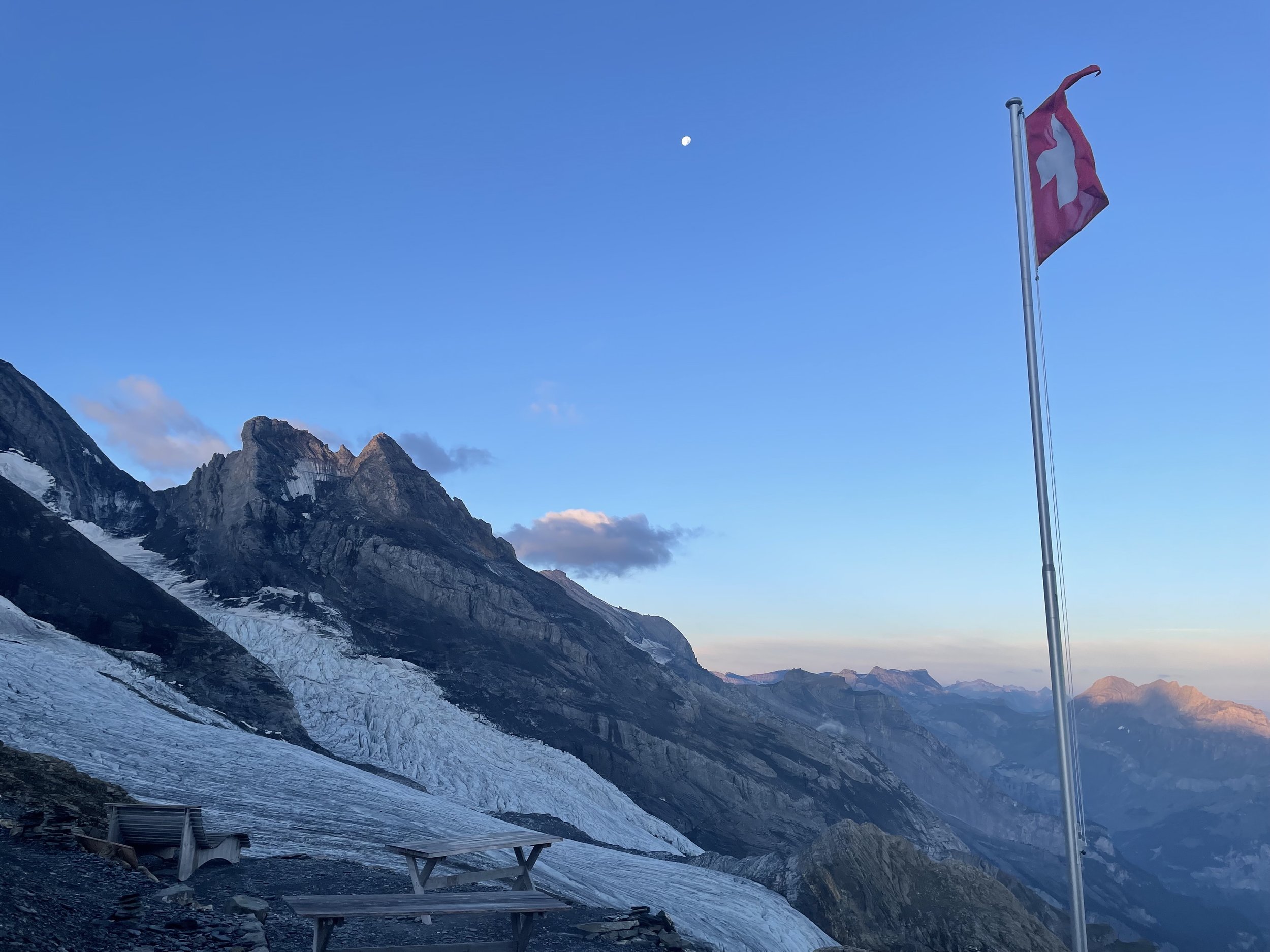
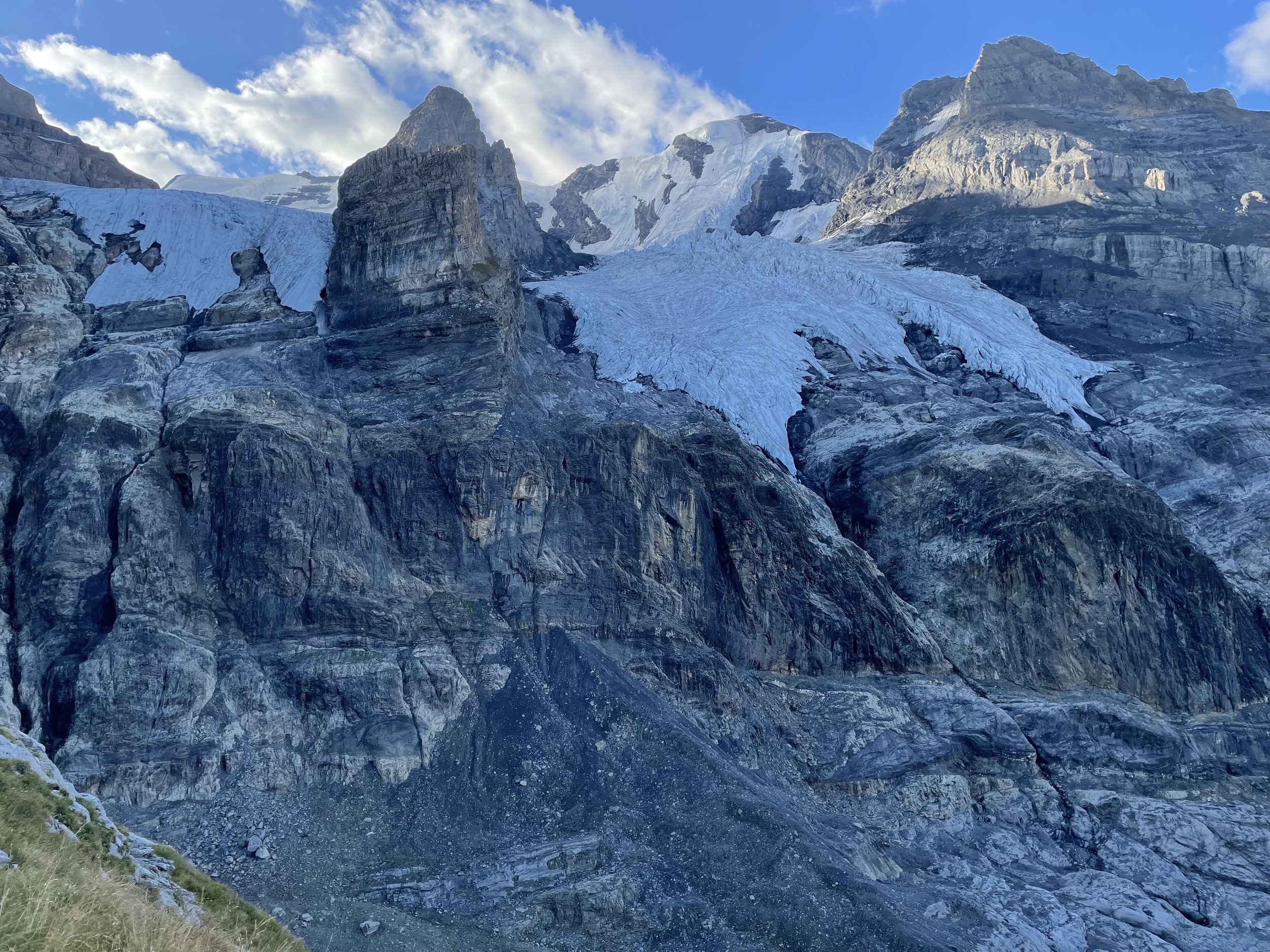
Blüemlisalphütte is situated just adjacent to a glacier so it’s in a pretty amazing setting. But it’s freezing. Even in summer and inside the hütte - I needed to wear my puffy for dinner. So bring warm things if you’re staying the night.
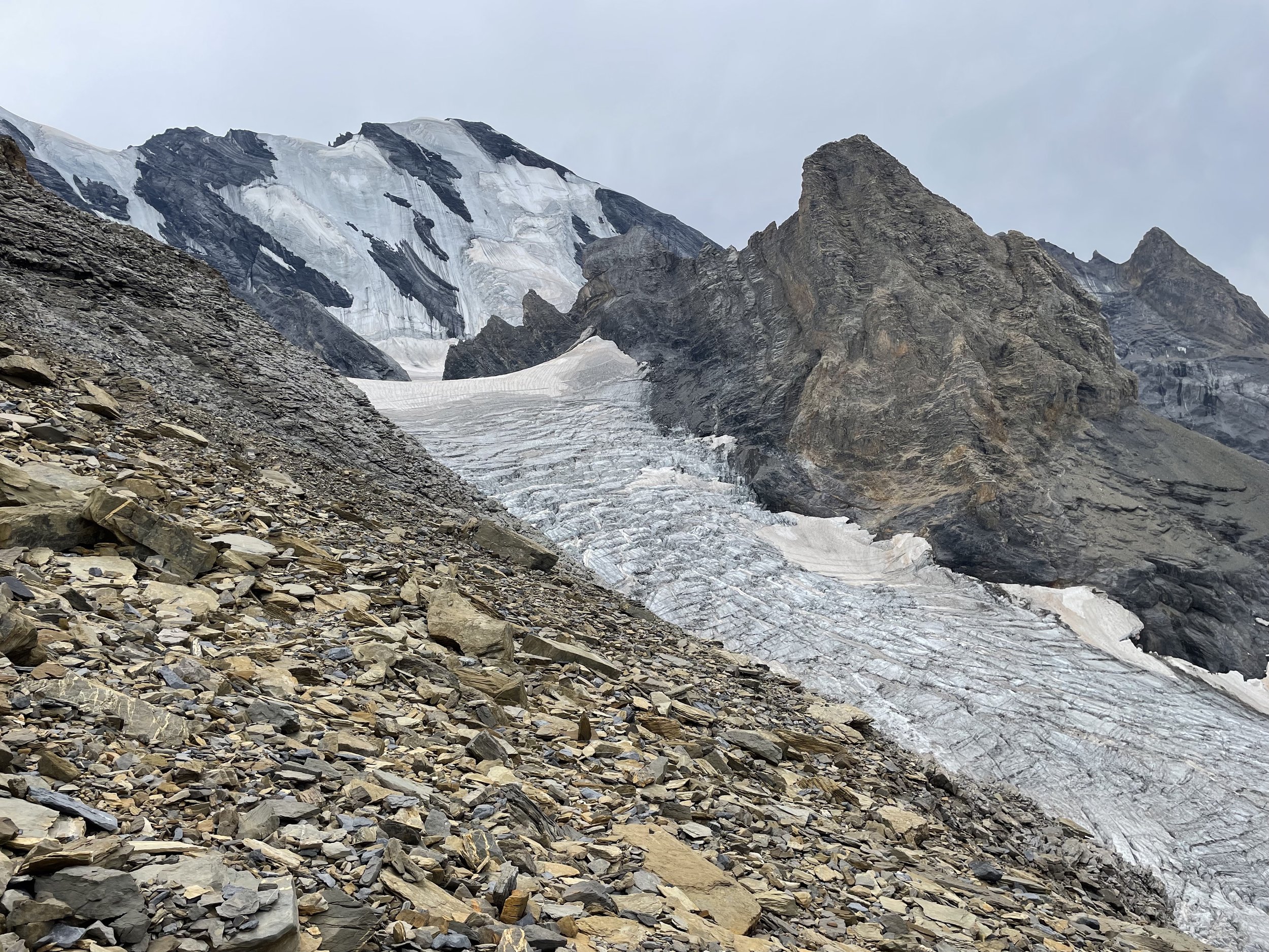
I got to the hütte well before noon and had time to kill. It was also too cold to just hang about so I did part of a blue and white route just above the hütte. It’s not mapped out of Schweizmobil or Swisstopo but it’s pretty well marked on the trail itself. It takes you up above the Blüemlisalp glacier and up a bit of a scramble. It was supposed to take you to a view of the Gamchi glacier - I never got that far but the views I got were pretty prime. There was a bit of weather coming in so I turned around before the end and skeedaddled back to the hütte. Safety first!
Difficulty: Moderate | Length: 7km / 1500 up / 100 down | Route
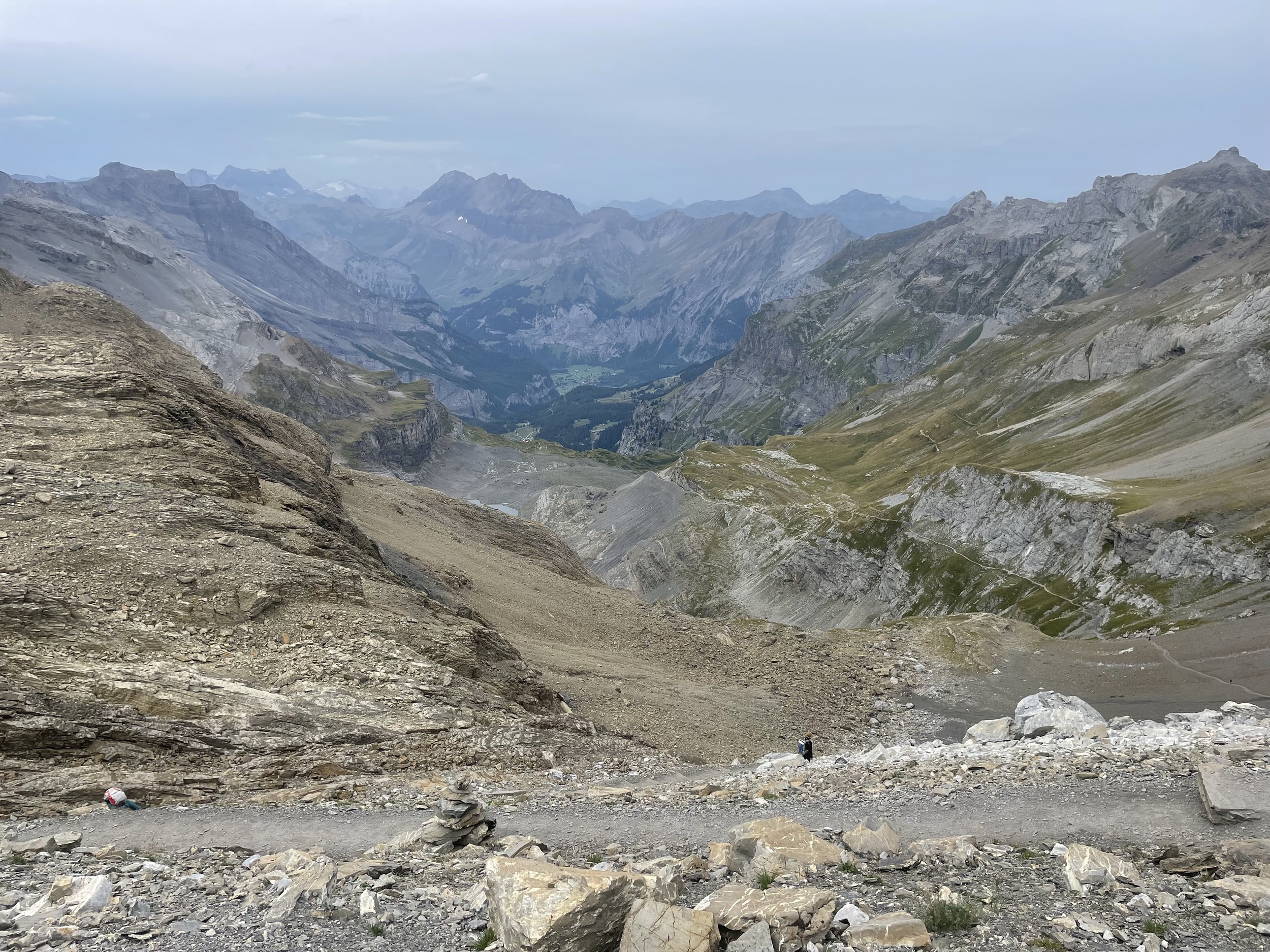
Blüemlisalphütte to Kandersteig
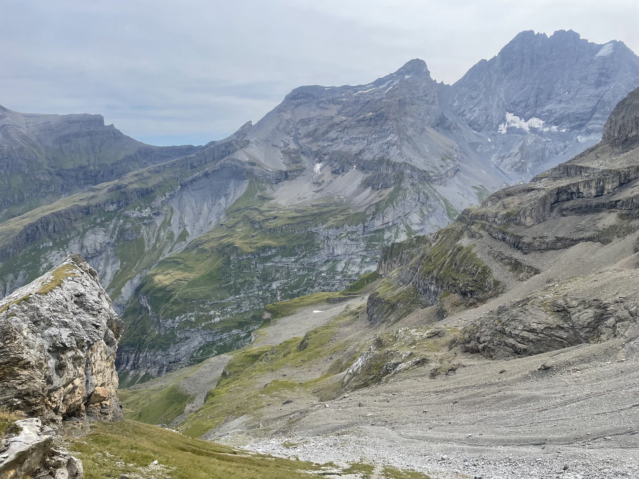
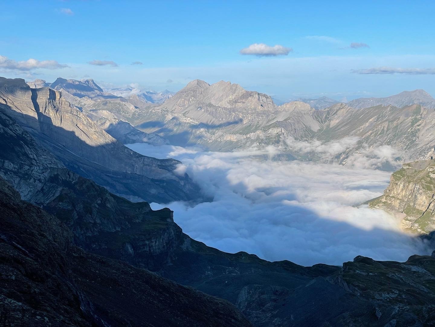
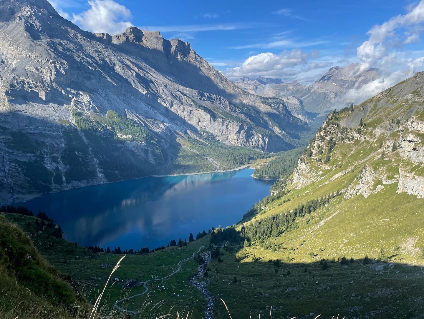
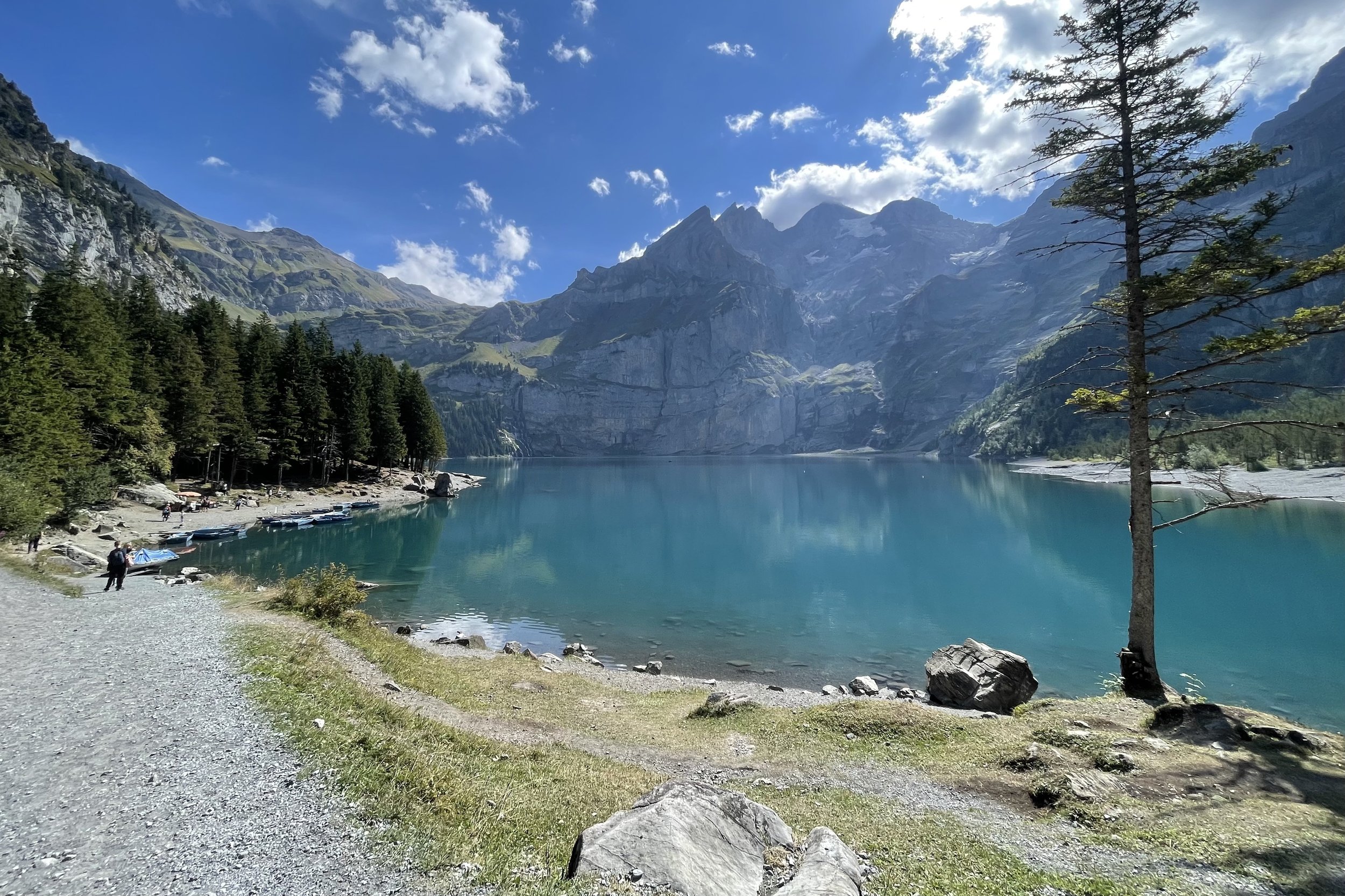
This is the second half of the Via Alpina stage. As mentioned above - this is probably a good idea to just do the full official stage. The descent is a pretty spectacular traverse down the mountainside through a narrow valley down to Oeschinensee. You pass the Blüemlisalp and the upper and lower Oeschinen glaciers on your left.
If you’ve been hiking for a few days I highly recommend jumping into the lake to wash off.
The trail down from Oeschinensee to Kandersteg is blah. If you’re so inclined I’d opt for the gondola instead.
While I didn’t do this as part of this route - the Oeschinensee panorama trail would be great addition (but only if you do this half stage - may be a bit much to tack onto the full Via Alpina route).
Difficulty: Easy | Length: 11km / 60 up / 1700 down | Route
If these posts have inspired your next adventure, consider leaving a tip. Your support keeps this space ad-free and fuels my work in the mountains. ☕
Leave a Tip![Raunaq's Hikes - Part 4: Ticino Huts [Guest Post]](https://images.squarespace-cdn.com/content/v1/5c33451b710699b10e8e4576/1664467934408-L7T5J5CHFLCN4EJND6WA/IMG_8817.jpg)
![Raunaq's Hikes - Part 2: Valais Huts [Guest Post]](https://images.squarespace-cdn.com/content/v1/5c33451b710699b10e8e4576/1664460007110-3JK1DN3U3XP38QCWMLY7/IMG_9333.jpg)
![Raunaq's Hikes - Part 1: Kesch Trek [Guest Post]](https://images.squarespace-cdn.com/content/v1/5c33451b710699b10e8e4576/1664451604215-M4NKRUC7BKIGB3ZCARC5/20220911_160546.jpg)