
![Raunaq's Hikes - Part 2: Valais Huts [Guest Post]](https://images.squarespace-cdn.com/content/v1/5c33451b710699b10e8e4576/1664460007110-3JK1DN3U3XP38QCWMLY7/IMG_9333.jpg)
Raunaq's Hikes - Part 2: Valais Huts [Guest Post]
Please sir - can I have some more #summerofraunaq hikes?

Welcome to Part 2 of the #summerofraunaq hikes.
#summerofwhat?! If you stumbled upon this without reading the disclaimers and caveats (this is a guest post) you can find them all listed in Part 1 here.
Exploring Val d’Anniviers
I spent a few days in the Val d’Anniviers area in the south of Switzerland - around Zinal and Grimentz - doing some hut to hut hikes and also a day hike. From what I gathered from some fellow hütte dwellers - it turned out I ended up routing a few stages of the Val d’ Anniviers Tour des Cabanes. This area was so nice I’d go back to do the rest!
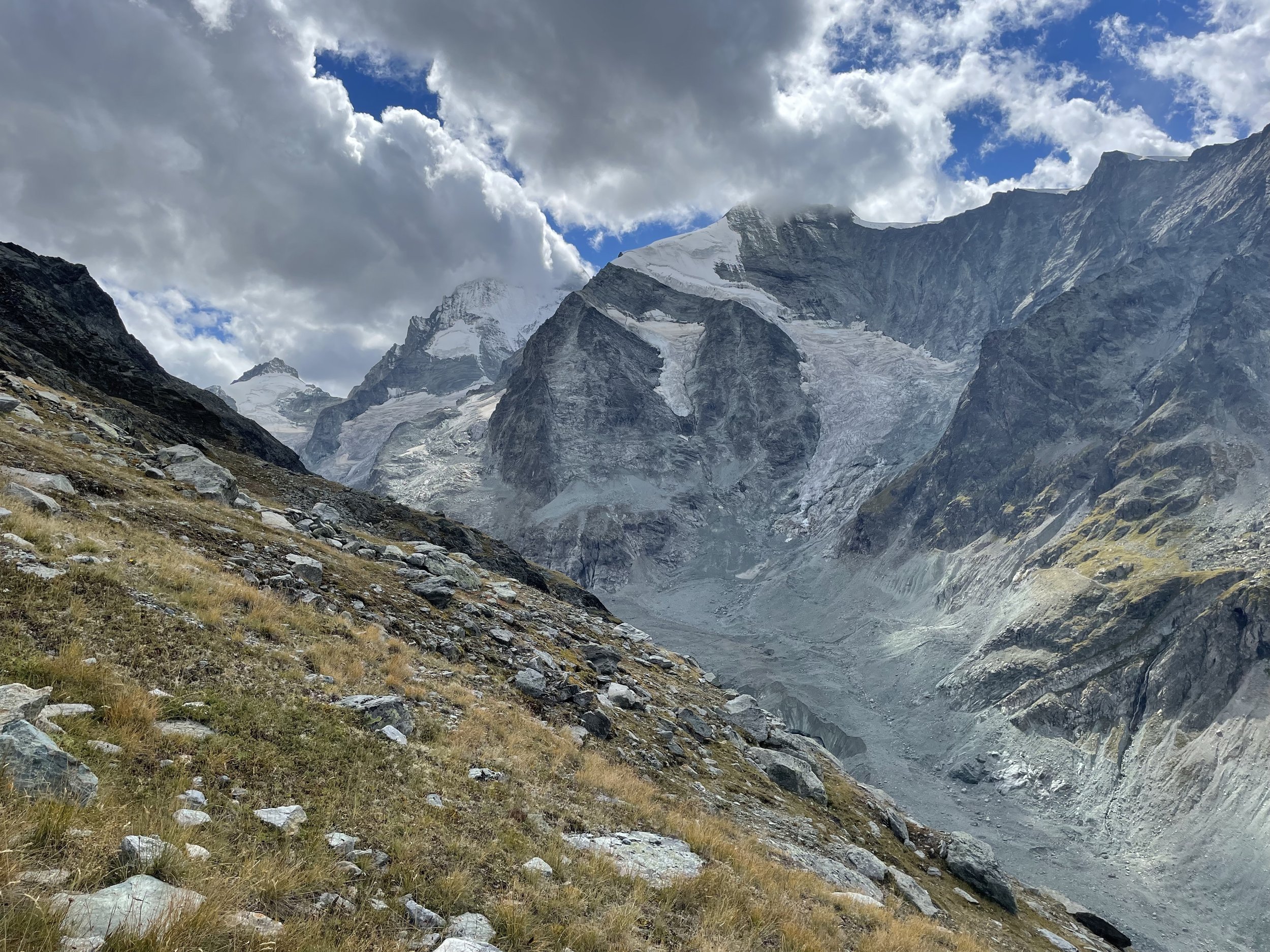
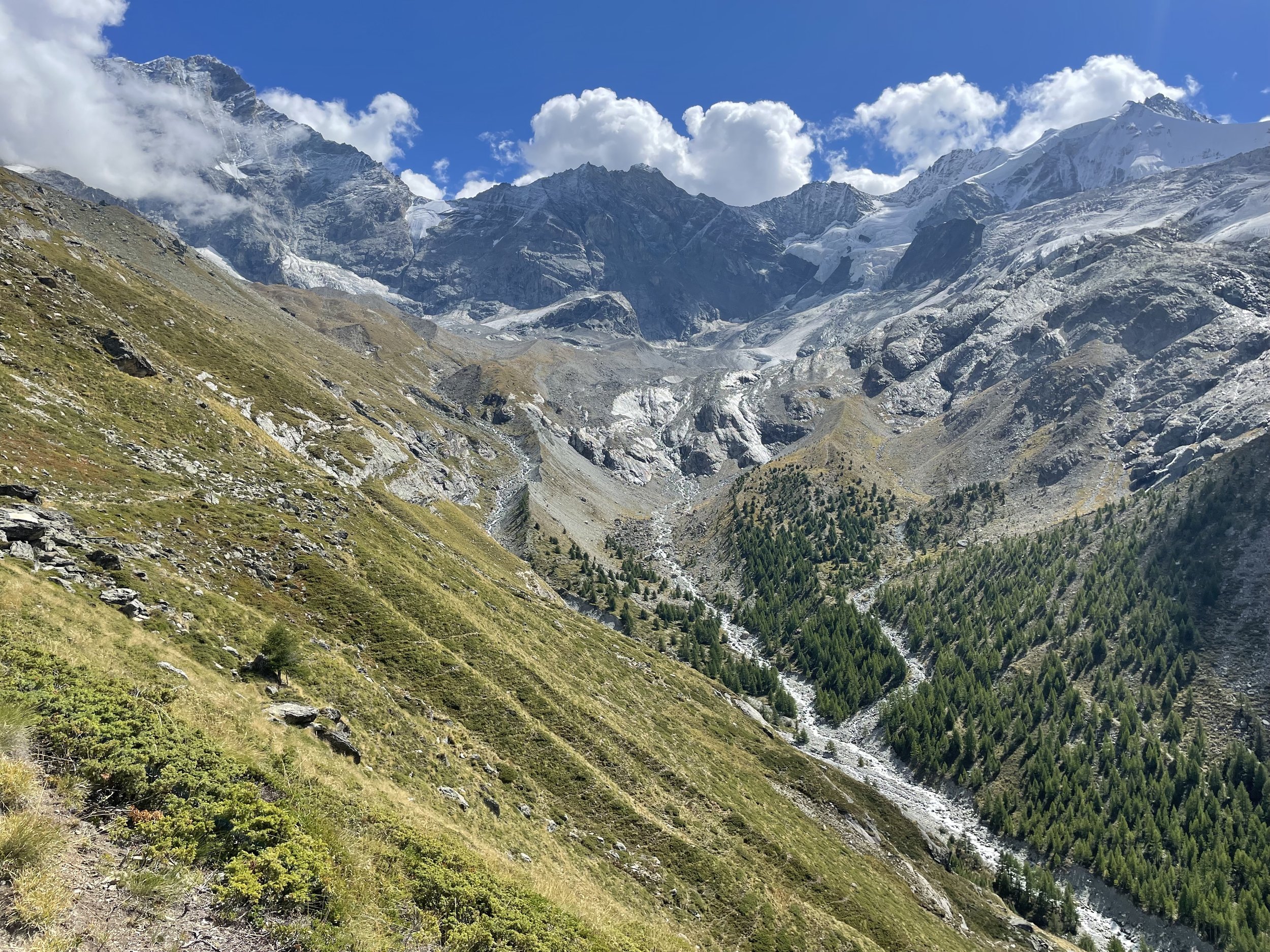
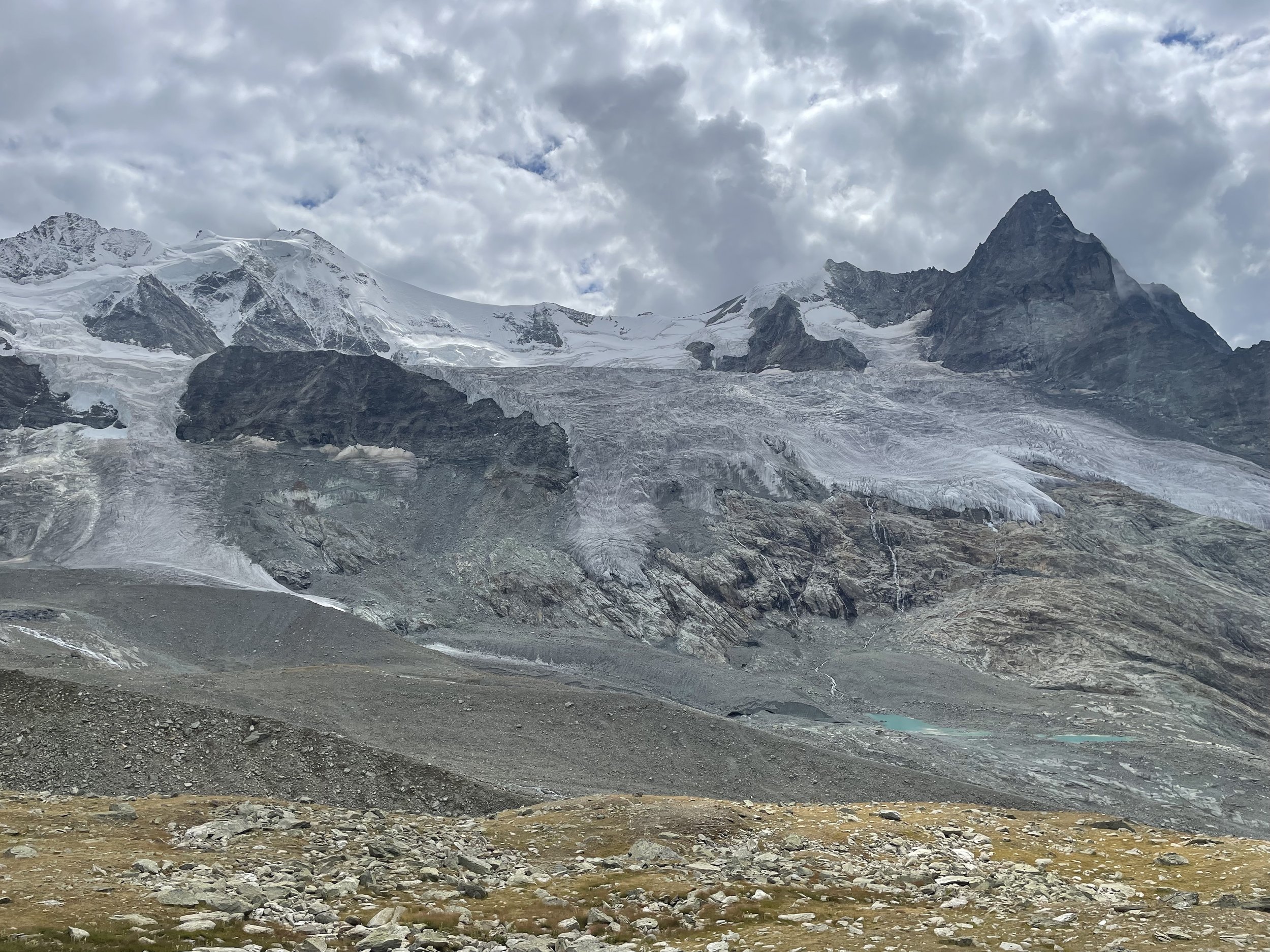
Zinal to Cabane du Grand Mountet
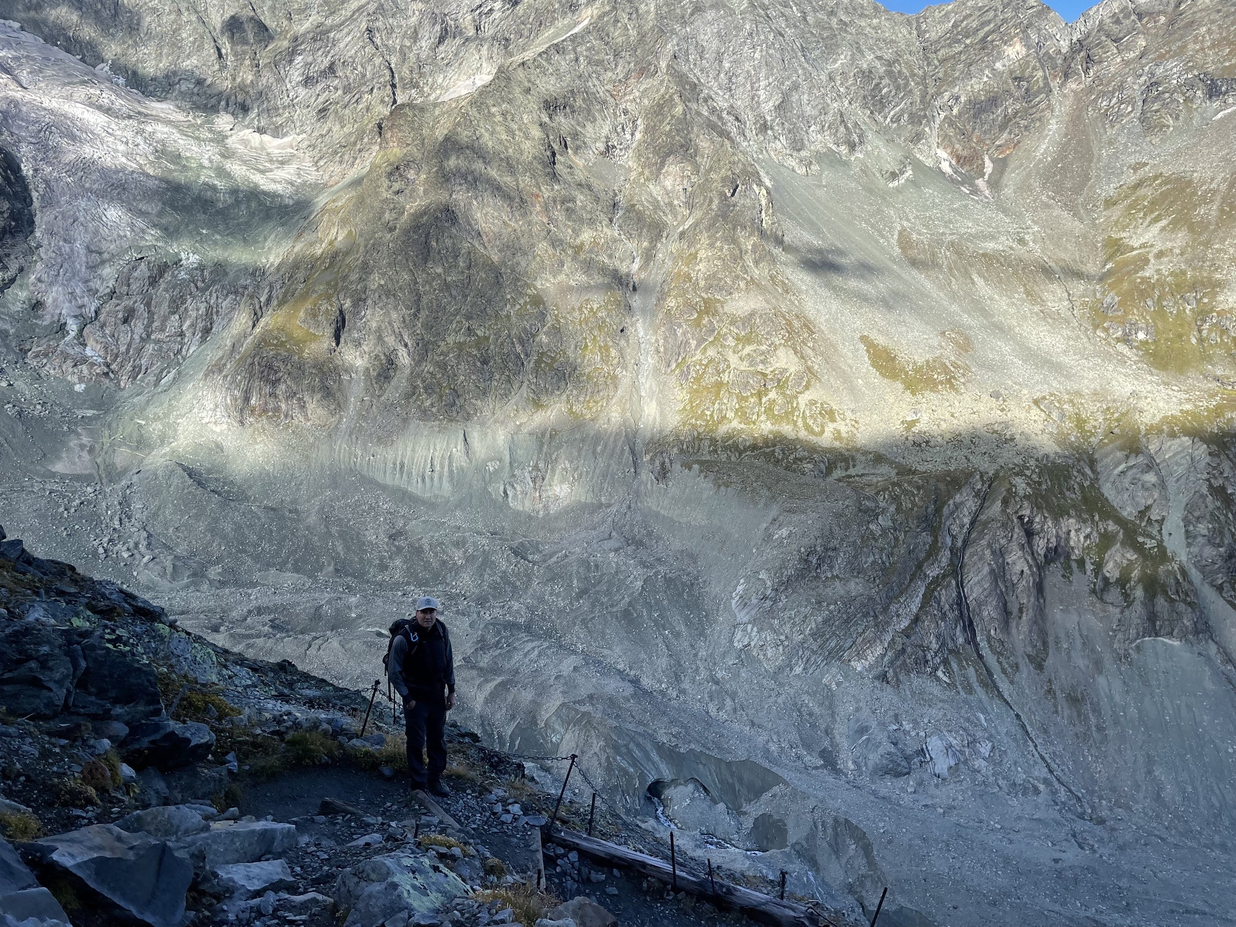
The trail from Zinal to Cabane du Grand Mountet is marked as a red/white trail, but in my opinion is really on the border between red/white and blue/white (alpin) trail.
The hike starts out pretty innocuous - gentle incline as you walk into the valley but gets pretty steep and then pretty hairy as you make the ascent up to the hütte.
There’s another Cabane du <enter french adjective> Mountet so don’t accidentally go up the path to it like I did because this hike has enough elevation gain without needing bonus points.
On the actual path, there are some pretty narrow sections with scree, some cable sections and a pretty long boulder / scree section before you reach the hütte.
All relatively do-able of course, but harder than most T3s I’ve been on.
However, this being Switzerland there’s enough opportunities for someone on the same trail skipping around to make you feel like a giant wuss as you fumble around trying not to die. When I did this there were people racing down the trail as part of an insane 56km race called the Trail du Besso. I am in awe of these humans.
The Cabane is right up near a bunch of glaciers and the people staying there when I was were doing pretty insane activities including climbing up and over one to go to Zermatt. But the winner is this champion who found the best way to get back to Zinal.
Difficulty: Hard | Length: 11km / 1400 up / 200 down | Route
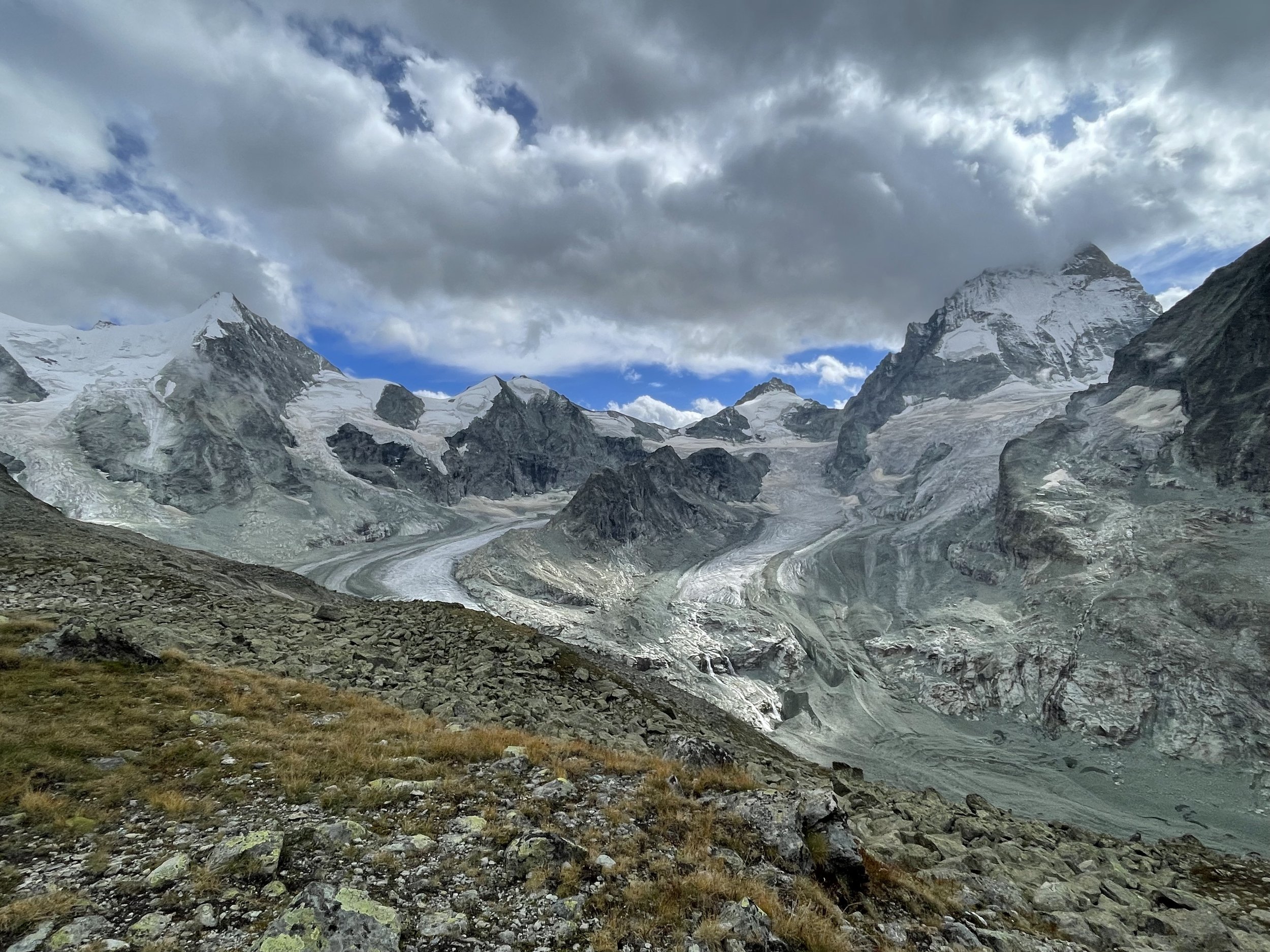
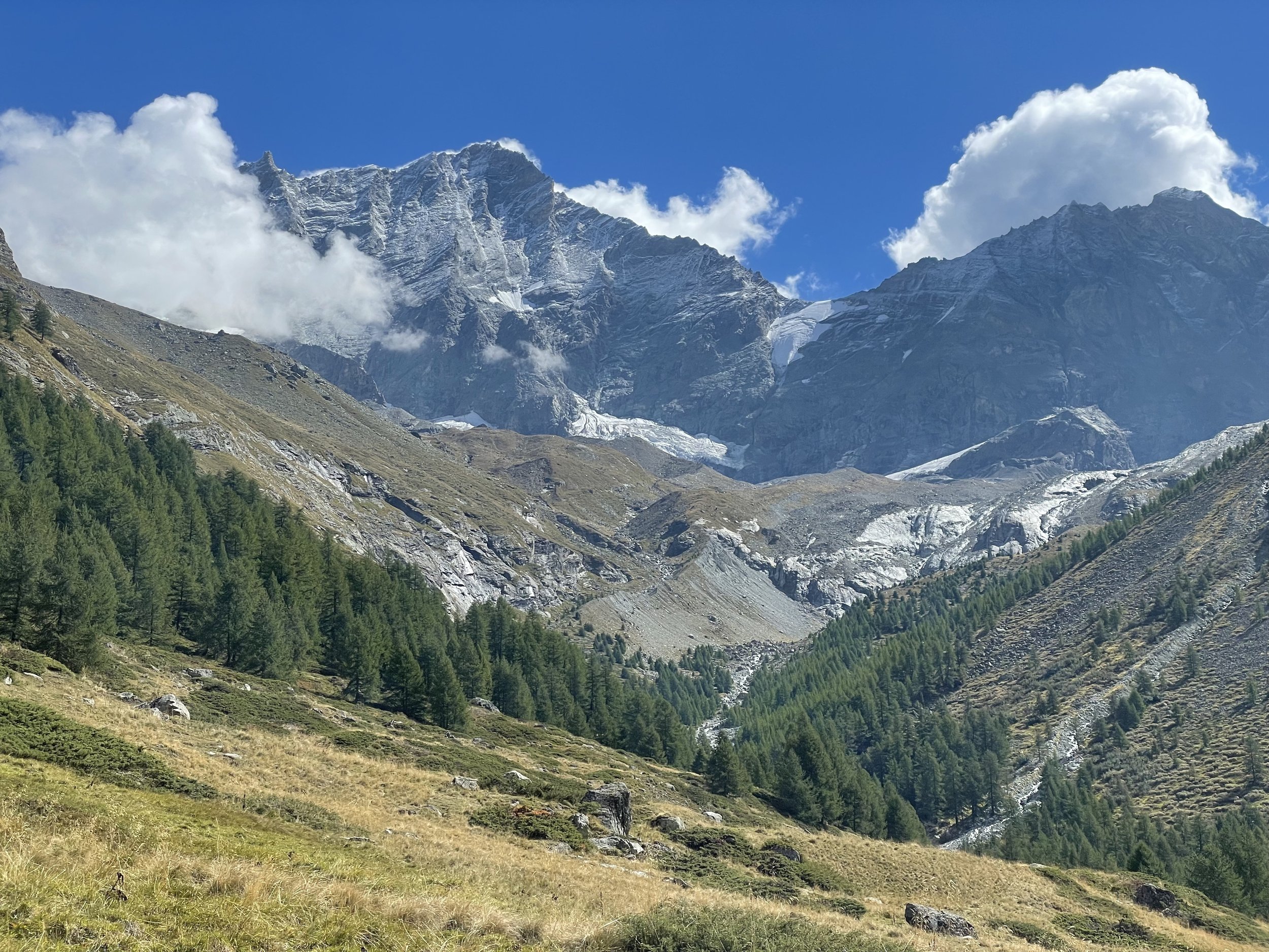
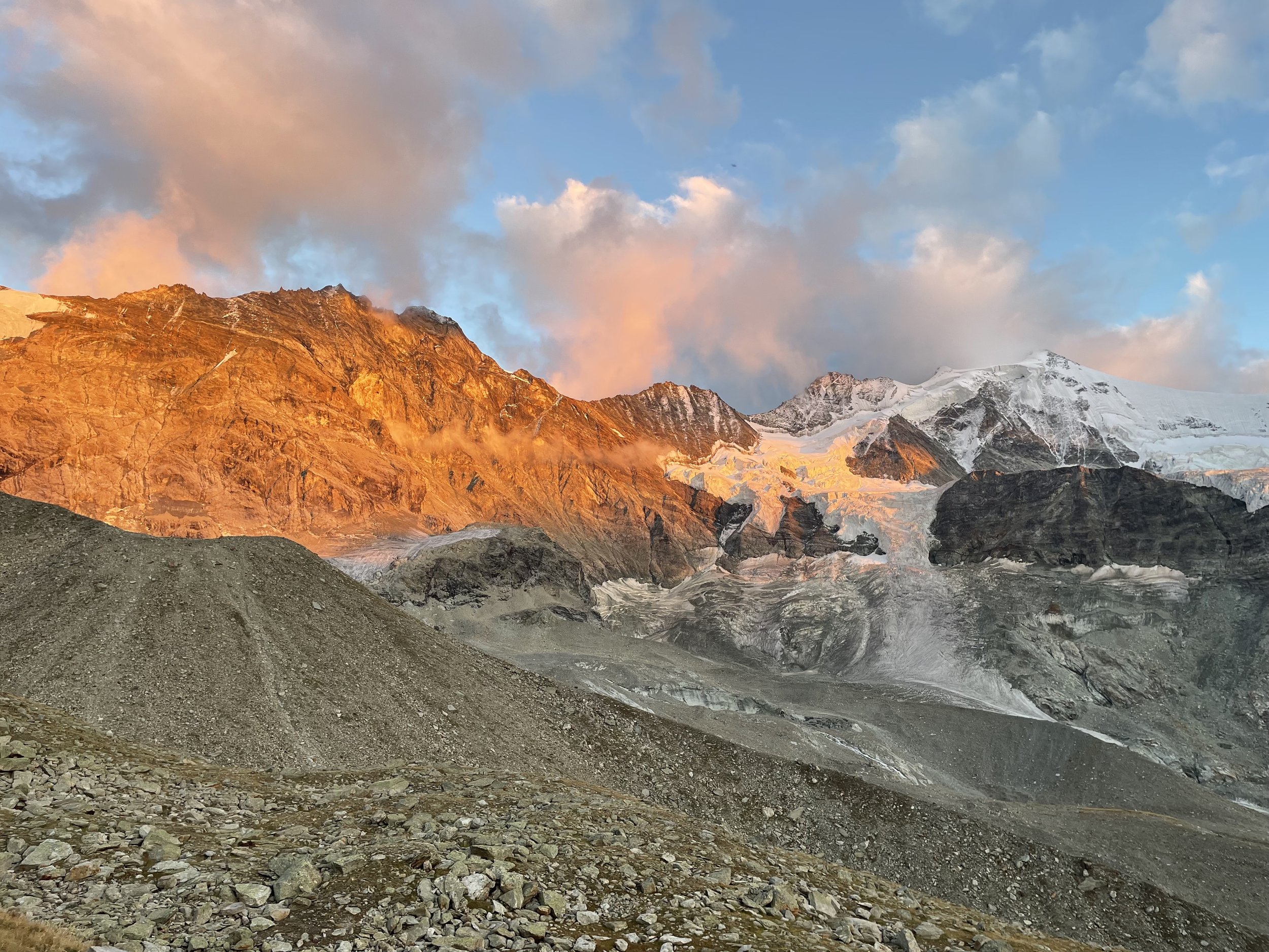
Cabane du Grand Mountet to Cabane Arpitettaz
This is a much easier trail though it involves backtracking part of the trail - including the scree and boulder fields. Maybe because my legs were fresher - the descent through this was much easier than the way up.
The trail goes down to the valley after which it ascends to a small plateau with 2 ‘lakes’ and then ascends further passing by small streams and waterfalls that one can take a dip in to wash off (I didn’t but should have).
Cabane Arpitettaz is my favorite hütte so far in Switzerland. It’s pretty small and it’s set right below the Weisshorn massif and glacier. The wardens were super nice and the vibe was very chill.
There appears to be a do-able blue and white trail from here to Cabane de Tracuit. I didn’t do it but from the photos the warden showed me - it seemed pretty reasonable.
Difficulty: Medium | Length: 12km / 1100 up / 1200 down | Route
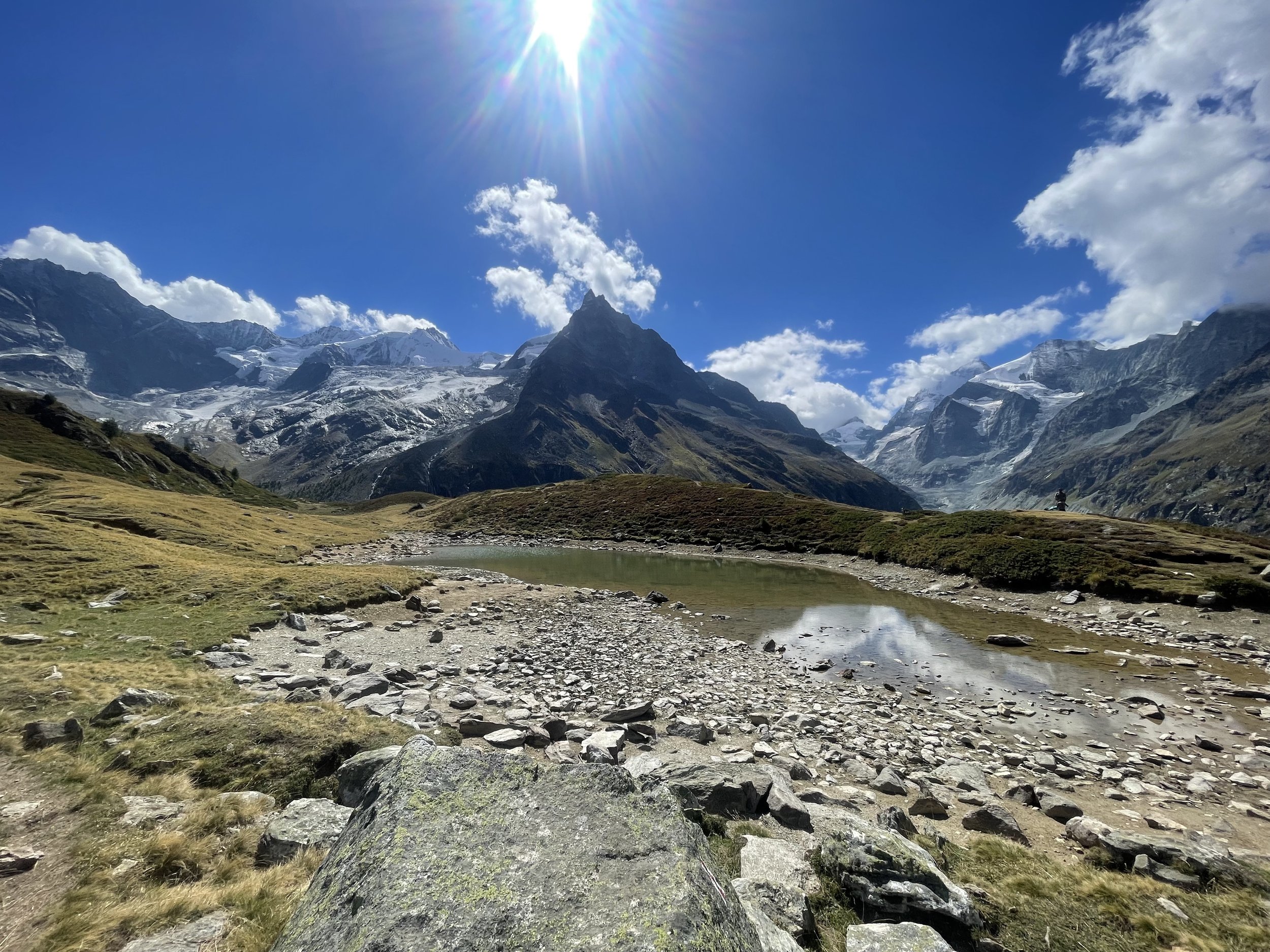
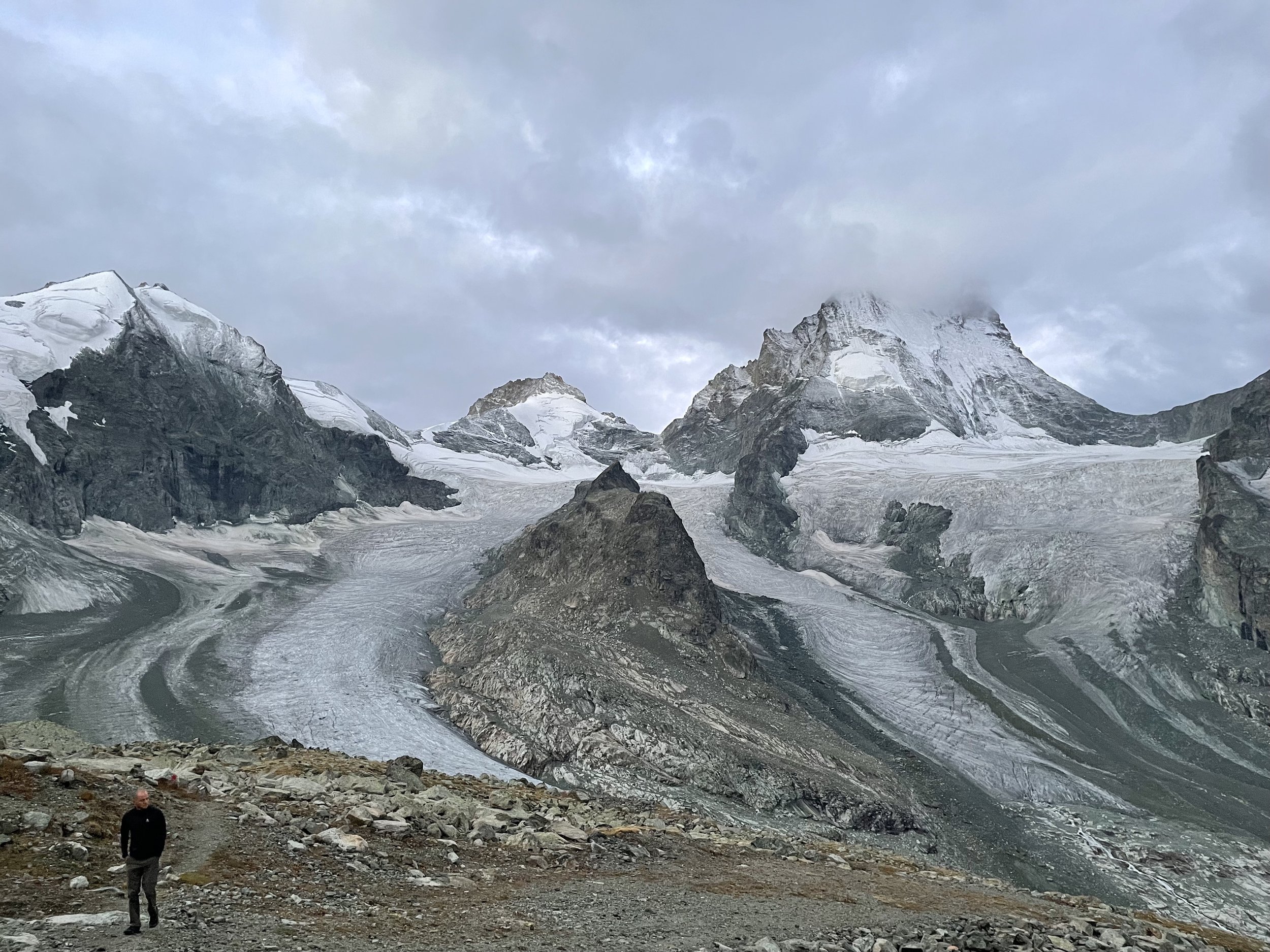
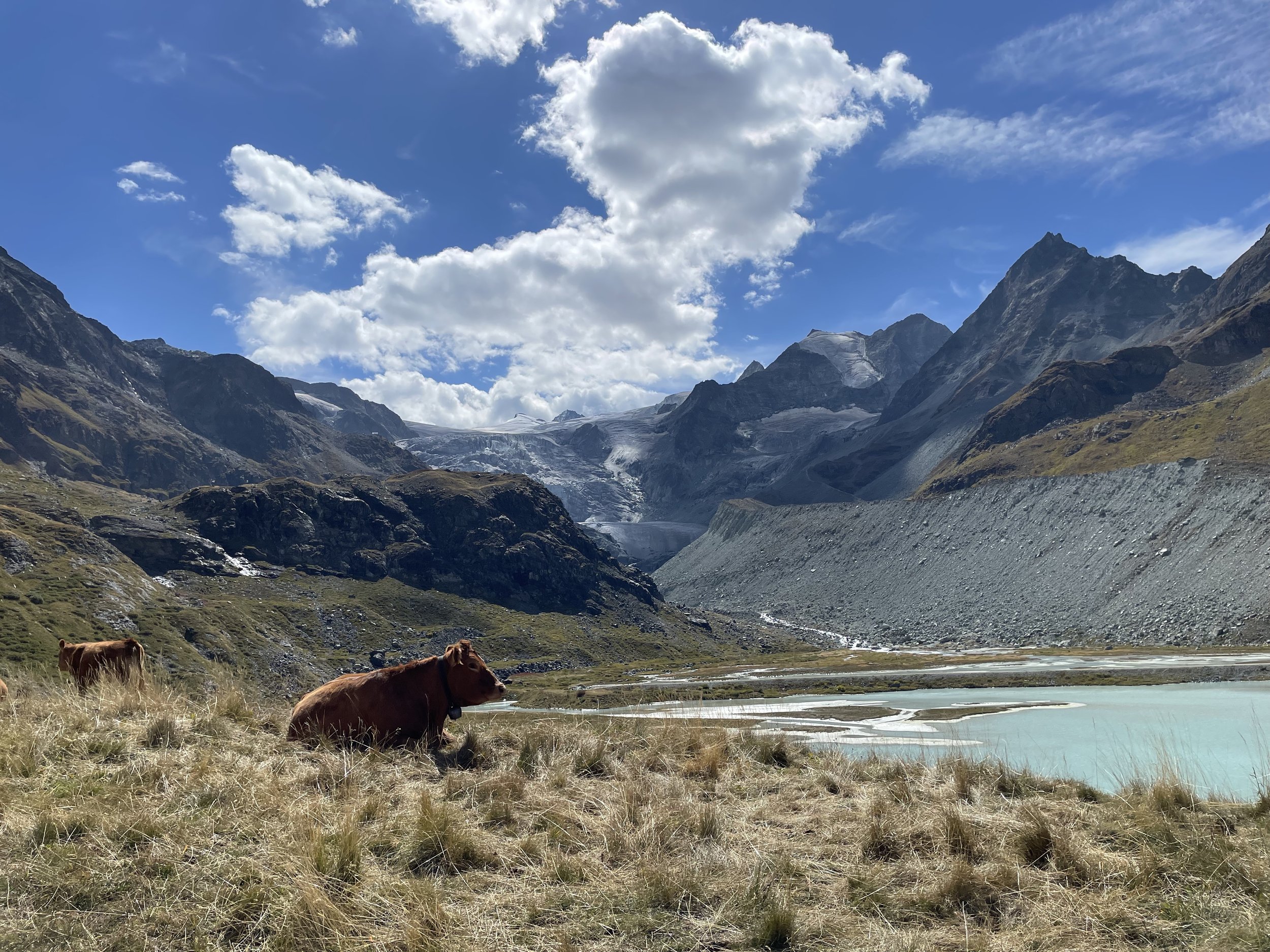
Cabane Arpitettaz to Zinal via Roc de la Vache
This is a pretty easy descent down to Zinal. You have to backtrack to the plateau with the 2 ‘lakes’ and then a relatively short ascent to Roc de la Vache - which has a great view down the valley to Zinal and also up the valley to the Weisshorn and Cabane de Tracuit.
Originally I had planned to stay in Cabane de Tracuit and from the Roc de la Vache it looked like a very do-able few hour climb up there. A group of Belgians who were staying at Cabane Arpitettaz were headed there to try and attempt a summit of the Weisshorn.
From Roc de la Vache it’s straight down to Zinal. Some very steep sections but nothing too exposed and as long as you don’t try and run down it, you won’t fall off the mountain.
Difficulty: Easy | Length: 11km / 400 up / 1500 down | Route

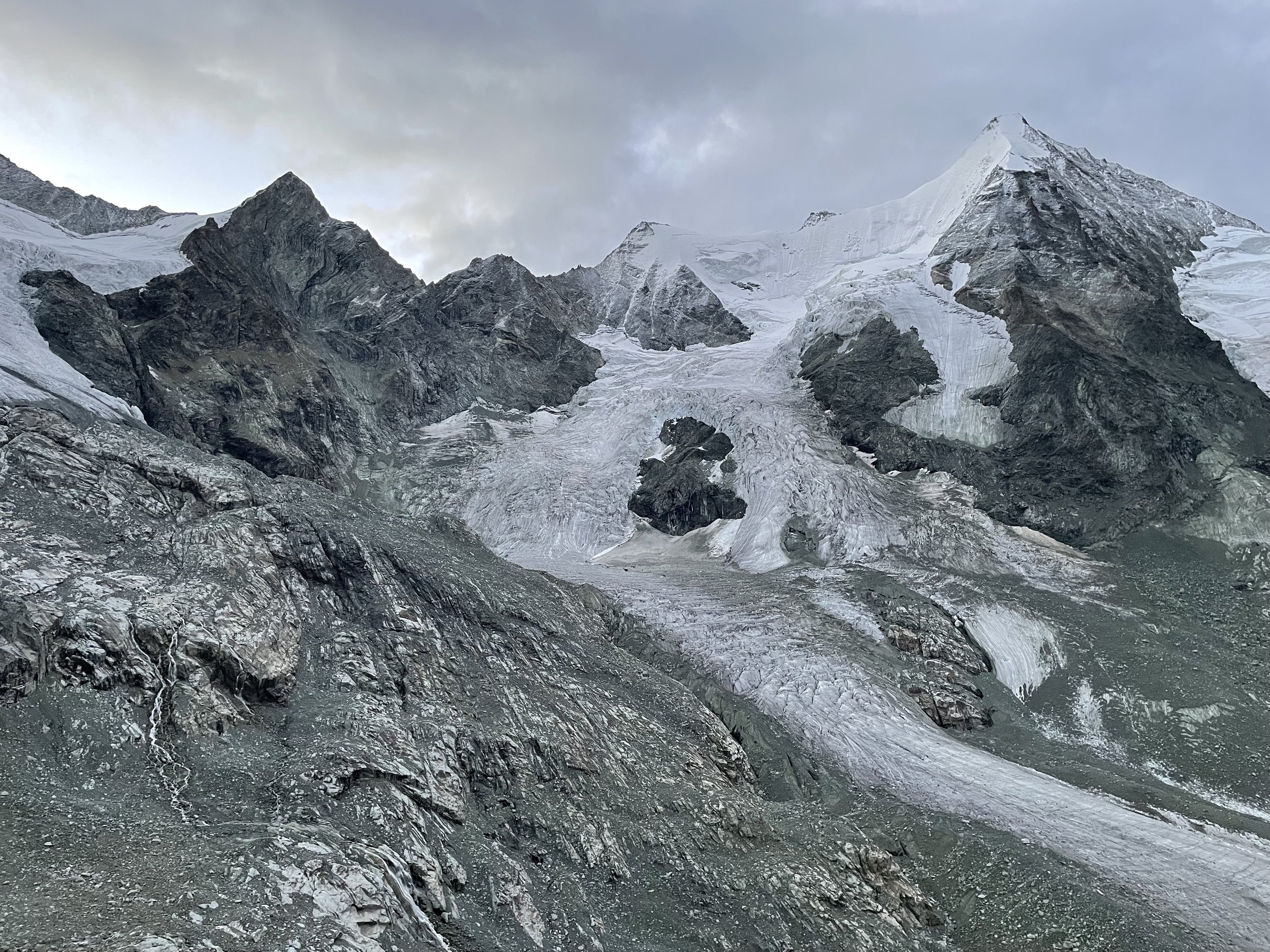
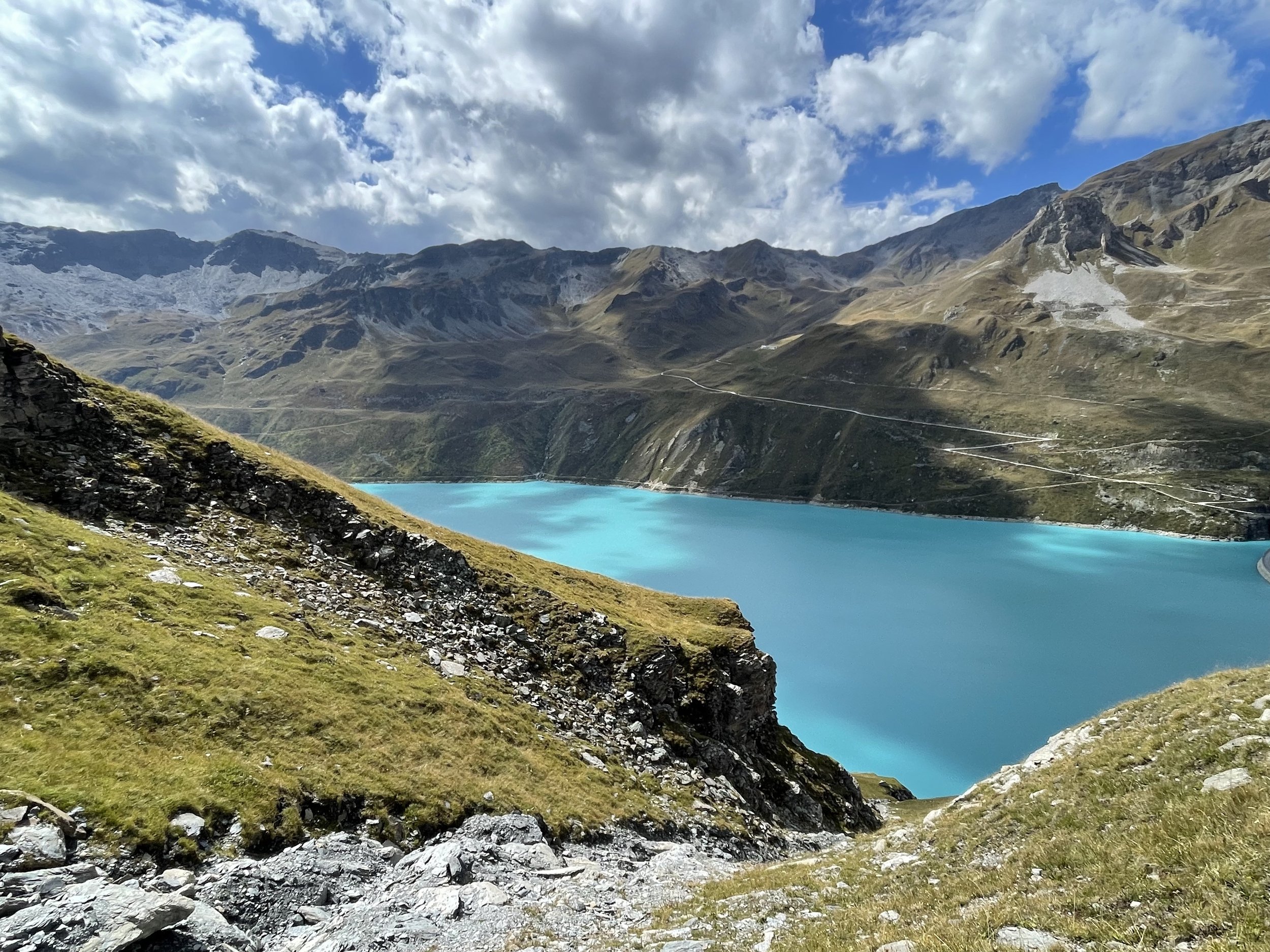
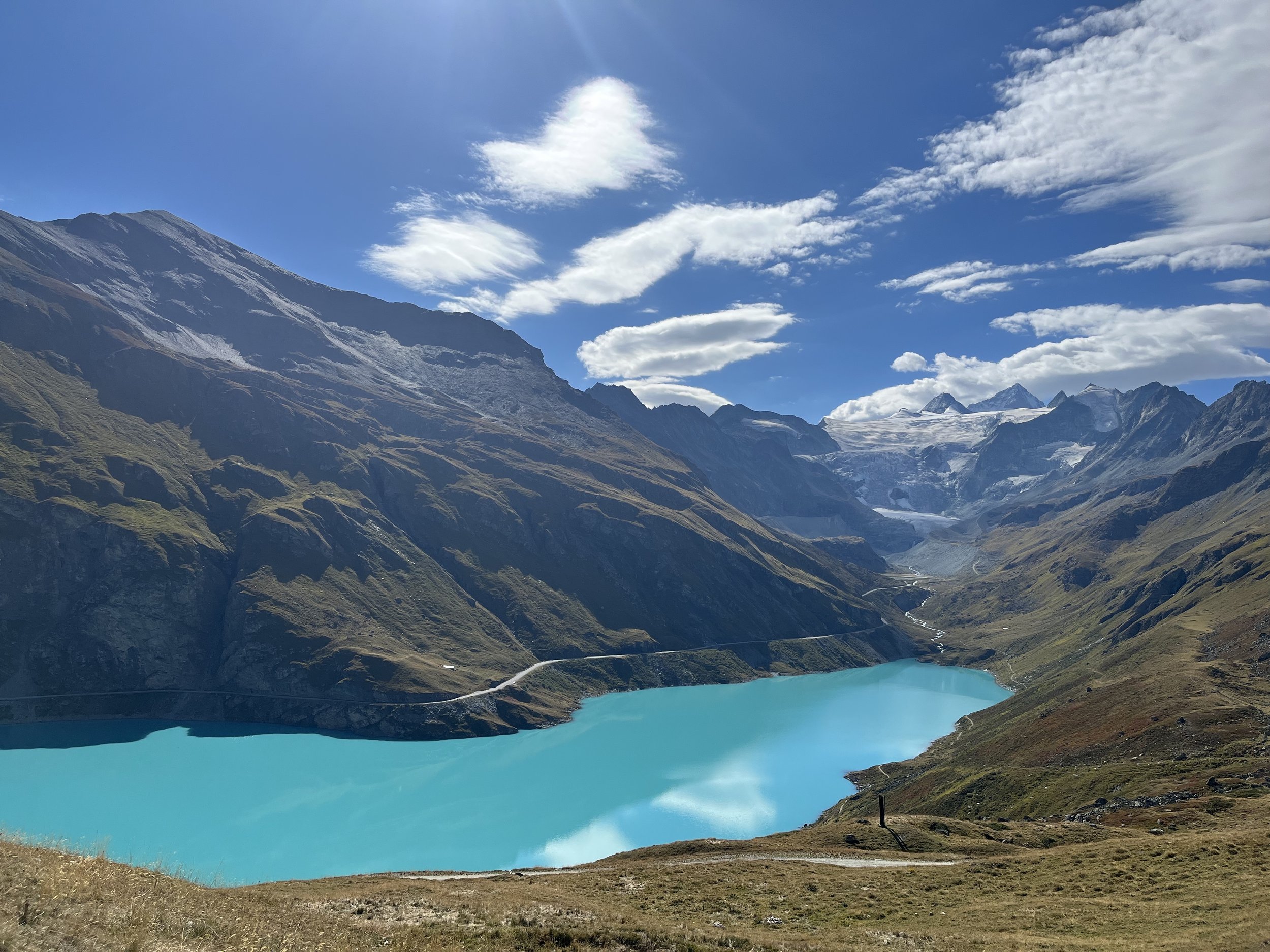
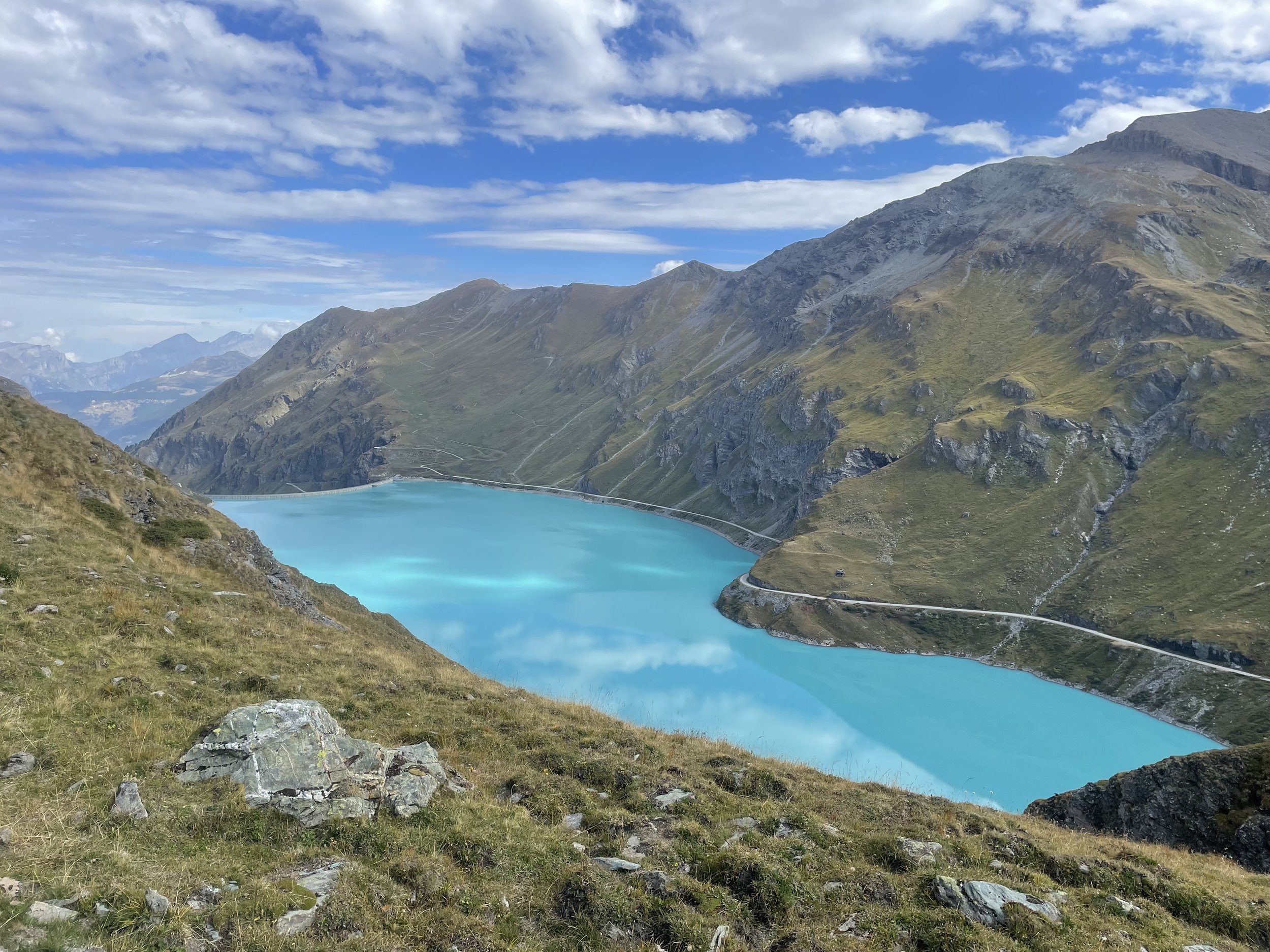
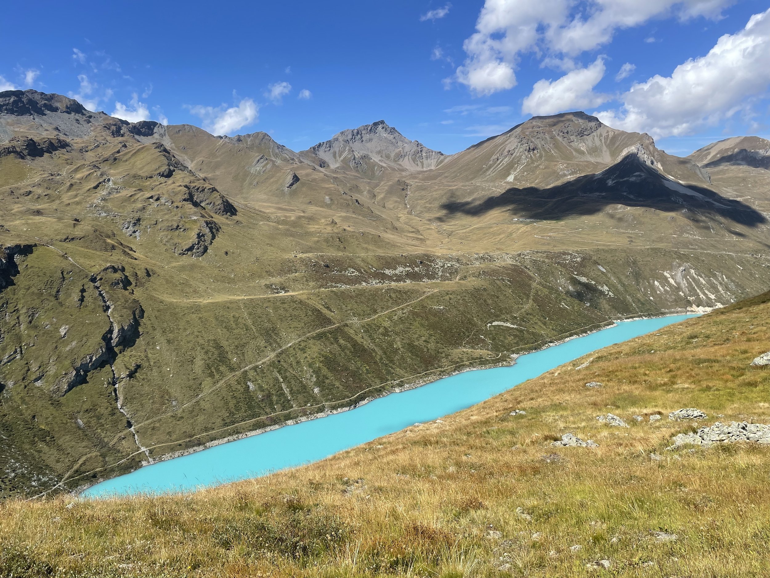
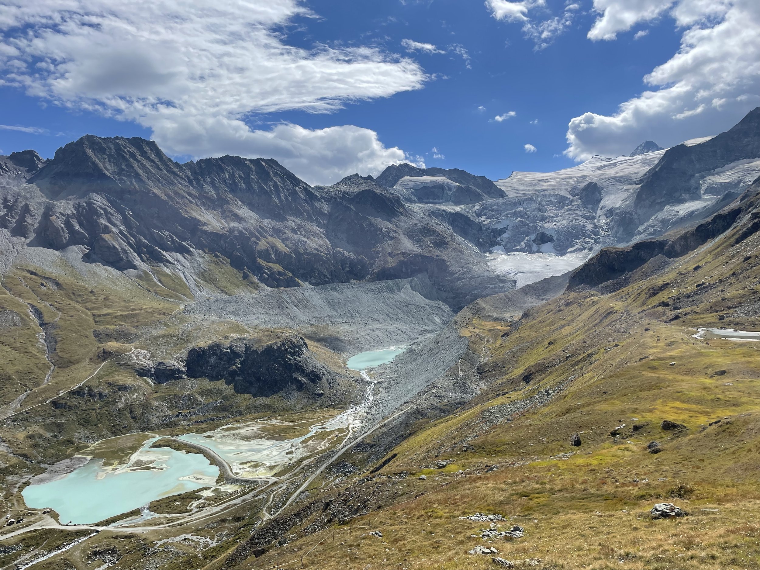
Tour du Lac de Moiry
This one’s an official Schweizmobil tour! I did this as a day hike from Grimentz but did the route counterclockwise instead of clockwise as suggested by Schweizmobil.
I did this because I wanted views up the Moiry glacier when walking to the midpoint, which the approach from the west side of the lake did give me. Without knowing the views doing the trail in the other direction I’d still recommend counterclockwise as the views were pretty epic throughout - first up the glacier and then on the way back across the lake and down the valley.
There’s a small exposed, rocky section as you approach the midpoint of the hike so you can’t completely do this on autopilot but it’s pretty easy the rest of the way.
The color of Moiry lake is as advertised if the weather is kind to you (it was to me). However, it is a dammed lake with a motorable road along it so it’s not as wild in person as the photos may suggest.
While I don’t think you’re ‘supposed’ to dip in the lake - there were some other people doing it in full sight of some officious looking people so I did so too (but with my underpants on, because it was a pretty public place with lots of people milling about and I’m not a savage) to wash off the sweat ahead of the long ride back to Zurich.
Difficulty: Easy | Length: 14km / 800 up / 800 down | Route
![Raunaq's Hikes - Part 3: Via Alpina [Guest Post]](https://images.squarespace-cdn.com/content/v1/5c33451b710699b10e8e4576/1664464182062-ADLP11H0FH4K22OWY78M/78E30AFB-271C-40D9-9F82-2798E8A602D9.jpg)

![Raunaq's Hikes - Part 1: Kesch Trek [Guest Post]](https://images.squarespace-cdn.com/content/v1/5c33451b710699b10e8e4576/1664451604215-M4NKRUC7BKIGB3ZCARC5/20220911_160546.jpg)
![Raunaq's Hikes - Part 4: Ticino Huts [Guest Post]](https://images.squarespace-cdn.com/content/v1/5c33451b710699b10e8e4576/1664467934408-L7T5J5CHFLCN4EJND6WA/IMG_8817.jpg)